Indonesia 印度尼西亚 => A Country of Beautiful Wood

Indonesia 印度尼西亚 => A Country of Beautiful Wood
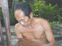

The Artisans

Indonesian Furniture Selection

The Objects

History of Indonesian Furniture

Indonesia 印度尼西亚 => A Country of Beautiful Wood

Updated 2023-11-09 09:24:11

Indonesia is a country on the continent Asia, her capital is Jakarta. Here is the hierarchy of the Indonesia administrative divisions: Indonesia is subdivided into provinces, that are at their turn subdivided into regencies (kabupaten), cities (kota), that are at their turn subdivided into districts, that are at their turn subdivided into towns and villages.

The names of countries/territories of the world are taught in English and Chinese. This collection of precious dry lands that shares the whole mankind includes not only the world's independent countries, but also specific areas that are not a UNUnited Nations: We the peoples...A stronger UN for a better world. member. Please visit the table of male and female genders of country names in French.

Countries/locations    Close
Indonesia | Countries/Territories | Regions of China | Provinces of China | Regions in France | French Departments | States/Provinces | Cities/Towns | Locations | World Continents | French AOP Wines

16

id
Country
Country
Gabon
Country in French
Gabon
countryucasefr
GABON
Country in Chinese
Country in Spanish
Gabón
Country in Italian
Il Gabon
Country in Portuguese
Gabon
Country in Germain
Gabun
countrypy
jia1 peng2
countrylocal
Gabon
countryfull
Gabon
countrynm
Gabon
ISO2
GA
ISO3
GAB
countrycodeisono
266
countrycodevehicle
G
countrycodeolympic
GAB
countrycodeirs
GB
countrycodeirsfr
GB
countrycodeirsmixt
GB
♂Male
15
4
57
languagesfr
Français
119
currency
franc
currencyfr
franc C.F.A.
currencyisocode
XAF
currencyisocodefull
XAF 950
currencypxcode
XAF
currencysymbol
CFAF
currencysubdivision
100 centimes [*]
currencyregime
Euro (655.957)
currencyvalue
0.00186
nationalityfr
Française
Capital
Libreville
capitalfr
Libreville
Phone Prefix
241
Area km2
267 667
arealand
257 667
areawater
10 000
landarablerate
0.0126
landforestrate
0.847
coastline
885
summit
Mont Iboudji 1 580 m.
boundarycountries
Guinée équatoriale, Cameroun, Congo.
timezonedeltabegin
1
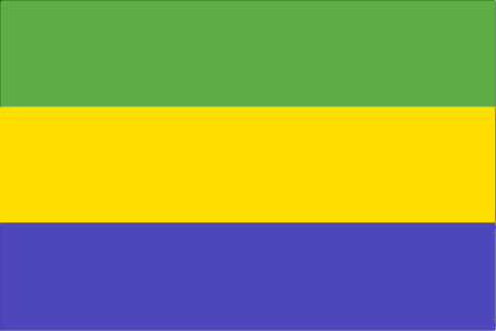
flaglink
maplink
gacolor.gif
outlinemaplink
gaout.gif
visapassenger
-1
maincities
Port Gentil, Lambarené, Mouila, Tchibanga, Oyem.
largestcity
Libreville
largestcitypopulation
419 000
rankpopulation
148
Population
1 344 000
rankgdp
111
gdp
6057000000
rankgdpppp
131
gdpppp
8600000000
rankgni
124
gni
4489000000
rankincomeorigin
89
rankincome
99
income
3340
rankincomeppp
110
incomeppp
5500
lifeexpectation
56.46
alphabetizationrate
0.71
natalityrate
0.0364
mortalityrate
0.01143
mortalityrateinfantile
0.05434
hdi
0.653
urbanization
0.823
precipitation
2841
nationalevent
Founding of the Gabonese Democratic Party (PDG)
nationaleventfr
Création du Parti Démocratique Gabonais
nationalholiday
12 March (1968)
Birthday yyyy-mm-dd
1968-03-12 00:00:00
5
9
location
Western Africa, bordering the Atlantic Ocean at the Equator, between Republic of the Congo and Equatorial Guinea
terrain
narrow coastal plain; hilly interior; savanna in east and south
naturalresources
petroleum, manganese, uranium, gold, timber, iron
9
Web
rgbback
16777215
todate
1

17

id
Country
Country
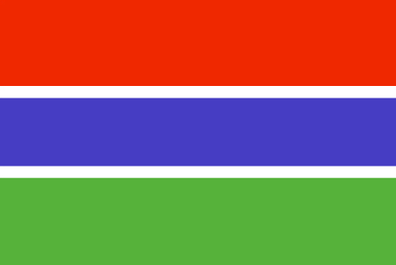
Gambia, The
Country in French
Gambie
countryucasefr
GAMBIE
Country in Chinese
Country in Spanish
Gambia
Country in Italian
La Gambia
Country in Portuguese
Gambia
Country in Germain
Gambia
countrypy
gang1 bi3 ya4
countrylocal
The Gambia
countryfull
Gambia, The
countrynm
Gambia, The
ISO2
GM
ISO3
GMB
countrycodeisono
270
countrycodevehicle
WAG
countrycodeolympic
GAM
countrycodeirs
GA
countrycodeirsfr
GA
countrycodeirsmixt
GA
♀Female
15
4
51
languagesfr
Anglais
136
currency
dalasi
currencyfr
Dalasi
currencyisocode
GMD
currencyisocodefull
GMD 270
currencypxcode
GMD
currencysymbol
D
currencysubdivision
100 butut
currencyregime
float
currencyvalue
0.03663
nationalityfr
Gambienne
Capital
Banjul
capitalfr
Banjul
Phone Prefix
220
Area km2
11 295
arealand
10 000
areawater
1 300
landarablerate
0.195
landforestrate
0.481
coastline
80
summit
53 m.
boundarycountries
Sénégal.
flaglink
maplink
gmcolor.gif
outlinemaplink
gmout.gif
visapassenger
-1
maincities
Serrekunda, Brikama, Bakau, Farafenni, Guntur, Sukuta.
largestcity
Banjul
largestcitypopulation
186 000
rankpopulation
146
Population
1 421 000
rankgdp
170
gdp
395000000
rankgdpppp
151
gdpppp
2641000000
rankgni
191
gni
387000000
rankincomeorigin
189
rankincome
203
income
270
rankincomeppp
169
incomeppp
1740
lifeexpectation
54.79
alphabetizationrate
0.3905
natalityrate
0.0403
mortalityrate
0.01208
mortalityrateinfantile
0.07348
hdi
0.463
urbanization
0.536
nationalevent
Independence Day
nationaleventfr
Jour de l'Indépendance
nationalholiday
18 February (1965)
Birthday yyyy-mm-dd
1965-02-18 00:00:00
2
6
location
Western Africa, bordering the North Atlantic Ocean and Senegal
terrain
flood plain of the Gambia River flanked by some low hills
naturalresources
fish
9
Web
rgbback
16777215
todate
1

18

id
Country
Country
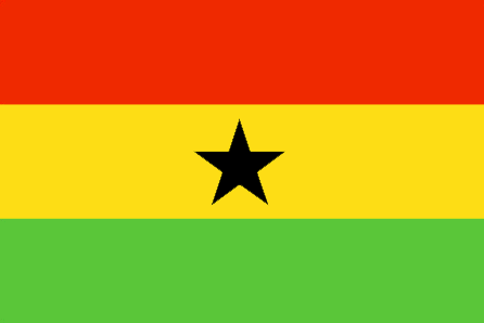
Ghana
Country in French
Ghana
countryucasefr
GHANA
Country in Chinese
Country in Spanish
Ghana
Country in Italian
Il Ghana
Country in Portuguese
Ghana
Country in Germain
Ghana
countrypy
jia1 na4
countrylocal
Ghana
countryfull
Ghana
countrynm
Ghana
ISO2
GH
ISO3
GHA
countrycodeisono
288
countrycodevehicle
GH
countrycodeolympic
GHA
countrycodeirs
GH
countrycodeirsfr
GH
countrycodeirsmixt
GH
♂Male
19
6
51
languagesfr
Anglais
41
currency
new cedi
currencyfr
cedi
currencyisocode
GHC
currencyisocodefull
GHC 288
currencypxcode
GHC
currencysymbol
¢
currencysubdivision
100 psewas
currencyregime
float
currencyvalue
0.00011
Capital
Accra
capitalfr
Accra
Phone Prefix
233
Area km2
238 538
arealand
230 940
areawater
8 520
landarablerate
0.1582
landforestrate
0.278
coastline
539
summit
Afadjoto 885 m.
boundarycountries
Côte d'Ivoire, Togo, Burkina Faso.
flaglink
maplink
ghcolor.gif
outlinemaplink
ghout.gif
visapassenger
-1
maincities
Kumasi, Tamale, Tema, Secondi-Takoradi, Cape Coast, Koforidua, Sunyani, Ho.
largestcity
Accra
largestcitypopulation
1 673 000
rankpopulation
48
Population
20 669 000
rankgdp
100
gdp
7624000000
rankgdpppp
70
gdpppp
46253000000
rankgni
107
gni
6548000000
rankincomeorigin
181
rankincome
195
income
320
rankincomeppp
155
incomeppp
2190
lifeexpectation
56.53
alphabetizationrate
0.603
natalityrate
0.02584
mortalityrate
0.01053
mortalityrateinfantile
0.05302
hdi
0.548
nationalevent
Independence Day
nationaleventfr
Jour de l'Indépendance
nationalholiday
6 March (1957)
Birthday yyyy-mm-dd
1957-03-06 00:00:00
4
10
location
Western Africa, bordering the Gulf of Guinea, between Cote d'Ivoire and Togo
terrain
mostly low plains with dissected plateau in south-central area
naturalresources
gold, timber, industrial diamonds, bauxite, mangan
cooking
Fruits de Mer
9
Web
rgbback
16777215
todate
1
Notes
Fruits de Mer

19

id
Country
Country
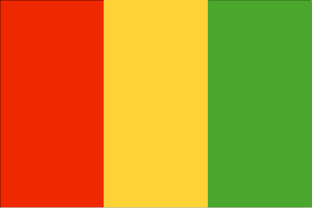
Guinea
Country in French
Guinée
countryucasefr
GUINEE
Country in Chinese
Country in Spanish
Guinea
Country in Italian
Guinea
Country in Portuguese
Guinea
Country in Germain
Guine
countrypy
ji1 nei4 ya4
countrylocal
Guinee
countryfull
Guinea
countrynm
Guinea
ISO2
GN
ISO3
GIN
countrycodeisono
324
countrycodevehicle
RG
countrycodeolympic
GUI
countrycodeirs
GV
countrycodeirsfr
GV
countrycodeirsmixt
GV
♀Female
15
4
57
languagesfr
Français
138
currency
syli
currencyfr
franc guinéen
currencyisocode
GNS
currencyisocodefull
GNS 324
currencypxcode
GNF
currencysymbol
FG
currencysubdivision
10 francs, 1 franc = 100 centimes
currencyregime
m.float
currencyvalue
0.0003
nationalityfr
Guinéenne
Capital
Conakry
capitalfr
Gonakry
Phone Prefix
224
Area km2
245 860
arealand
245 857
landarablerate
0.036
landforestrate
0.282
coastline
320
summit
Mont Nimba 1 752 m.
boundarycountries
Guinée Bissau, Côte d'Ivoire, Sénégal, Mali, Libéria, Sierra Leone.
flaglink
maplink
gncolor.gif
outlinemaplink
gnout.gif
visapassenger
-1
maincities
Kankan, Labé, Nzerékoré.
largestcity
Conakry
largestcitypopulation
1 558 000
rankpopulation
89
Population
7 909 000
rankgdp
129
gdp
3630000000
rankgdpppp
105
gdpppp
16582000000
rankgni
138
gni
3384000000
rankincomeorigin
171
rankincome
185
income
430
rankincomeppp
158
incomeppp
2080
lifeexpectation
49.7
alphabetizationrate
0.4105
natalityrate
0.04226
mortalityrate
0.01553
mortalityrateinfantile
0.09182
hdi
0.425
urbanization
0.279
precipitation
3784
nationalevent
Independence Day
nationaleventfr
Jour de l'Indépendance
nationalholiday
2 October (1958)
Birthday yyyy-mm-dd
1958-10-02 00:00:00
5
11
location
Western Africa, bordering the North Atlantic Ocean, between Guinea-Bissau and Sierra Leone
terrain
generally flat coastal plain, hilly to mountainous interior
naturalresources
bauxite, iron ore, diamonds, gold, uranium, hydrop
9
Web
rgbback
16777215
todate
1

20

id
Country
Country
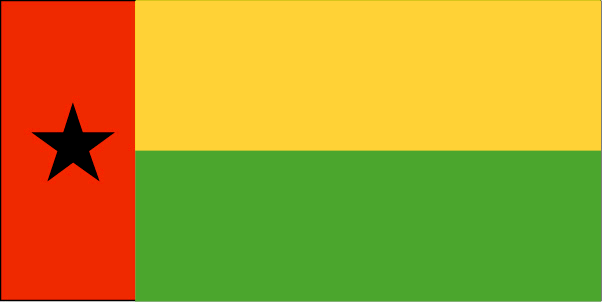
Guinea-Bissau
Country in French
Guinée-Bissau
countryucasefr
GUINEE-BISSAU
Country in Chinese
Country in Spanish
Guinea-Bissau
Country in Italian
La Guinea-Bissau
Country in Portuguese
Guiné-Bissau
Country in Germain
Guinea-Bissau
countryfull
Guinea-Bissau
countrynm
Guinea-Bissau
ISO2
GW
ISO3
GNB
countrycodeisono
624
countrycodeolympic
GBS
countrycodeirs
PU
countrycodeirsfr
PU
countrycodeirsmixt
PU
♀Female
15
6
114
languagesfr
Portugais
139
currency
franc
currencyfr
peso
currencyisocode
XOF
currencyisocodefull
XOF 952
currencypxcode
XOF
currencysymbol
CFAF
currencysubdivision
100 centimes [*]
currencyregime
Euro (655.957)
currencyvalue
0.00186
nationalityfr
Guinéenne
Capital
Bissau
capitalfr
Bissau
Phone Prefix
245
Area km2
36 120
arealand
28 000
areawater
8 120
landarablerate
0.1067
landforestrate
0.605
coastline
350
summit
300 m.
boundarycountries
Sénégal, Guinée.
flaglink
maplink
gwcolor.gif
outlinemaplink
gwout.gif
visapassenger
-1
maincities
Bafatá, Gabu, Mansôa, Catió, Canchungo, Farim.
largestcity
Bissau
largestcitypopulation
233 000
rankpopulation
145
Population
1 489 000
rankgdp
180
gdp
239000000
rankgdpppp
155
gdpppp
1058000000
rankgni
203
gni
202000000
rankincomeorigin
202
rankincome
217
income
140
rankincomeppp
202
incomeppp
680
lifeexpectation
46.98
alphabetizationrate
0.4145
natalityrate
0.03803
mortalityrate
0.01657
mortalityrateinfantile
0.10872
hdi
0.373
urbanization
0.323
nationalevent
Independence Day
nationaleventfr
Jour de l'Indépendance
nationalholiday
24 September (1973)
Birthday yyyy-mm-dd
1973-09-24 00:00:00
10
2
location
Western Africa, bordering the North Atlantic Ocean, between Guinea and Senegal
terrain
mostly low coastal plain rising to savanna in east
naturalresources
fish, timber, phosphates, bauxite, unexploited dep
9
Web
rgbback
16777215
todate
1

More+
A | B | C | D | E | F | G | H | I | J | K | L | M | N | O | P | Q | R | S | T | U | V | W | X | Y | Z
 
All<=>Deco::!Filtered Products List!

Give us feedback (37)

32. Visitor *.*.146.* - 2021-11-26 15:18:47
Awesome post, thanks for starting the thread that leads to great information!
31. Visitor *:*:*:*:*:*:*:*:*:*:*:*:*:*:643c - 2021-09-28 14:20:11
This article is one of the best in the history of articles. I'm a antique 'Article' collector and I sometimes read them interesting
30. Visitor *.*.249.* - 2021-08-12 17:31:21
Qué buena esta página siempre ahí para consultar lo necesario, cualquier cosa esta bien poder verlo!
29. Visitor *.*.249.* - 2021-08-05 19:38:52
Buenas ideas, siempre es bueno consultar páginas así!
28. Visitor *.*.152.* - 2021-05-08 03:34:38
Excellent information on your content, thank you for taking the time to share with us.
Email Web

Please copy the string:
String to copy.

Chinese Shoes > Gabon 加蓬 => Indonesia 印度尼西亚 => A Country of Beautiful Wood
  

Want to come? | Call us 7/700 33 467 790 487 (Phone)

Popup Window    Close
Patience please...