Indonesia 印度尼西亚 => A Country of Beautiful Wood

Indonesia 印度尼西亚 => A Country of Beautiful Wood
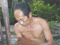

The Artisans

Indonesian Furniture Selection

The Objects

History of Indonesian Furniture

Indonesia 印度尼西亚 => A Country of Beautiful Wood

Updated 2023-11-09 09:24:11

Indonesia is a country on the continent Asia, her capital is Jakarta. Here is the hierarchy of the Indonesia administrative divisions: Indonesia is subdivided into provinces, that are at their turn subdivided into regencies (kabupaten), cities (kota), that are at their turn subdivided into districts, that are at their turn subdivided into towns and villages.

The names of countries/territories of the world are taught in English and Chinese. This collection of precious dry lands that shares the whole mankind includes not only the world's independent countries, but also specific areas that are not a UNUnited Nations: We the peoples...A stronger UN for a better world. member. Please visit the table of male and female genders of country names in French.

Countries/locations    Close
Indonesia | Countries/Territories | Regions of China | Provinces of China | Regions in France | French Departments | States/Provinces | Cities/Towns | Locations | World Continents | French AOP Wines

6

id
Country
Country
Burkina Faso
Country in French
Burkina Faso
countryucasefr
BURKINA FASO
Country in Chinese
Country in Spanish
Burkino Faso
Country in Italian
Burkino Faso
Country in Portuguese
Burkino Faso
Country in Germain
Burkino Faso
countrypy
bu4 ji1 na4 fa3 suo3
countrylocal
Burkina Faso
countryfull
Burkina Faso
countrynm
Burkina Faso
ISO2
BF
ISO3
BFA
countrycodeisono
854
countrycodevehicle
BF
countrycodeolympic
BUR
countrycodeirs
UV
countrycodeirsfr
UV
countrycodeirsmixt
UV
♂Male
16
4
57
languagesfr
Français
119
currency
franc
currencyfr
franc C.F.A.
currencyisocode
XOF
currencyisocodefull
XOF 952
currencypxcode
XOF
currencysymbol
CFAF
currencysubdivision
100 centimes
currencyregime
Euro (655.957)
currencyvalue
0.00186
Capital
Ouagadougou
capitalfr
Ouagadougou
Phone Prefix
226
Area km2
274 200
arealand
273 800
areawater
400
landarablerate
0.1243
landforestrate
0.259
summit
Tena Kourou 749 m.
boundarycountries
Côte d'Ivoire, Mali, Bénin, Togo, Ghana.
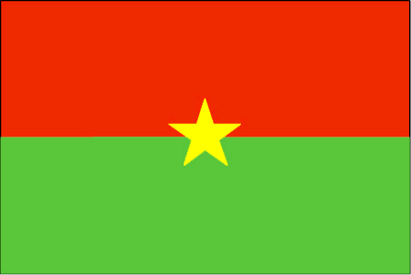
flaglink
maplink
bfcolor.gif
outlinemaplink
bfout.gif
visapassenger
-1
maincities
Bobo Dioulasso, Koudougou, Ouahigouya, Banfora, Kaya.
largestcity
Ouagadougou
largestcitypopulation
824 000
rankpopulation
65
Population
12 109 000
rankgdp
126
gdp
4182000000
rankgdpppp
110
gdpppp
14218000000
rankgni
135
gni
3587000000
rankincomeorigin
183
rankincome
197
income
300
rankincomeppp
183
incomeppp
1170
lifeexpectation
53.8
alphabetizationrate
0.2585
natalityrate
0.04478
mortalityrate
0.01876
mortalityrateinfantile
0.09978
hdi
0.33
nationalevent
Republic Day
nationaleventfr
Jour de la République
nationalholiday
11 December (1958)
Birthday yyyy-mm-dd
1958-12-11 00:00:00
5
11
location
Western Africa, north of Ghana
terrain
mostly flat to dissected, undulating plains; hills in west and southeast
naturalresources
manganese, limestone, marble; small deposits of go
9
Web
rgbback
16777215
todate
1

7

id
Country
Country
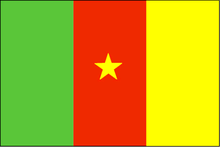
Cameroon
Country in French
Cameroun
countryucasefr
CAMEROUN
Country in Chinese
Country in Spanish
Camerún
Country in Italian
Il Cameroon
Country in Portuguese
Cameroon
Country in Germain
Cameroon
countrypy
ka4 mai4 long2
countrylocal
Cameroon
countryfull
Cameroon
countrynm
Cameroon
ISO2
CM
ISO3
CMR
countrycodeisono
120
countrycodevehicle
CAM
countrycodeolympic
CMR
countrycodeirs
CM
countrycodeirsfr
CM
countrycodeirsmixt
CM
♂Male
15
4
57
languagesfr
Français
119
currency
franc
currencyfr
franc C.F.A.
currencyisocode
XAF
currencyisocodefull
XAF 950
currencypxcode
XAF
currencysymbol
CFAF
currencysubdivision
100 centimes
currencyregime
Euro (655.957)
currencyvalue
0.00186
nationalityfr
Camerounaise
Capital
Yaounde
capitalfr
Yaoundé
Phone Prefix
237
Area km2
475 439
arealand
469 440
areawater
6 000
landarablerate
0.1281
landforestrate
0.513
coastline
402
summit
Fako 4 095 m.
boundarycountries
Nigeria, Tchad, Centrafrique, Congo, Guinée équatoriale, Gabon.
timezonedeltabegin
1
flaglink
maplink
cmcolor.gif
outlinemaplink
cmout.gif
visapassenger
-1
maincities
Douala, N'kongsamba, Maroua, Garoua, Bafoussam, Kumba, Bamenda, Foumban.
largestcity
Douala
largestcitypopulation
1 320 000
rankpopulation
57
Population
16 087 000
rankgdp
86
gdp
12491000000
rankgdpppp
79
gdpppp
34077000000
rankgni
92
gni
10139000000
rankincomeorigin
154
rankincome
168
income
630
rankincomeppp
161
incomeppp
1990
lifeexpectation
48.05
alphabetizationrate
0.541
natalityrate
0.03549
mortalityrate
0.0153
mortalityrateinfantile
0.07012
hdi
0.528
nationalevent
Republic Day (National Day)
nationaleventfr
Jour de la République (Jour National)
nationalholiday
20 May (1972)
Birthday yyyy-mm-dd
1972-05-20 00:00:00
9
1
location
Western Africa, bordering the Bight of Biafra, between Equatorial Guinea and Nigeria
terrain
diverse, with coastal plain in southwest, dissected plateau in center, mountains in west, plains in north
naturalresources
petroleum, bauxite, iron ore, timber, hydropower
cooking
Magnoc.
9
Web
rgbback
16777215
todate
1
Notes
Magnoc.

8

id
Country
Country
Central Africa
Country in French
République Centrafricaine
countryucasefr
CENTRAFRICAINE
Country in Chinese
Country in Spanish
República Africana De centro
Country in Italian
Repubblica Africana Concenta
Country in Portuguese
República Africana Center
Country in Germain
Afrikanische Mittelrepublik
countrypy
zhong1 fei1 gong4 he2 guo2
countrylocal
Republique Centrafricaine
countryfull
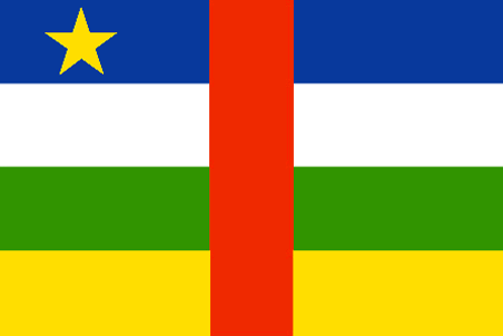
Central African Republic
countrynm
Central African Republic
ISO2
CF
ISO3
CAF
countrycodeisono
140
countrycodevehicle
RCA
countrycodeolympic
CAF
countrycodeirs
CT
countrycodeirsfr
CT
countrycodeirsmixt
CT
♀Female
15
1
57
languagesfr
Français
119
currency
franc
currencyfr
franc C.F.A.
currencyisocode
XAF
currencyisocodefull
XAF 950
currencypxcode
XAF
currencysymbol
CFAF
currencysubdivision
100 centimes
currencyregime
Euro (655.957)
currencyvalue
0.00186
nationalityfr
Centre-Africaine
Capital
Bangui
capitalfr
Bangui
Phone Prefix
236
Area km2
622 984
arealand
622 984
landarablerate
0.031
landforestrate
0.368
summit
Mont Gaou 1 420 m.
boundarycountries
Cameroun, Tchad, Soudan, Congo démocratique, Congo.
timezonedeltabegin
1
flaglink
maplink
cfcolor.gif
outlinemaplink
cfout.gif
visapassenger
-1
maincities
Berbérati, Bouar, Bambari, Bangassou, Mbaïki.
largestcity
Bangui
largestcitypopulation
553 000
rankpopulation
125
Population
3 881 000
rankgdp
151
gdp
1198000000
rankgdpppp
146
gdpppp
4225000000
rankgni
172
gni
1019000000
rankincomeorigin
190
rankincome
204
income
260
rankincomeppp
185
incomeppp
1080
lifeexpectation
41.71
alphabetizationrate
0.377
natalityrate
0.03593
mortalityrate
0.01973
mortalityrateinfantile
0.0933
nationalevent
Republic Day
nationaleventfr
Jour de la République
nationalholiday
1 December (1958)
Birthday yyyy-mm-dd
1958-12-01 00:00:00
5
11
location
Central Africa, north of Democratic Republic of the Congo
terrain
vast, flat to rolling, monotonous plateau; scattered hills in northeast and southwest
naturalresources
diamonds, uranium, timber, gold, oil, hydropower
9
Web
rgbback
16777215
todate
1

9

id
Country
Country
Chad
Country in French
Tchad
countryucasefr
TCHAD
Country in Chinese
Country in Spanish
Sábalo
Country in Italian
Il Ritaglio
Country in Portuguese
República do Tchad
Country in Germain
Tschad
countrypy
zha4 de2
countrylocal
Tchad
countryfull
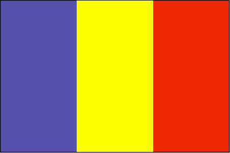
Chad
countrynm
Chad
ISO2
TD
ISO3
TCD
countrycodeisono
148
countrycodevehicle
TCH
countrycodeolympic
CHA
countrycodeirs
CD
countrycodeirsfr
CD
countrycodeirsmixt
CD
♂Male
15
4
57
languagesfr
Arabe, Français
119
currency
franc
currencyfr
franc C.F.A.
currencyisocode
XAF
currencyisocodefull
XAF 950
currencypxcode
XAF
currencysymbol
CFAF
currencysubdivision
100 centimes
currencyregime
Euro (655.957)
currencyvalue
0.00186
nationalityfr
Chadienne
Capital
N'Djamena
capitalfr
N'Djamena
Phone Prefix
235
Area km2
1 284 000
arealand
1 259 200
areawater
24 800
landarablerate
0.0278
landforestrate
0.101
summit
Emi Koussi 3 415 m.
boundarycountries
Niger, Libye, Soudan, Centrafrique, Cameroun, Nigeria.
timezonedeltabegin
1
flaglink
maplink
tdcolor.gif
outlinemaplink
tdout.gif
visapassenger
-1
maincities
Sarh, Moundou, Abéché, Bongor, Doba, Lai, Koumra, Kélo.
largestcity
Ndjamena
largestcitypopulation
826 000
rankpopulation
83
Population
8 582 000
rankgdp
139
gdp
2608000000
rankgdpppp
123
gdpppp
10386000000
rankgni
151
gni
2073000000
rankincomeorigin
192
rankincome
206
income
240
rankincomeppp
185
incomeppp
1080
lifeexpectation
48.24
alphabetizationrate
0.46
natalityrate
0.0465
mortalityrate
0.01638
mortalityrateinfantile
0.09478
hdi
0.376
urbanization
0.241
nationalevent
Independence Day
nationaleventfr
Jour de l'Indépendance
nationalholiday
11 August (1960)
Birthday yyyy-mm-dd
1960-08-11 00:00:00
7
1
location
Central Africa, south of Libya
terrain
broad, arid plains in center, desert in north, mountains in northwest, lowlands in south
naturalresources
petroleum (unexploited but exploration under way),
9
Web
rgbback
16777215
todate
1

10

id
Country
Country
Congo
Country in French
Congo
countryucasefr
CONGO
Country in Chinese
Country in Spanish
Congo
Country in Italian
Il Congo
Country in Portuguese
Congo
Country in Germain
Der Kongo
countrypy
gang1 guo3 gong4 he2 guo2
countrylocal
République du Congo
countryfull
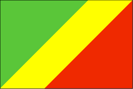
Congo, Republic of the
countrynm
Congo, Republic of the
ISO2
CG
ISO3
COG
countrycodeisono
178
countrycodevehicle
RCB
countrycodeolympic
CGO
countrycodeirs
CF
countrycodeirsfr
CF
countrycodeirsmixt
CF
♂Male
15
57
languagesfr
Français
119
currency
franc
currencyfr
franc C.F.A.
currencyisocode
XAF
currencyisocodefull
XAF 950
currencypxcode
XAF
currencysymbol
CFAF
currencysubdivision
100 centimes [*]
currencyregime
Euro (655.957)
currencyvalue
0.00186
nationalityfr
Congolaise
Capital
Brazzaville
capitalfr
Brazzaville
Phone Prefix
242
Area km2
342 000
arealand
341 500
areawater
500
landarablerate
0.005
coastline
169
summit
Monts de la Lékéti 1 040 m.
boundarycountries
Gabon, Cameroun, Centrafrique, Congo démocratique, Angola.
timezonedeltabegin
1
flaglink
maplink
cgcolor.gif
outlinemaplink
cgout.gif
visapassenger
-1
maincities
Pointe Noire, N'Kayi, Loubomo, Ngamaba-Mfilou, Loandjili, Massendjo.
largestcity
Brazzaville
rankpopulation
126
Population
3 757 000
rankgdp
130
gdp
3564000000
rankgdpppp
148
gdpppp
3625000000
rankgni
147
gni
2443000000
rankincomeorigin
153
rankincome
167
income
650
rankincomeppp
200
incomeppp
730
lifeexpectation
50.02
alphabetizationrate
0.566
natalityrate
0.02946
mortalityrate
0.0142
mortalityrateinfantile
0.09534
nationalevent
Independence Day
nationaleventfr
Jour de l'Indépendance
nationalholiday
15 August (1960)
Birthday yyyy-mm-dd
1960-08-15 00:00:00
7
1
location
Western Africa, bordering the South Atlantic Ocean, between Angola and Gabon
terrain
coastal plain, southern basin, central plateau, northern basin
naturalresources
petroleum, timber, potash, lead, zinc, uranium, co
9
Web
rgbback
16777215
todate
1

More+
A | B | C | D | E | F | G | H | I | J | K | L | M | N | O | P | Q | R | S | T | U | V | W | X | Y | Z
 

Give us feedback (37)

37. Visitor *.*.164.* - 2022-03-16 17:43:29
Buenas recomendaciones y todo lo que lleva el contenido de la web es increíble!
36. Visitor *.*.222.* - 2022-02-09 12:45:33
Los materiales que se utilizan para realizar este tipo de prácticas están todos hechos de madera!
35. Visitor *.*.225.* - 2022-01-24 16:55:06
Buenas ideas sabemos como podemos inspirarnos gracias a links así!
34. Visitor *.*.32.* - 2022-01-19 19:32:41
Los sitios web de esta manera me inspiran a seguir trabajando duro!
33. Visitor *.*.146.* - 2021-11-26 15:19:37
Excellent information on your content, thank you for taking the time to share with us.
Email Web

Please copy the string:
String to copy.

Chinese Shoes > Burkina Faso 布基纳法索 => Indonesia 印度尼西亚 => A Country of Beautiful Wood
  

Want to come? | Call us 7/700 33 467 790 487 (Phone)

Popup Window    Close
Patience please...