Indonesia 印度尼西亚 => A Country of Beautiful Wood

Indonesia 印度尼西亚 => A Country of Beautiful Wood
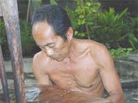

The Artisans

Indonesian Furniture Selection

The Objects

History of Indonesian Furniture

Indonesia 印度尼西亚 => A Country of Beautiful Wood

Updated 2023-11-09 09:24:11

Indonesia is a country on the continent Asia, her capital is Jakarta. Here is the hierarchy of the Indonesia administrative divisions: Indonesia is subdivided into provinces, that are at their turn subdivided into regencies (kabupaten), cities (kota), that are at their turn subdivided into districts, that are at their turn subdivided into towns and villages.

The names of countries/territories of the world are taught in English and Chinese. This collection of precious dry lands that shares the whole mankind includes not only the world's independent countries, but also specific areas that are not a UNUnited Nations: We the peoples...A stronger UN for a better world. member. Please visit the table of male and female genders of country names in French.

Countries/locations    Close
Indonesia | Countries/Territories | Regions of China | Provinces of China | Regions in France | French Departments | States/Provinces | Cities/Towns | Locations | World Continents | French AOP Wines

16

id
Country
Country
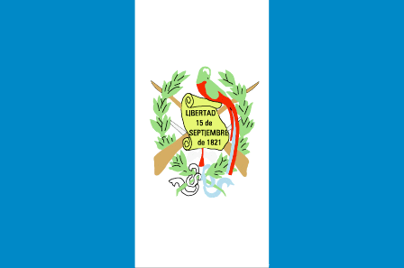
Guatemala
Country in French
Guatemala
countryucasefr
GUATEMALA
Country in Chinese
Country in Spanish
Guatemala
Country in Italian
Il Guatemala
Country in Portuguese
Guatemala
Country in Germain
Guatemala
countrypy
gua1 di4 ma3 la1
countrylocal
Guatemala
countryfull
Guatemala
countrynm
Guatemala
ISO2
GT
ISO3
GTM
countrycodeisono
320
countrycodevehicle
GCA
countrycodeolympic
GUA
countrycodeirs
GT
countrycodeirsfr
GT
countrycodeirsmixt
GT
countrycode
502
♂Male
19
6
131
languagesfr
Espagnol
43
currency
quetzal
currencyfr
quetzal
currencyisocode
GTQ
currencyisocodefull
GTQ 320
currencypxcode
GTQ
currencysymbol
Q
currencysubdivision
100 centavos
currencyregime
float
currencyvalue
0.1317
Capital
Guatemala City
capitalfr
Guatemala
Phone Prefix
502
Area km2
108 890
arealand
108 430
areawater
460
landarablerate
0.1254
landforestrate
0.263
coastline
400
summit
Volcán Tajumulco 4 220 m
boundarycountries
Mexique, Bélize, El Salvador, Honduras.
timezonedeltabegin
-6
flaglink
maplink
gtcolor.gif
outlinemaplink
gtoutl.gif
visapassenger
-1
maincities
Escuintla, Quezaltenango, Puerto Barrios, Retlahuleu, Cobán, Chiquimula, Mazatenangoy
largestcity
Guatemala City
largestcitypopulation
2 205 000
rankpopulation
64
Population
12 307 000
rankgdp
66
gdp
24730000000
rankgdpppp
66
gdpppp
51056000000
rankgni
67
gni
23486000000
rankincomeorigin
114
rankincome
124
income
1910
rankincomeppp
130
incomeppp
4090
lifeexpectation
65.26
alphabetizationrate
0.551
natalityrate
0.03551
mortalityrate
0.00677
mortalityrateinfantile
0.03896
nationalevent
Independence Day
nationaleventfr
Jour de l'Indépendance
nationalholiday
15 September (1821)
Birthday yyyy-mm-dd
1821-09-15 00:00:00
8
6
location
Middle America, bordering the North Pacific Ocean, between El Salvador and Mexico, and bordering the Gulf of Honduras (Caribbean Sea) between Honduras and Belize
terrain
mostly mountains with narrow coastal plains and rolling limestone plateau (Peten)
naturalresources
petroleum, nickel, rare woods, fish, chicle, hydro
9
Web
rgbback
16777215
todate
1

17

id
Country
Country
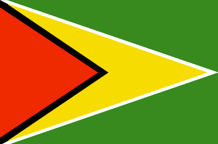
Guyana
Country in French
Guyana
countryucasefr
GUYANA
Country in Chinese
Country in Spanish
Guyana
Country in Italian
La Guyana
Country in Portuguese
Guyana
Country in Germain
Guyana
countrypy
gui1 ya4 na4
countrylocal
Guyana
countryfull
Guyana
countrynm
Guyana
ISO2
GY
ISO3
GUY
countrycodeisono
328
countrycodevehicle
GUY
countrycodeolympic
GUY
countrycodeirs
GY
countrycodeirsfr
GY
countrycodeirsmixt
GY
♂Male
15
6
51
languagesfr
Anglais
45
currency
dollar
currencyfr
dollar de Guyana
currencyisocode
GYD
currencyisocodefull
GYD 328
currencypxcode
GYD
currencysymbol
G$
currencysubdivision
100 cents
currencyregime
float
currencyvalue
0.0056
nationalityfr
Guyanaise
Capital
Georgetown
capitalfr
Georgetown
Phone Prefix
592
Area km2
214 970
arealand
196 850
areawater
18 120
landarablerate
0.0244
landforestrate
0.785
coastline
459
summit
Mount Roraima 2 772 m.
boundarycountries
Vénézuéla, Surinam, Brésil .
timezonedeltabegin
-3
flaglink
maplink
gycolor.gif
outlinemaplink
gy.gif
visapassenger
-1
maincities
Linden, New Amsterdam, Corriverton, Mahaicony.
largestcity
Georgetown
largestcitypopulation
254 000
rankpopulation
156
Population
769 000
rankgdp
161
gdp
742000000
rankgdpppp
149
gdpppp
3253000000
rankgni
182
gni
689000000
rankincomeorigin
142
rankincome
155
income
900
rankincomeppp
131
incomeppp
3980
lifeexpectation
62.43
alphabetizationrate
0.9865
natalityrate
0.01785
mortalityrate
0.00971
mortalityrateinfantile
0.03722
hdi
0.74
urbanization
0.00467
precipitation
2262
nationalevent
Republic Day
nationaleventfr
Jour de la République
nationalholiday
23 February (1970)
Birthday yyyy-mm-dd
1970-02-23 00:00:00
7
11
location
Northern South America, bordering the North Atlantic Ocean, between Suriname and Venezuela
terrain
mostly rolling highlands; low coastal plain; savanna in south
naturalresources
bauxite, gold, diamonds, hardwood timber, shrimp,
cooking
Sucre.
9
rgbback
16777215
todate
1
Notes
Sucre.

18

id
Country
Country
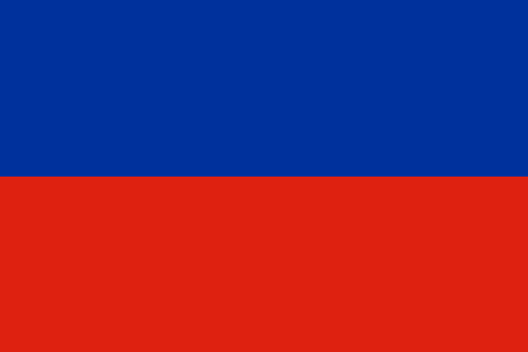
Haiti
Country in French
Haïti
countryucasefr
HAITI
Country in Chinese
Country in Spanish
Haití
Country in Italian
L'Haiti
Country in Portuguese
Haiti
Country in Germain
Haiti
countrypy
hai3 di4
countrylocal
Haiti
countryfull
Haiti
countrynm
Haiti
ISO2
HT
ISO3
HTI
countrycodeisono
332
countrycodevehicle
RH
countrycodeolympic
HAI
countrycodeirs
HA
countrycodeirsfr
HA
countrycodeirsmixt
HA
8
57
languagesfr
Français, créole.
140
currency
gourde
currencyfr
gourde
currencyisocode
HTG
currencyisocodefull
HTG 332
currencypxcode
HTG
currencysymbol
G
currencysubdivision
100 centimes
currencyregime
float
currencyvalue
0.0274
nationalityfr
Haïtienne
Capital
Port-au-Prince
capitalfr
Port-au-Prince
Phone Prefix
509
Area km2
247.50
arealand
27 560
areawater
190
landarablerate
0.2032
landforestrate
0.032
coastline
1771
summit
Pic La Selle 2 674 m.
boundarycountries
République Dominicaine.
timezonedeltabegin
-5
flaglink
maplink
htcolor.gif
outlinemaplink
ht.gif
visapassenger
-1
maincities
Cap Haïtien, Pétionville, Gonaives, Les Cayes, Port-de-Paix.
largestcity
Port-au-Prince
largestcitypopulation
1 461 000
rankpopulation
84
Population
8 440 000
rankgdp
134
gdp
2921000000
rankgdpppp
107
gdpppp
14703000000
rankgni
139
gni
3342000000
rankincomeorigin
173
rankincome
187
income
400
rankincomeppp
170
incomeppp
1730
lifeexpectation
51.78
alphabetizationrate
0.5195
natalityrate
0.03376
mortalityrate
0.01321
mortalityrateinfantile
0.07438
hdi
0.467
urbanization
0.363
nationalevent
Independence Day
nationaleventfr
Jour de l'Indépendance
nationalholiday
1 January (1804)
Birthday yyyy-mm-dd
1804-01-01 00:00:00
10
12
location
Caribbean, western one-third of the island of Hispaniola, between the Caribbean Sea and the North Atlantic Ocean, west of the Dominican Republic
terrain
mostly rough and mountainous
naturalresources
bauxite, copper, calcium carbonate, gold, marble,
9
Web
rgbback
16777215
todate
1

19

id
Country
Country
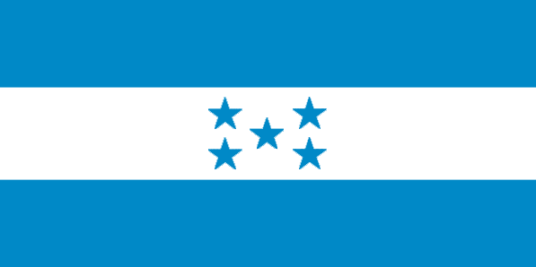
Honduras
Country in French
Honduras
countryucasefr
HONDURAS
Country in Chinese
Country in Spanish
Honduras
Country in Italian
L'Honduras
Country in Portuguese
Honduras
Country in Germain
Honduras
countrypy
hong2 du1 la1 si1
countrylocal
Honduras
countryfull
Honduras
countrynm
Honduras
ISO2
HN
ISO3
HND
countrycodeisono
340
countrycodeolympic
HON
countrycodeirs
HO
countrycodeirsfr
HO
countrycodeirsmixt
HO
countrycode
504
♂Male
19
6
131
languagesfr
Espagnol
46
currency
lempira
currencyfr
lempira
currencyisocode
HNL
currencyisocodefull
HNL 340
currencypxcode
HNL
currencysymbol
L
currencysubdivision
100 centavos
currencyregime
m.float
currencyvalue
0.05549
Capital
Tegucigalpa
capitalfr
Tegucigalpa
Phone Prefix
504
Area km2
112 088
arealand
111 890
areawater
200
landarablerate
0.1515
landforestrate
0.481
coastline
820
summit
Cerro Las Minas 2 865
boundarycountries
Guatémala, El Salvador, Nicaragua.
timezonedeltabegin
-6
flaglink
maplink
hncolor.gif
outlinemaplink
hnoutl.gif
visapassenger
-1
maincities
San Pedro Sula, La Ceiba, Choluteca, El Progeso, Puerto Cortés, Comayagua, Tela, Siguatepeque.
largestcity
Tegucigalpa
largestcitypopulation
995 000
rankpopulation
93
Population
6 969 000
rankgdp
103
gdp
6978000000
rankgdpppp
100
gdpppp
18572000000
rankgni
103
gni
6760000000
rankincomeorigin
137
rankincome
148
income
970
rankincomeppp
149
incomeppp
2590
lifeexpectation
66.15
alphabetizationrate
0.7565
natalityrate
0.03104
mortalityrate
0.00664
mortalityrateinfantile
0.02964
hdi
0.667
urbanization
0.537
precipitation
873
nationalevent
Independence Day
nationaleventfr
Jour de l'Indépendance
nationalholiday
15 September (1821)
Birthday yyyy-mm-dd
1821-09-15 00:00:00
8
6
location
Middle America, bordering the Caribbean Sea, between Guatemala and Nicaragua and bordering the Gulf of Fonseca (North Pacific Ocean), between El Salvador and Nicaragua
terrain
mostly mountains in interior, narrow coastal plains
naturalresources
timber, gold, silver, copper, lead, zinc, iron ore
cooking
Fruits de Mer
9
Web
rgbback
16777215
todate
1
Notes
Fruits de Mer

20

id
Country
Country
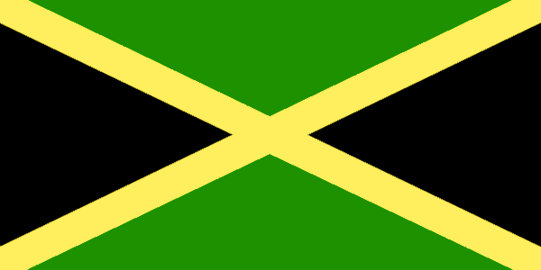
Jamaica
Country in French
Jamaïque
countryucasefr
JAMAIQUE
Country in Chinese
Country in Spanish
Jamaica
Country in Italian
La Giamaica
Country in Portuguese
Jamaica
Country in Germain
Jamaika
countrypy
ya2 mai3 jia1
countrylocal
Jamaica
countryfull
Jamaica
countrynm
Jamaica
ISO2
JM
ISO3
JAM
countrycodeisono
388
countrycodevehicle
JA
countrycodeolympic
JAM
countrycodeirs
JM
countrycodeirsfr
JM
countrycodeirsmixt
JM
♀Female
20
6
51
languagesfr
Anglais
55
currency
dollar
currencyfr
dollar de la Jamaïque
currencyisocode
JMD
currencyisocodefull
JMD 388
currencypxcode
JMD
currencysymbol
J$
currencysubdivision
100 cents
currencyregime
float
currencyvalue
0.02
nationalityfr
Jamaïcaine
Capital
Kingston
capitalfr
Kingston
Phone Prefix
1-876
Area km2
10 991
arealand
10 831
areawater
160
landarablerate
0.1607
landforestrate
0.3
coastline
1022
summit
Blue Mountain Peak 2 256 m.
timezonedeltabegin
-5
flaglink
maplink
jmcolor.gif
outlinemaplink
jm.gif
visapassenger
-1
maincities
Spanish Town, Montego Bay, May Pen, Mandeville, Savanna la Mar
largestcity
Kingston
largestcitypopulation
621 000
rankpopulation
135
Population
2 643 000
rankgdp
97
gdp
8147000000
rankgdpppp
121
gdpppp
10846000000
rankgni
100
gni
7882000000
rankincomeorigin
92
rankincome
102
income
2980
rankincomeppp
134
incomeppp
3790
lifeexpectation
76.07
alphabetizationrate
0.875
natalityrate
0.01694
mortalityrate
0.0054
mortalityrateinfantile
0.01281
hdi
0.757
urbanization
0.566
nationalevent
Independence Day
nationaleventfr
Jour de l'Indépendance
nationalholiday
First Monday in August (1962)
Birthday yyyy-mm-dd
1962-08-01 00:00:00
9
3
location
Caribbean, island in the Caribbean Sea, south of Cuba
terrain
mostly mountains, with narrow, discontinuous coastal plain
naturalresources
bauxite, gypsum, limestone
9
Web
rgbback
16777215
todate
1

More+
A | B | C | D | E | F | G | H | I | J | K | L | M | N | O | P | Q | R | S | T | U | V | W | X | Y | Z
 
All<=>Life::!Filtered Products List!

Give us feedback (37)

37. Visitor *.*.164.* - 2022-03-16 17:43:29
Buenas recomendaciones y todo lo que lleva el contenido de la web es increíble!
36. Visitor *.*.222.* - 2022-02-09 12:45:33
Los materiales que se utilizan para realizar este tipo de prácticas están todos hechos de madera!
35. Visitor *.*.225.* - 2022-01-24 16:55:06
Buenas ideas sabemos como podemos inspirarnos gracias a links así!
34. Visitor *.*.32.* - 2022-01-19 19:32:41
Los sitios web de esta manera me inspiran a seguir trabajando duro!
33. Visitor *.*.146.* - 2021-11-26 15:19:37
Excellent information on your content, thank you for taking the time to share with us.
Email Web

Please copy the string:
String to copy.

Chinese Shoes > Guatemala 危地马拉 => Indonesia 印度尼西亚 => A Country of Beautiful Wood
  

Want to come? | Call us 7/700 33 467 790 487 (Phone)

Popup Window    Close
Patience please...