Indonésie 印度尼西亚 => Pays de Beau Bois

Indonésie 印度尼西亚 => Pays de Beau Bois

Les artisans

Sélection des meubles indonésiens

Les objets

Histoire des meubles indonésiens

Indonésie 印度尼西亚 => Pays de Beau Bois

Mise à jour 2023-11-09 09:24:11

L'Indonésie est un pays situé en Asie dont la capitale est Jakarta. La hiérarchie des divisions administratives est la suivante : L'Indonésie est subdivisée en provinces, qui se divisent à leur tour en régences (kabupaten), villes (kota), qui se divisent à leur tour en districts, qui se divisent à leur tour en bourgades, villages.

Les noms des pays/territoires du monde sont donnés en Français et Chinois. Cette collection des précieuses terres fermes du monde que toute l'humanité partage inclut non seulement les pays indépendants, mais aussi des régions spécifiques qui ne sont pas membre de l'ONUOrganisation des Nations Unies: Nous, peuples des Nations Unies ... Une ONU plus forte pour un monde meilleur. Veuillez aussi consulter les noms des pays en masculin et féminin en Français.

GéoPays    Fermer
Indonésie | Pays/Territoires | Régions en Chine | Provinces de Chine | Régions en France | Départements de France | Provinces du Monde | Villes/Villages | Localités | Continents du Monde | Vins AOP

21

id
Pays
Pays en Anglais
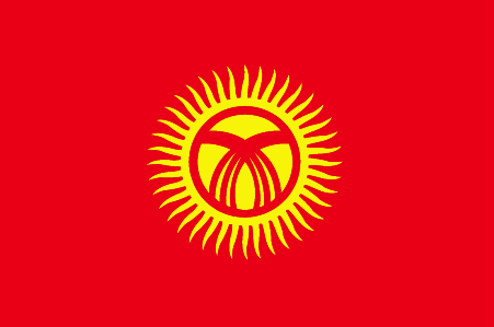
Kyrgyzstan
Pays
Kirghizstan
countryucasefr
KIRGHIZSTAN
Pays en Chinois
Pays en Espagnol
Kyrgyzstan
Pays en Italien
Kyrgyzstan
Pays en Portugais
Kyrgyzstan
Pays en Allemand
Kyrgyzstan
countrypy
ji2 er3 ji2 si1 si1 tan3
countrylocal
Kyrgyz Respublikasy
countryfull
Kyrgyzstan
countrynm
Kyrgyzstan
ISO2
KG
ISO3
KGZ
countrycodeisono
417
countrycodevehicle
KS
countrycodeolympic
KGZ
countrycodeirs
KG
countrycodeirsfr
KG
countrycodeirsmixt
KG
♂Masulin
15
4
90
languagesfr
Kirghiz
60
currency
som
currencyfr
rouble
currencyisocode
KGS
currencyisocodefull
KGS 417
currencypxcode
KGS
currencysubdivision
100 tyyn
currencyregime
float
nationalityfr
Kyrgyz
Capitale
Bishkek
capitalfr
Bichpek
Préfixe Tél.
996
Superficie km2
198 500
arealand
191 300
areawater
7 200
landarablerate
0.0704
landforestrate
0.052
summit
Jengish Chokusu 7 439 m.
boundarycountries
Ouzbekistan, Kazakhstan, Chine, Tadjikistan
timezonedeltabegin
5
flaglink
maplink
kgcolor.gif
outlinemaplink
kgout.gif
visapassenger
-1
maincities
Osh, Dzhalal-Abad, Przheval'sk, Kyzyl-Kiya, Naryn.
largestcity
Bishkek
largestcitypopulation
896 259
rankpopulation
110
Population
5 052 000
rankgdp
143
gdp
1909000000
rankgdpppp
129
gdpppp
8845000000
rankgni
156
gni
1717000000
rankincomeorigin
179
rankincome
193
income
340
rankincomeppp
175
incomeppp
1690
lifeexpectation
67.84
alphabetizationrate
0.97
natalityrate
0.02213
mortalityrate
0.00719
mortalityrateinfantile
0.03681
hdi
0.727
urbanization
0.343
precipitation
443
nationalevent
Independence Day
nationaleventfr
Jour de l'Indépendance
nationalholiday
31 August (1991)
Date de naissance aaaa-mm-jj
1991-08-31 00:00:00
8
8
location
Central Asia, west of China
terrain
peaks of Tien Shan and associated valleys and basins encompass entire nation
naturalresources
abundant hydropower; significant deposits of gold
9
Web
rgbback
16777215
todate
1

22

id
Pays
Pays en Anglais
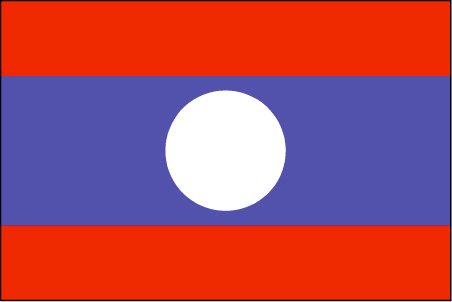
Laos
Pays
Laos
countryucasefr
LAOS
Pays en Chinois
Pays en Espagnol
Laos
Pays en Italien
Il Laos
Pays en Portugais
Laos
Pays en Allemand
Laos
countrypy
lao3 wo1
countrylocal
Lao
countryfull
Laos
countrynm
Laos
ISO2
LA
ISO3
LAO
countrycodeisono
418
countrycodevehicle
LAO
countrycodeolympic
LAO
countrycodeirs
LA
countrycodeirsfr
LA
countrycodeirsmixt
LA
♂Masulin
5
1
93
languagesfr
Laotien
61
currency
new kip
currencyfr
kip
currencyisocode
LAK
currencyisocodefull
LAK 418
currencypxcode
LAK
currencysymbol
KN
currencysubdivision
100 at [*]
currencyregime
m.float
currencyvalue
0.0001
nationalityfr
Laotienne
Capitale
Vientiane
capitalfr
Vientiane
Préfixe Tél.
856
Superficie km2
236 804
arealand
230 800
areawater
6 000
landarablerate
0.0347
landforestrate
0.544
summit
Phou Bia 2 817 m.
boundarycountries
Thaïlande, Myanmar, Chine, Vietnam, Cambodge.
timezonedeltabegin
7
flaglink
maplink
la.jpg
visapassenger
-1
maincities
Luang Prabang, Savannakhet, Pakse, Sayaboury, Khammouane.
largestcity
Vientiane
largestcitypopulation
534 000
rankpopulation
99
Population
5 660 000
rankgdp
140
gdp
2122000000
rankgdpppp
124
gdpppp
9954000000
rankgni
152
gni
1945000000
rankincomeorigin
179
rankincome
193
income
340
rankincomeppp
170
incomeppp
1730
lifeexpectation
54.69
alphabetizationrate
0.514
natalityrate
0.03647
mortalityrate
0.0121
mortalityrateinfantile
0.08706
hdi
0.525
urbanization
0.197
precipitation
1651
nationalevent
Republic Day
nationaleventfr
Jour de la République
nationalholiday
2 December (1975)
Date de naissance aaaa-mm-jj
1975-12-02 00:00:00
2
4
location
Southeastern Asia, northeast of Thailand, west of Vietnam
terrain
mostly rugged mountains; some plains and plateaus
naturalresources
timber, hydropower, gypsum, tin, gold, gemstones
9
Web
rgbback
16777215
todate
1

23

id
Pays
Pays en Anglais
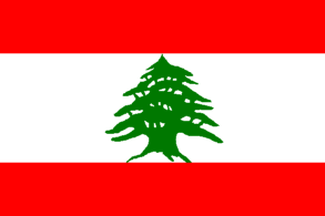
Lebanon
Pays
Liban
countryucasefr
LIBAN
Pays en Chinois
Pays en Espagnol
Líbano
Pays en Italien
Il Libano
Pays en Portugais
Líbano
Pays en Allemand
Der Libanon
countrypy
li2 ba1 nen4
countrylocal
Lubnan
countryfull
Lebanon
countrynm
Lebanon
ISO2
LB
ISO3
LBN
countrycodeisono
422
countrycodevehicle
RL
countrycodeolympic
LIB
countrycodeirs
LE
countrycodeirsfr
LE
countrycodeirsmixt
LE
♂Masulin
15
4
3
languagesfr
Arabe
63
currency
pound (livre)
currencyfr
livre libanaise
currencyisocode
LBP
currencyisocodefull
LBP 422
currencypxcode
LBP
currencysymbol
L.L.
currencysubdivision
100 piastres
currencyregime
float
currencyvalue
0.00066
nationalityfr
Libanaise
Capitale
Bayrut
capitalfr
Beyrouth
Préfixe Tél.
961
Superficie km2
10 400
arealand
10 230
areawater
170
landarablerate
0.176
landforestrate
0.035
coastline
225
summit
Qurnat as-Sawda' 3 083 m.
boundarycountries
Syrie, Israël.
timezonedeltabegin
2
flaglink
maplink
lbcolor.gif
outlinemaplink
lbout.gif
visapassenger
-1
maincities
Tripoli, Zahle, Saïda, Tyr.
largestcity
Beirut
largestcitypopulation
1 826 000
rankpopulation
114
Population
4 498 000
rankgdp
72
gdp
19000000000
rankgdpppp
95
gdpppp
22820000000
rankgni
73
gni
18187000000
rankincomeorigin
81
rankincome
89
income
4040
rankincomeppp
124
incomeppp
4840
lifeexpectation
72.35
alphabetizationrate
0.8715
natalityrate
0.01931
mortalityrate
0.00628
mortalityrateinfantile
0.02548
hdi
0.752
urbanization
0.901
precipitation
825
nationalevent
Independence Day
nationaleventfr
Jour de l'Indépendance
nationalholiday
22 November (1943)
Date de naissance aaaa-mm-jj
1943-11-22 00:00:00
10
8
location
Middle East, bordering the Mediterranean Sea, between Israel and Syria
terrain
narrow coastal plain; El Beqaa (Bekaa Valley) separates Lebanon and Anti-Lebanon Mountains
naturalresources
limestone, iron ore, salt, water-surplus state in
9
Web
rgbback
16777215
todate
1

24

id
Pays
Pays en Anglais
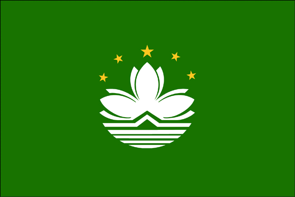
Macau
Pays
Macao
countryucasefr
MACAO
Pays en Chinois
Pays en Espagnol
Macau
Pays en Italien
Macau
Pays en Portugais
Macau
Pays en Allemand
Macau
countryfull
Macau
countrynm
Macau
ISO2
MO
ISO3
MAC
countrycodeisono
446
countrycodeirs
MC
countrycodeirsfr
MC
countrycodeirsmixt
MC
♂Masulin
8
1
34
languagesfr
Chinois, Portuguais
147
currency
pataca
currencyfr
patacas
currencyisocode
MOP
currencyisocodefull
MOP 446
currencypxcode
MOP
currencysymbol
P
currencysubdivision
100 avos
currencyregime
HK-$ (1.03)
currencyvalue
0.1303
nationalityfr
Chinoise
Capitale
Macau
capitalfr
Macao
Préfixe Tél.
853
Superficie km2
15,50
arealand
25,40
coastline
41
summit
Coloane Alto 174 m.
boundarycountries
Chine.
timezonedeltabegin
8
flaglink
maplink
macau.gif
visapassenger
-1
maincities
Taipa, Coloane.
largestcity
Macau
rankpopulation
165
Population
444 000
rankgdp
105
gdp
6765000000
rankgdpppp
130
gdpppp
8615000000
rankgni
105
gni
6335000000
rankincomeorigin
43
rankincome
39
income
14600
rankincomeppp
35
incomeppp
21950
lifeexpectation
82.03
alphabetizationrate
0.945
natalityrate
0.00804
fecondity
0.93
mortalityrate
0.00423
mortalityrateinfantile
0.00439
growthrate
0.00866
urbanization
1
nationalevent
National Day (Anniversary of the Founding of the People's Republic of China)
nationaleventfr
Jour National
nationalholiday
1 October (1949
Date de naissance aaaa-mm-jj
1949-10-01 00:00:00
6
2
location
Eastern Asia, bordering the South China Sea and China
terrain
generally flat
naturalresources
NEGL
8
Web
rgbback
16777215
todate
1

25

id
Pays
Pays en Anglais
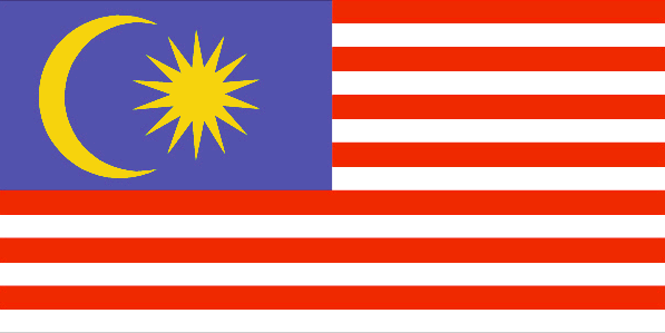
Malaysia
Pays
Malaisie
countryucasefr
MALAISIE
Pays en Chinois
Pays en Espagnol
Malasia
Pays en Italien
La Malesia
Pays en Portugais
Malaysia
Pays en Allemand
Malaysia
countrypy
ma3 lai2 xi1 ya4
countrylocal
Malaysia
countryfull
Malaysia
countrynm
Malaysia
ISO2
MY
ISO3
MYS
countrycodeisono
458
countrycodevehicle
MAL
countrycodeolympic
MAS
countrycodeirs
MY
countrycodeirsfr
MY
countrycodeirsmixt
ML
♀Féminin
12
5
100
languagesfr
Malais
67
currency
ringgit
currencyfr
dollar de la Malaysie
currencyisocode
MYR
currencyisocodefull
MYR 458
currencypxcode
MYR
currencysymbol
RM
currencysubdivision
100 sen
currencyregime
m.float
currencyvalue
0.2632
nationalityfr
Malaise
Capitale
Kuala Lumpur
capitalfr
Kuala Lumpur
Préfixe Tél.
60
Superficie km2
329 750
arealand
328 550
areawater
1 200
landarablerate
0.0554
landforestrate
0.587
coastline
4675
summit
Gunung Kinabalu 4 101 m.
boundarycountries
Thaïlande, Indonésie, Brunei.
timezonedeltabegin
8
flaglink
maplink
mylarge.gif
outlinemaplink
myout.gif
visapassenger
-1
maincities
Ipoh, Johore Bharu, Taiping, George Town, Kota Bharu, Kuala Trengganu, Kuantan, Seremban, Malacca, Kuching, Alor Setar, Kota Kinabalu.
largestcity
Kuala Lumpur
largestcitypopulation
1 236 000
rankpopulation
42
Population
24 774 000
rankgdp
37
gdp
103737000000
rankgdpppp
34
gdpppp
235662000000
rankgni
37
gni
96082000000
rankincomeorigin
82
rankincome
91
income
3880
rankincomeppp
81
incomeppp
8970
lifeexpectation
73.05
alphabetizationrate
0.784
natalityrate
0.0214
mortalityrate
0.0044
mortalityrateinfantile
0.0051
hdi
0.794
precipitation
2366
nationalevent
Independence Day/Malaysia Day
nationaleventfr
Jour de l'Indépendance
nationalholiday
31 August (1957)
Date de naissance aaaa-mm-jj
1957-08-31 00:00:00
4
10
location
Southeastern Asia, peninsula and northern one-third of the island of Borneo, bordering Indonesia and the South China Sea, south of Vietnam
terrain
coastal plains rising to hills and mountains
naturalresources
tin, petroleum, timber, copper, iron ore, natural
cooking
Fruits de Mer.
9
Web
rgbback
16777215
todate
1
Notes
Fruits de Mer.

Plus+
A | B | C | D | E | F | G | H | I | J | K | L | M | N | O | P | Q | R | S | T | U | V | W | X | Y | Z
 

Envoyez vos commentaires (37)

32. Visiteur *.*.146.* - 2021-11-26 15:18:47
Awesome post, thanks for starting the thread that leads to great information!
31. Visiteur *:*:*:*:*:*:*:*:*:*:*:*:*:*:643c - 2021-09-28 14:20:11
This article is one of the best in the history of articles. I'm a antique 'Article' collector and I sometimes read them interesting
30. Visiteur *.*.249.* - 2021-08-12 17:31:21
Qué buena esta página siempre ahí para consultar lo necesario, cualquier cosa esta bien poder verlo!
29. Visiteur *.*.249.* - 2021-08-05 19:38:52
Buenas ideas, siempre es bueno consultar páginas así!
28. Visiteur *.*.152.* - 2021-05-08 03:34:38
Excellent information on your content, thank you for taking the time to share with us.
Email Web

Veuillez recopier la chaîne :
Texte à recopier.

Chaussures Chinoises > Kirghizstan 吉尔吉斯斯坦 => Indonésie 印度尼西亚 => Pays de Beau Bois
  

Envie de venir ? | Appelez-nous 7/704 67 79 04 87 (Service Epices)

Fenêtre contextuelle    Fermer
Veuillez patienter...