Indonesia 印度尼西亚 => A Country of Beautiful Wood

Indonesia 印度尼西亚 => A Country of Beautiful Wood
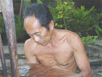

The Artisans

Indonesian Furniture Selection

The Objects

History of Indonesian Furniture

Indonesia 印度尼西亚 => A Country of Beautiful Wood

Updated 2023-11-09 09:24:11

Indonesia is a country on the continent Asia, her capital is Jakarta. Here is the hierarchy of the Indonesia administrative divisions: Indonesia is subdivided into provinces, that are at their turn subdivided into regencies (kabupaten), cities (kota), that are at their turn subdivided into districts, that are at their turn subdivided into towns and villages.

The names of countries/territories of the world are taught in English and Chinese. This collection of precious dry lands that shares the whole mankind includes not only the world's independent countries, but also specific areas that are not a UNUnited Nations: We the peoples...A stronger UN for a better world. member. Please visit the table of male and female genders of country names in French.

Countries/locations    Close
Indonesia | Countries/Territories | Regions of China | Provinces of China | Regions in France | French Departments | States/Provinces | Cities/Towns | Locations | World Continents | French AOP Wines

26

id
Country
Country
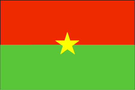
Burkina Faso
Country in French
Burkina Faso
countryucasefr
BURKINA FASO
Country in Chinese
Country in Spanish
Burkino Faso
Country in Italian
Burkino Faso
Country in Portuguese
Burkino Faso
Country in Germain
Burkino Faso
countrypy
bu4 ji1 na4 fa3 suo3
countrylocal
Burkina Faso
countryfull
Burkina Faso
countrynm
Burkina Faso
ISO2
BF
ISO3
BFA
countrycodeisono
854
countrycodevehicle
BF
countrycodeolympic
BUR
countrycodeirs
UV
countrycodeirsfr
UV
countrycodeirsmixt
UV
♂Male
16
4
57
languagesfr
Français
119
currency
franc
currencyfr
franc C.F.A.
currencyisocode
XOF
currencyisocodefull
XOF 952
currencypxcode
XOF
currencysymbol
CFAF
currencysubdivision
100 centimes
currencyregime
Euro (655.957)
currencyvalue
0.00186
Capital
Ouagadougou
capitalfr
Ouagadougou
Phone Prefix
226
Area km2
274 200
arealand
273 800
areawater
400
landarablerate
0.1243
landforestrate
0.259
summit
Tena Kourou 749 m.
boundarycountries
Côte d'Ivoire, Mali, Bénin, Togo, Ghana.
flaglink
maplink
bfcolor.gif
outlinemaplink
bfout.gif
visapassenger
-1
maincities
Bobo Dioulasso, Koudougou, Ouahigouya, Banfora, Kaya.
largestcity
Ouagadougou
largestcitypopulation
824 000
rankpopulation
65
Population
12 109 000
rankgdp
126
gdp
4182000000
rankgdpppp
110
gdpppp
14218000000
rankgni
135
gni
3587000000
rankincomeorigin
183
rankincome
197
income
300
rankincomeppp
183
incomeppp
1170
lifeexpectation
53.8
alphabetizationrate
0.2585
natalityrate
0.04478
mortalityrate
0.01876
mortalityrateinfantile
0.09978
hdi
0.33
nationalevent
Republic Day
nationaleventfr
Jour de la République
nationalholiday
11 December (1958)
Birthday yyyy-mm-dd
1958-12-11 00:00:00
5
11
location
Western Africa, north of Ghana
terrain
mostly flat to dissected, undulating plains; hills in west and southeast
naturalresources
manganese, limestone, marble; small deposits of go
9
Web
rgbback
16777215
todate
1

27

id
Country
Country
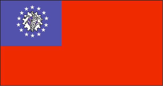
Myanmar
Country in French
Birmanie
countryucasefr
BIRMANIE
Country in Chinese
Country in Spanish
Birmania
Country in Italian
La Birmania
Country in Portuguese
Burma
Country in Germain
Birma
countrypy
mian3 dian4
countrylocal
Myanma Naingngandaw
countryfull
Burma
countrynm
Burma
ISO2
MM
ISO3
MMR
countrycodeisono
104
countrycodevehicle
BUR
countrycodeolympic
MYA
countrycodeirs
BM
countrycodeirsfr
BM
countrycodeirsmixt
BM
♀Female
2
1
30
languagesfr
Birman
120
currency
kyat
currencyfr
kyat
currencyisocode
MMK
currencyisocodefull
MMK 104
currencypxcode
MMK
currencysymbol
K
currencysubdivision
100 pyas
currencyregime
US-$ (5.86of, 200-300bm)
currencyvalue
0.1599
Capital
Rangoon
capitalfr
Rangoon
Phone Prefix
95
Area km2
676 552
arealand
657 740
areawater
20 760
landarablerate
0.1453
landforestrate
0.523
coastline
1930
summit
Hkakabo Razi 5 881 m.
boundarycountries
Bangladesh, Inde, Tibet, Chine, Laos, Thaïlande.
timezonedeltabegin
6.5
flaglink
maplink
mmcolor.gif
outlinemaplink
mmout.gif
visapassenger
-1
maincities
Mandalay, Moulmein, Pegu, Bassein, Akyab, Myeik.
largestcity
Yangon
largestcitypopulation
3 873 000
rankpopulation
24
Population
49 363 000
rankgni
38
gni
92900000000
rankincomeorigin
117
rankincome
126
income
1896
lifeexpectation
55.79
alphabetizationrate
0.806
natalityrate
0.01915
mortalityrate
0.01217
mortalityrateinfantile
0.07035
precipitation
2681
nationalevent
Independence Day
nationaleventfr
Jour de l'Indépendance
nationalholiday
4 January (1948)
Birthday yyyy-mm-dd
1948-01-04 00:00:00
4
12
location
Southeastern Asia, bordering the Andaman Sea and the Bay of Bengal, between Bangladesh and Thailand
terrain
central lowlands ringed by steep, rugged highlands
naturalresources
petroleum, timber, tin, antimony, zinc, copper, tu
9
rgbback
16777215
todate
1

28

id
Country
Country
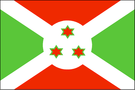
Burundi
Country in French
Burundi
countryucasefr
BURUNDI
Country in Chinese
Country in Spanish
Burundi
Country in Italian
Il Burundi
Country in Portuguese
Burundi
Country in Germain
Burundi
countrypy
pu2 long2 di4
countrylocal
Burundi
countryfull
Burundi
countrynm
Burundi
ISO2
BI
ISO3
BDI
countrycodeisono
108
countrycodevehicle
RU
countrycodeolympic
BDI
countrycodeirs
BY
countrycodeirsfr
BY
countrycodeirsmixt
BY
♂Male
15
2
57
languagesfr
Français
131
currency
franc
currencyfr
franc de Burundi
currencyisocode
BIF
currencyisocodefull
BIF 108
currencypxcode
BIF
currencysymbol
FBu
currencysubdivision
100 centimes [*]
currencyregime
composite
currencyvalue
0.00097
Capital
Bujumbura
capitalfr
Bujumbura
Phone Prefix
257
Area km2
27 834
arealand
25 650
areawater
2 180
landarablerate
0.2998
landforestrate
0.037
summit
Mont Heha 2 760 m.
boundarycountries
Congo démocratique, Rwanda, Tanzanie.
timezonedeltabegin
2
flaglink
maplink
bicolor.gif
outlinemaplink
biout.gif
visapassenger
-1
maincities
Gitega, Bururi, Rumonge, Ngozi.
largestcity
Bujumbura
largestcitypopulation
278 000
rankpopulation
92
Population
7 206 000
rankgdp
167
gdp
595000000
rankgdpppp
142
gdpppp
4668000000
rankgni
186
gni
628000000
rankincomeorigin
207
rankincome
220
income
90
rankincomeppp
205
incomeppp
630
lifeexpectation
43.36
alphabetizationrate
0.507
natalityrate
0.03968
mortalityrate
0.01761
mortalityrateinfantile
0.0704
hdi
0.37
urbanization
0.093
nationalevent
Independence Day
nationaleventfr
Jour de l'Indépendance
nationalholiday
1 July (1962)
Birthday yyyy-mm-dd
1962-07-01 00:00:00
9
3
location
Central Africa, east of Democratic Republic of the Congo
terrain
hilly and mountainous, dropping to a plateau in east, some plains
naturalresources
nickel, uranium, rare earth oxides, peat, cobalt,
9
Web
rgbback
16777215
todate
1

29

id
Country
Country
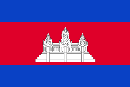
Cambodia
Country in French
Cambodge
countryucasefr
CAMBODGE
Country in Chinese
Country in Spanish
Camboya
Country in Italian
La Cambogia
Country in Portuguese
Cambodia
Country in Germain
Kambodscha
countrypy
jian3 pu3 zhai4
countrylocal
Kampuchea
countryfull
Cambodia
countrynm
Cambodia
ISO2
KH
ISO3
KHM
countrycodeisono
116
countrycodevehicle
K
countrycodeolympic
CAM
countrycodeirs
CB
countrycodeirsfr
CB
countrycodeirsmixt
CB
♂Male
14
4
89
languagesfr
Khmer
24
currency
new riel
currencyfr
riel
currencyisocode
KHR
currencyisocodefull
KHR 116
currencypxcode
KHR
currencysymbol
CR
currencysubdivision
100 sen
currencyregime
m.float
currencyvalue
0.00025
nationalityfr
Cambodgienne
Capital
Phnum Penh
capitalfr
Phnom Penh
Phone Prefix
855
Area km2
181 035
arealand
176 520
areawater
4 520
landarablerate
0.2096
landforestrate
0.529
coastline
443
summit
Phnum Aôral 1 813 m.
boundarycountries
Thaïlande, Laos, Vietnam.
timezonedeltabegin
7
flaglink
maplink
khcolor.gif
outlinemaplink
khout.gif
visapassenger
-1
maincities
Battambang, Pursat, Kompong Cham, Kampot, Siem Reap, Kratie, Kompong Chhnang.
largestcity
Phnum Penh
largestcitypopulation
429 000
rankpopulation
61
Population
13 404 000
rankgdp
125
gdp
4228000000
rankgdpppp
89
gdpppp
27856000000
rankgni
126
gni
4088000000
rankincomeorigin
183
rankincome
197
income
300
rankincomeppp
160
incomeppp
2000
lifeexpectation
57.92
alphabetizationrate
0.673
natalityrate
0.02728
mortalityrate
0.00926
mortalityrateinfantile
0.07594
nationalevent
Independence Day
nationaleventfr
Jour de l'Indépendance
nationalholiday
9 November (1953)
Birthday yyyy-mm-dd
1953-11-09 00:00:00
10
6
location
Southeastern Asia, bordering the Gulf of Thailand, between Thailand, Vietnam, and Laos
terrain
mostly low, flat plains; mountains in southwest and north
naturalresources
timber, gemstones, some iron ore, manganese, phosp
cooking
Riz.
9
rgbback
16777215
todate
1
Notes
Riz.

30

id
Country
Country
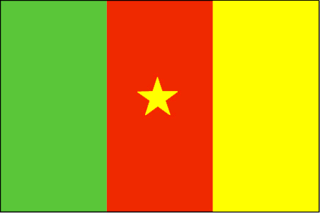
Cameroon
Country in French
Cameroun
countryucasefr
CAMEROUN
Country in Chinese
Country in Spanish
Camerún
Country in Italian
Il Cameroon
Country in Portuguese
Cameroon
Country in Germain
Cameroon
countrypy
ka4 mai4 long2
countrylocal
Cameroon
countryfull
Cameroon
countrynm
Cameroon
ISO2
CM
ISO3
CMR
countrycodeisono
120
countrycodevehicle
CAM
countrycodeolympic
CMR
countrycodeirs
CM
countrycodeirsfr
CM
countrycodeirsmixt
CM
♂Male
15
4
57
languagesfr
Français
119
currency
franc
currencyfr
franc C.F.A.
currencyisocode
XAF
currencyisocodefull
XAF 950
currencypxcode
XAF
currencysymbol
CFAF
currencysubdivision
100 centimes
currencyregime
Euro (655.957)
currencyvalue
0.00186
nationalityfr
Camerounaise
Capital
Yaounde
capitalfr
Yaoundé
Phone Prefix
237
Area km2
475 439
arealand
469 440
areawater
6 000
landarablerate
0.1281
landforestrate
0.513
coastline
402
summit
Fako 4 095 m.
boundarycountries
Nigeria, Tchad, Centrafrique, Congo, Guinée équatoriale, Gabon.
timezonedeltabegin
1
flaglink
maplink
cmcolor.gif
outlinemaplink
cmout.gif
visapassenger
-1
maincities
Douala, N'kongsamba, Maroua, Garoua, Bafoussam, Kumba, Bamenda, Foumban.
largestcity
Douala
largestcitypopulation
1 320 000
rankpopulation
57
Population
16 087 000
rankgdp
86
gdp
12491000000
rankgdpppp
79
gdpppp
34077000000
rankgni
92
gni
10139000000
rankincomeorigin
154
rankincome
168
income
630
rankincomeppp
161
incomeppp
1990
lifeexpectation
48.05
alphabetizationrate
0.541
natalityrate
0.03549
mortalityrate
0.0153
mortalityrateinfantile
0.07012
hdi
0.528
nationalevent
Republic Day (National Day)
nationaleventfr
Jour de la République (Jour National)
nationalholiday
20 May (1972)
Birthday yyyy-mm-dd
1972-05-20 00:00:00
9
1
location
Western Africa, bordering the Bight of Biafra, between Equatorial Guinea and Nigeria
terrain
diverse, with coastal plain in southwest, dissected plateau in center, mountains in west, plains in north
naturalresources
petroleum, bauxite, iron ore, timber, hydropower
cooking
Magnoc.
9
Web
rgbback
16777215
todate
1
Notes
Magnoc.

More+
A | B | C | D | E | F | G | H | I | J | K | L | M | N | O | P | Q | R | S | T | U | V | W | X | Y | Z
 

Give us feedback (37)

32. Visitor *.*.146.* - 2021-11-26 15:18:47
Awesome post, thanks for starting the thread that leads to great information!
31. Visitor *:*:*:*:*:*:*:*:*:*:*:*:*:*:643c - 2021-09-28 14:20:11
This article is one of the best in the history of articles. I'm a antique 'Article' collector and I sometimes read them interesting
30. Visitor *.*.249.* - 2021-08-12 17:31:21
Qué buena esta página siempre ahí para consultar lo necesario, cualquier cosa esta bien poder verlo!
29. Visitor *.*.249.* - 2021-08-05 19:38:52
Buenas ideas, siempre es bueno consultar páginas así!
28. Visitor *.*.152.* - 2021-05-08 03:34:38
Excellent information on your content, thank you for taking the time to share with us.
Email Web

Please copy the string:
String to copy.

Chinese Shoes > Burkina Faso 布基纳法索 => Indonesia 印度尼西亚 => A Country of Beautiful Wood
  

Want to come? | Call us 7/700 33 467 790 487 (Phone)

Popup Window    Close
Patience please...