Indonésie 印度尼西亚 => Pays de Beau Bois

Indonésie 印度尼西亚 => Pays de Beau Bois

Les artisans

Sélection des meubles indonésiens

Les objets

Histoire des meubles indonésiens

Indonésie 印度尼西亚 => Pays de Beau Bois

Mise à jour 2023-11-09 09:24:11

L'Indonésie est un pays situé en Asie dont la capitale est Jakarta. La hiérarchie des divisions administratives est la suivante : L'Indonésie est subdivisée en provinces, qui se divisent à leur tour en régences (kabupaten), villes (kota), qui se divisent à leur tour en districts, qui se divisent à leur tour en bourgades, villages.

Les noms des pays/territoires du monde sont donnés en Français et Chinois. Cette collection des précieuses terres fermes du monde que toute l'humanité partage inclut non seulement les pays indépendants, mais aussi des régions spécifiques qui ne sont pas membre de l'ONUOrganisation des Nations Unies: Nous, peuples des Nations Unies ... Une ONU plus forte pour un monde meilleur. Veuillez aussi consulter les noms des pays en masculin et féminin en Français.

GéoPays    Fermer
Indonésie | Pays/Territoires | Régions en Chine | Provinces de Chine | Régions en France | Départements de France | Provinces du Monde | Villes/Villages | Localités | Continents du Monde | Vins AOP

16

id
Pays
Pays en Anglais
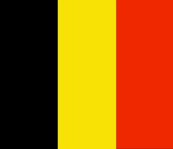
Belgium
Pays
Belgique
countryucasefr
BELGIQUE
Pays en Chinois
Pays en Espagnol
Bélgica
Pays en Italien
Il Belgio
Pays en Portugais
Bélgica
Pays en Allemand
Belgien
countrypy
bi3 li4 shi2
countrylocal
Belgique/Belgie
countryfull
Belgium
countrynm
Belgium
ISO2
BE
ISO3
BEL
countrycodeisono
056
countrycodevehicle
B
countrycodeolympic
BEL
countrycodeirs
BE
countrycodeirsfr
BE
countrycodeirsmixt
BE
countrycode
32
♀Féminin
1
20
7
57
languagesfr
Néerlandais, Français, Allemand
2
currency
euro
currencyfr
euro
currencyisocode
EUR
currencyisocodefull
EUR 978
currencypxcode
EUR
currencysymbol
currencysubdivision
100 cents
currencyregime
float
currencyvalue
1.2203
nationalityfr
Belge
Capitale
Brussels
capitalfr
Bruxelles
Préfixe Tél.
32
Superficie km2
31 100
arealand
30 230
areawater
280
landarablerate
0.25
coastline
66
summit
Signal de Botrange 694 m.
boundarycountries
France, Pays-Bas, Allemagne, Luxembourg
timezonedeltabegin
1
flaglink
maplink
becolor.gif
outlinemaplink
be.gif
maincities
Anvers, Gand, Charleroi, Liège, Bruges, Namur, Mons, Louvain, Alost, Courtrai.
largestcity
Brussels
largestcitypopulation
1 122 000
rankpopulation
73
Population
10 376 000
rankgdp
18
gdp
301896000000
rankgdpppp
28
gdpppp
294001000000
rankgni
18
gni
267250000000
rankincomeorigin
20
rankincome
16
income
25760
rankincomeppp
14
incomeppp
28920
lifeexpectation
78.13
alphabetizationrate
0.99
natalityrate
0.0106
mortalityrate
0.01008
mortalityrateinfantile
0.00464
nationalevent
Ascension to the Throne of King Leopold I
nationaleventfr
Ascension au Tronc du Roi Léopold I
nationalholiday
21 July (1831)
Date de naissance aaaa-mm-jj
1831-06-21 00:00:00
8
4
location
Western Europe, bordering the North Sea, between France and the Netherlands
terrain
flat coastal plains in northwest, central rolling hills, rugged mountains of Ardennes Forest in southeast
naturalresources
coal, natural gas
cooking
Bonbons.
4
Web
rgbback
16777215
todate
1
Notes
Bonbons.

17

id
Pays
Pays en Anglais
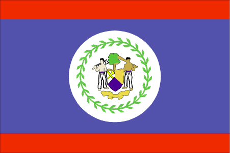
Belize
Pays
Belize
countryucasefr
BELIZE
Pays en Chinois
Pays en Espagnol
Belice
Pays en Italien
Belize
Pays en Portugais
Belize
Pays en Allemand
Belize
countryfull
Belize
countrynm
Belize
ISO2
BZ
ISO3
BLZ
countrycodeisono
084
countrycodevehicle
BH
countrycodeolympic
BIZ
countrycodeirs
BH
countrycodeirsfr
BH
countrycodeirsmixt
BH
♂Masulin
18
6
51
languagesfr
Anglais
15
currency
dollar
currencyfr
dollar de Bélize
currencyisocode
BZD
currencyisocodefull
BZD 084
currencypxcode
BZD
currencysymbol
BZ$
currencysubdivision
100 cents
currencyregime
US-$ (2.0)
currencyvalue
0.5089
Capitale
Belmopan
capitalfr
Belmopan
Préfixe Tél.
501
Superficie km2
22 963
arealand
22 806
areawater
160
landarablerate
0.0281
landforestrate
0.591
coastline
386
summit
Victoria Peak 1 122 m.
boundarycountries
Guatémala, Mexique.
timezonedeltabegin
-6
flaglink
maplink
bzcolor.gif
outlinemaplink
bzoutl.gif
visapassenger
-1
maincities
Belize, Corozal, San Ignacio, Dangriga, Orange Walk.
largestcity
Belmopan
largestcitypopulation
6 000
rankpopulation
172
Population
274 000
rankgdp
155
gdp
988000000
rankgdpppp
153
gdpppp
1902000000
rankgni
174
gni
923000000
rankincomeorigin
88
rankincome
98
income
3370
rankincomeppp
98
incomeppp
6320
lifeexpectation
67.43
alphabetizationrate
0.937
natalityrate
0.02989
fecondity
3.15
mortalityrate
0.00604
mortalityrateinfantile
0.02637
growthrate
0.02385
hdi
0.776
urbanization
0.481
nationalevent
Independence Day
nationaleventfr
Jour de l'Indépendance
nationalholiday
21 September (1981)
Date de naissance aaaa-mm-jj
1981-09-21 00:00:00
8
10
location
Middle America, bordering the Caribbean Sea, between Guatemala and Mexico
terrain
flat, swampy coastal plain; low mountains in south
naturalresources
arable land potential, timber, fish, hydropower
9
Web
rgbback
16777215
todate
1

18

id
Pays
Pays en Anglais
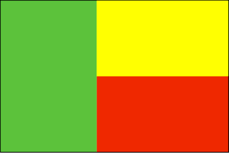
Benin
Pays
Bénin
countryucasefr
BENIN
Pays en Chinois
Pays en Espagnol
Benin
Pays en Italien
Il Benin
Pays en Portugais
Benin
Pays en Allemand
Benin
countrypy
bei4 ning2
countrylocal
Benin
countryfull
Benin
countrynm
Benin
ISO2
BJ
ISO3
BEN
countrycodeisono
204
countrycodevehicle
DY
countrycodeolympic
BEN
countrycodeirs
BN
countrycodeirsfr
BN
countrycodeirsmixt
BN
♂Masulin
15
4
57
languagesfr
Français
119
currency
franc
currencyfr
franc C.F.A.
currencyisocode
XOF
currencyisocodefull
XOF 952
currencypxcode
XOF
currencysymbol
CFAF
currencysubdivision
100 centimes
currencyregime
Euro (655.957)
currencyvalue
0.00186
nationalityfr
Béninoise
Capitale
Porto-Novo
capitalfr
Porto-Novo
Préfixe Tél.
229
Superficie km2
112 622
arealand
110 620
areawater
2 000
landarablerate
0.1528
landforestrate
0.24
coastline
121
summit
Mont Tanekas 641 m.
boundarycountries
Togo, Burkina Faso, Niger, Nigeria.
timezonedeltabegin
1
flaglink
maplink
bjcolor.gif
outlinemaplink
bjout.gif
visapassenger
-1
maincities
Cotonou, Parakou, Abomey, Natitingou.
largestcity
Porto-Novo
largestcitypopulation
194 000
rankpopulation
95
Population
6 720 000
rankgdp
131
gdp
3476000000
rankgdpppp
133
gdpppp
7490000000
rankgni
141
gni
2972000000
rankincomeorigin
170
rankincome
184
income
440
rankincomeppp
184
incomeppp
1110
lifeexpectation
50.81
alphabetizationrate
0.4015
natalityrate
0.04257
mortalityrate
0.01369
mortalityrateinfantile
0.08588
hdi
0.411
urbanization
0.43
nationalevent
National Day
nationaleventfr
Jour National
nationalholiday
1 August (1960)
Date de naissance aaaa-mm-jj
1960-08-01 00:00:00
7
1
location
Western Africa, bordering the Bight of Benin, between Nigeria and Togo
terrain
mostly flat to undulating plain; some hills and low mountains
naturalresources
small offshore oil deposits, limestone, marble, ti
9
Web
rgbback
16777215
todate
1

19

id
Pays
Pays en Anglais
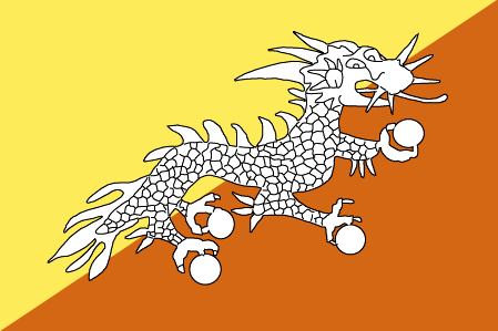
Bhutan
Pays
Bhoutan
countryucasefr
BHOUTAN
Pays en Chinois
Pays en Espagnol
Bhután
Pays en Italien
Il Bhutan
Pays en Portugais
Bhutan
Pays en Allemand
Bhutan
countrypy
bu4 dan1
countrylocal
Bhutan
countryfull
Bhutan
countrynm
Bhutan
ISO2
BT
ISO3
BTN
countrycodeisono
064
countrycodeolympic
BHU
countrycodeirs
BT
countrycodeirsfr
BT
countrycodeirsmixt
BT
♂Masulin
1
3
179
languagesfr
Dzongkha
130
currency
ngultrum
currencyfr
ngultrom et roupie indienne
currencyisocode
BTN
currencyisocodefull
BTN 064
currencypxcode
BTN
currencysymbol
Nu
currencysubdivision
100 chetrum
currencyregime
Indian Rupee (1.0)
currencyvalue
0.0221
nationalityfr
Bhoutanaise
Capitale
Thimphu
capitalfr
Thimbu
Préfixe Tél.
975
Superficie km2
46 620
arealand
47 000
landarablerate
0.0298
landforestrate
0.642
summit
Kula Kangri 7 554 m.
boundarycountries
Inde, Chine.
timezonedeltabegin
6
flaglink
maplink
btcolor.gif
outlinemaplink
btout.gif
visapassenger
-1
maincities
Taga Dzong, Punakha, Bumtang, Phuntsholing.
largestcity
Thimphu
largestcitypopulation
22 000
rankpopulation
153
Population
874 000
rankgdp
164
gdp
697000000
rankgni
188
gni
554000000
rankincomeorigin
154
rankincome
168
income
630
lifeexpectation
53.99
alphabetizationrate
0.4735
natalityrate
0.03441
mortalityrate
0.0132
mortalityrateinfantile
0.10256
hdi
0.511
urbanization
0.084
nationalevent
National Day (Ugyen WANGCHUCK became first hereditary king)
nationaleventfr
Jour National
nationalholiday
17 December (1907)
Date de naissance aaaa-mm-jj
1907-12-17 00:00:00
4
8
location
Southern Asia, between China and India
terrain
mostly mountainous with some fertile valleys and savanna
naturalresources
timber, hydropower, gypsum, calcium carbide
9
rgbback
16777215
todate
1

20

id
Pays
Pays en Anglais
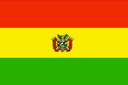
Bolivia
Pays
Bolivie
countryucasefr
BOLIVIE
Pays en Chinois
Pays en Espagnol
Bolivia
Pays en Italien
La Bolivia
Pays en Portugais
Bolívia
Pays en Allemand
Bolivien
countrypy
bo1 li4 wei2 ya4
countrylocal
Bolivia
countryfull
Bolivia
countrynm
Bolivia
ISO2
BO
ISO3
BOL
countrycodeisono
068
countrycodevehicle
BOL
countrycodeolympic
BOL
countrycodeirs
BL
countrycodeirsfr
BL
countrycodeirsmixt
BL
countrycode
591
♀Féminin
15
6
131
languagesfr
Quechua, Espagnol, Aymara
17
currency
boliviano
currencyfr
boliviano
currencyisocode
BOB
currencyisocodefull
BOB 068
currencypxcode
BOB
currencysymbol
Bs
currencysubdivision
100 centavos
currencyregime
float
currencyvalue
0.1239
nationalityfr
Bolivienne
Capitale
La Paz
capitalfr
La Paz
Préfixe Tél.
591
Superficie km2
1 098 581
arealand
1 084 390
areawater
14 190
landarablerate
0.0173
landforestrate
0.489
summit
Cerro Illimani 6 882 m.
boundarycountries
Pérou, Brésil, Paraguay, Argentine, Chili.
timezonedeltabegin
-4
flaglink
maplink
bocolor.gif
outlinemaplink
bo.gif
visapassenger
-1
maincities
Cochabamba, Oruro, Santa Cruz, Sucre, Potosi.
largestcity
La Paz
largestcitypopulation
1 250 000
rankpopulation
81
Population
8 814 000
rankgdp
98
gdp
7867000000
rankgdpppp
96
gdpppp
22800000000
rankgni
99
gni
7924000000
rankincomeorigin
142
rankincome
155
income
900
rankincomeppp
151
incomeppp
2490
lifeexpectation
64.78
alphabetizationrate
0.8229
natalityrate
0.02553
mortalityrate
0.00791
mortalityrateinfantile
0.05605
hdi
0.643
nationalevent
Independence Day
nationaleventfr
Jour de l'Indépendance
nationalholiday
6 August (1825)
Date de naissance aaaa-mm-jj
1825-08-06 00:00:00
2
10
location
Central South America, southwest of Brazil
terrain
rugged Andes Mountains with a highland plateau (Altiplano), hills, lowland plains of the Amazon Basin
naturalresources
tin, natural gas, petroleum, zinc, tungsten, antim
9
Web
rgbback
16777215
todate
1

Plus+
A | B | C | D | E | F | G | H | I | J | K | L | M | N | O | P | Q | R | S | T | U | V | W | X | Y | Z
 

Envoyez vos commentaires (37)

37. Visiteur *.*.164.* - 2022-03-16 17:43:29
Buenas recomendaciones y todo lo que lleva el contenido de la web es increíble!
36. Visiteur *.*.222.* - 2022-02-09 12:45:33
Los materiales que se utilizan para realizar este tipo de prácticas están todos hechos de madera!
35. Visiteur *.*.225.* - 2022-01-24 16:55:06
Buenas ideas sabemos como podemos inspirarnos gracias a links así!
34. Visiteur *.*.32.* - 2022-01-19 19:32:41
Los sitios web de esta manera me inspiran a seguir trabajando duro!
33. Visiteur *.*.146.* - 2021-11-26 15:19:37
Excellent information on your content, thank you for taking the time to share with us.
Email Web

Veuillez recopier la chaîne :
Texte à recopier.

Chaussures Chinoises > Belgique 比利时 => Indonésie 印度尼西亚 => Pays de Beau Bois
  

Envie de venir ? | Appelez-nous 7/704 67 79 04 87 (Service Epices)

Fenêtre contextuelle    Fermer
Veuillez patienter...