Indonésie 印度尼西亚 => Pays de Beau Bois

Indonésie 印度尼西亚 => Pays de Beau Bois

Les artisans

Sélection des meubles indonésiens

Les objets

Histoire des meubles indonésiens

Indonésie 印度尼西亚 => Pays de Beau Bois

Mise à jour 2023-11-09 09:24:11

L'Indonésie est un pays situé en Asie dont la capitale est Jakarta. La hiérarchie des divisions administratives est la suivante : L'Indonésie est subdivisée en provinces, qui se divisent à leur tour en régences (kabupaten), villes (kota), qui se divisent à leur tour en districts, qui se divisent à leur tour en bourgades, villages.

Les noms des pays/territoires du monde sont donnés en Français et Chinois. Cette collection des précieuses terres fermes du monde que toute l'humanité partage inclut non seulement les pays indépendants, mais aussi des régions spécifiques qui ne sont pas membre de l'ONUOrganisation des Nations Unies: Nous, peuples des Nations Unies ... Une ONU plus forte pour un monde meilleur. Veuillez aussi consulter les noms des pays en masculin et féminin en Français.

GéoPays    Fermer
Indonésie | Pays/Territoires | Régions en Chine | Provinces de Chine | Régions en France | Départements de France | Provinces du Monde | Villes/Villages | Localités | Continents du Monde | Vins AOP

26

id
Pays
Pays en Anglais
Burkina Faso
Pays
Burkina Faso
countryucasefr
BURKINA FASO
Pays en Chinois
Pays en Espagnol
Burkino Faso
Pays en Italien
Burkino Faso
Pays en Portugais
Burkino Faso
Pays en Allemand
Burkino Faso
countrypy
bu4 ji1 na4 fa3 suo3
countrylocal
Burkina Faso
countryfull
Burkina Faso
countrynm
Burkina Faso
ISO2
BF
ISO3
BFA
countrycodeisono
854
countrycodevehicle
BF
countrycodeolympic
BUR
countrycodeirs
UV
countrycodeirsfr
UV
countrycodeirsmixt
UV
♂Masulin
16
4
57
languagesfr
Français
119
currency
franc
currencyfr
franc C.F.A.
currencyisocode
XOF
currencyisocodefull
XOF 952
currencypxcode
XOF
currencysymbol
CFAF
currencysubdivision
100 centimes
currencyregime
Euro (655.957)
currencyvalue
0.00186
Capitale
Ouagadougou
capitalfr
Ouagadougou
Préfixe Tél.
226
Superficie km2
274 200
arealand
273 800
areawater
400
landarablerate
0.1243
landforestrate
0.259
summit
Tena Kourou 749 m.
boundarycountries
Côte d'Ivoire, Mali, Bénin, Togo, Ghana.
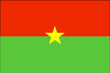
flaglink
maplink
bfcolor.gif
outlinemaplink
bfout.gif
visapassenger
-1
maincities
Bobo Dioulasso, Koudougou, Ouahigouya, Banfora, Kaya.
largestcity
Ouagadougou
largestcitypopulation
824 000
rankpopulation
65
Population
12 109 000
rankgdp
126
gdp
4182000000
rankgdpppp
110
gdpppp
14218000000
rankgni
135
gni
3587000000
rankincomeorigin
183
rankincome
197
income
300
rankincomeppp
183
incomeppp
1170
lifeexpectation
53.8
alphabetizationrate
0.2585
natalityrate
0.04478
mortalityrate
0.01876
mortalityrateinfantile
0.09978
hdi
0.33
nationalevent
Republic Day
nationaleventfr
Jour de la République
nationalholiday
11 December (1958)
Date de naissance aaaa-mm-jj
1958-12-11 00:00:00
5
11
location
Western Africa, north of Ghana
terrain
mostly flat to dissected, undulating plains; hills in west and southeast
naturalresources
manganese, limestone, marble; small deposits of go
9
Web
rgbback
16777215
todate
1

27

id
Pays
Pays en Anglais
Myanmar
Pays
Birmanie
countryucasefr
BIRMANIE
Pays en Chinois
Pays en Espagnol
Birmania
Pays en Italien
La Birmania
Pays en Portugais
Burma
Pays en Allemand
Birma
countrypy
mian3 dian4
countrylocal
Myanma Naingngandaw
countryfull
Burma
countrynm
Burma
ISO2
MM
ISO3
MMR
countrycodeisono
104
countrycodevehicle
BUR
countrycodeolympic
MYA
countrycodeirs
BM
countrycodeirsfr
BM
countrycodeirsmixt
BM
♀Féminin
2
1
30
languagesfr
Birman
120
currency
kyat
currencyfr
kyat
currencyisocode
MMK
currencyisocodefull
MMK 104
currencypxcode
MMK
currencysymbol
K
currencysubdivision
100 pyas
currencyregime
US-$ (5.86of, 200-300bm)
currencyvalue
0.1599
Capitale
Rangoon
capitalfr
Rangoon
Préfixe Tél.
95
Superficie km2
676 552
arealand
657 740
areawater
20 760
landarablerate
0.1453
landforestrate
0.523
coastline
1930
summit
Hkakabo Razi 5 881 m.
boundarycountries
Bangladesh, Inde, Tibet, Chine, Laos, Thaïlande.
timezonedeltabegin
6.5
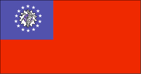
flaglink
maplink
mmcolor.gif
outlinemaplink
mmout.gif
visapassenger
-1
maincities
Mandalay, Moulmein, Pegu, Bassein, Akyab, Myeik.
largestcity
Yangon
largestcitypopulation
3 873 000
rankpopulation
24
Population
49 363 000
rankgni
38
gni
92900000000
rankincomeorigin
117
rankincome
126
income
1896
lifeexpectation
55.79
alphabetizationrate
0.806
natalityrate
0.01915
mortalityrate
0.01217
mortalityrateinfantile
0.07035
precipitation
2681
nationalevent
Independence Day
nationaleventfr
Jour de l'Indépendance
nationalholiday
4 January (1948)
Date de naissance aaaa-mm-jj
1948-01-04 00:00:00
4
12
location
Southeastern Asia, bordering the Andaman Sea and the Bay of Bengal, between Bangladesh and Thailand
terrain
central lowlands ringed by steep, rugged highlands
naturalresources
petroleum, timber, tin, antimony, zinc, copper, tu
9
rgbback
16777215
todate
1

28

id
Pays
Pays en Anglais
Burundi
Pays
Burundi
countryucasefr
BURUNDI
Pays en Chinois
Pays en Espagnol
Burundi
Pays en Italien
Il Burundi
Pays en Portugais
Burundi
Pays en Allemand
Burundi
countrypy
pu2 long2 di4
countrylocal
Burundi
countryfull
Burundi
countrynm
Burundi
ISO2
BI
ISO3
BDI
countrycodeisono
108
countrycodevehicle
RU
countrycodeolympic
BDI
countrycodeirs
BY
countrycodeirsfr
BY
countrycodeirsmixt
BY
♂Masulin
15
2
57
languagesfr
Français
131
currency
franc
currencyfr
franc de Burundi
currencyisocode
BIF
currencyisocodefull
BIF 108
currencypxcode
BIF
currencysymbol
FBu
currencysubdivision
100 centimes [*]
currencyregime
composite
currencyvalue
0.00097
Capitale
Bujumbura
capitalfr
Bujumbura
Préfixe Tél.
257
Superficie km2
27 834
arealand
25 650
areawater
2 180
landarablerate
0.2998
landforestrate
0.037
summit
Mont Heha 2 760 m.
boundarycountries
Congo démocratique, Rwanda, Tanzanie.
timezonedeltabegin
2
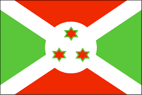
flaglink
maplink
bicolor.gif
outlinemaplink
biout.gif
visapassenger
-1
maincities
Gitega, Bururi, Rumonge, Ngozi.
largestcity
Bujumbura
largestcitypopulation
278 000
rankpopulation
92
Population
7 206 000
rankgdp
167
gdp
595000000
rankgdpppp
142
gdpppp
4668000000
rankgni
186
gni
628000000
rankincomeorigin
207
rankincome
220
income
90
rankincomeppp
205
incomeppp
630
lifeexpectation
43.36
alphabetizationrate
0.507
natalityrate
0.03968
mortalityrate
0.01761
mortalityrateinfantile
0.0704
hdi
0.37
urbanization
0.093
nationalevent
Independence Day
nationaleventfr
Jour de l'Indépendance
nationalholiday
1 July (1962)
Date de naissance aaaa-mm-jj
1962-07-01 00:00:00
9
3
location
Central Africa, east of Democratic Republic of the Congo
terrain
hilly and mountainous, dropping to a plateau in east, some plains
naturalresources
nickel, uranium, rare earth oxides, peat, cobalt,
9
Web
rgbback
16777215
todate
1

29

id
Pays
Pays en Anglais
Cambodia
Pays
Cambodge
countryucasefr
CAMBODGE
Pays en Chinois
Pays en Espagnol
Camboya
Pays en Italien
La Cambogia
Pays en Portugais
Cambodia
Pays en Allemand
Kambodscha
countrypy
jian3 pu3 zhai4
countrylocal
Kampuchea
countryfull
Cambodia
countrynm
Cambodia
ISO2
KH
ISO3
KHM
countrycodeisono
116
countrycodevehicle
K
countrycodeolympic
CAM
countrycodeirs
CB
countrycodeirsfr
CB
countrycodeirsmixt
CB
♂Masulin
14
4
89
languagesfr
Khmer
24
currency
new riel
currencyfr
riel
currencyisocode
KHR
currencyisocodefull
KHR 116
currencypxcode
KHR
currencysymbol
CR
currencysubdivision
100 sen
currencyregime
m.float
currencyvalue
0.00025
nationalityfr
Cambodgienne
Capitale
Phnum Penh
capitalfr
Phnom Penh
Préfixe Tél.
855
Superficie km2
181 035
arealand
176 520
areawater
4 520
landarablerate
0.2096
landforestrate
0.529
coastline
443
summit
Phnum Aôral 1 813 m.
boundarycountries
Thaïlande, Laos, Vietnam.
timezonedeltabegin
7
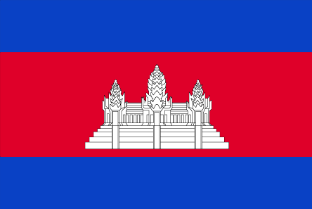
flaglink
maplink
khcolor.gif
outlinemaplink
khout.gif
visapassenger
-1
maincities
Battambang, Pursat, Kompong Cham, Kampot, Siem Reap, Kratie, Kompong Chhnang.
largestcity
Phnum Penh
largestcitypopulation
429 000
rankpopulation
61
Population
13 404 000
rankgdp
125
gdp
4228000000
rankgdpppp
89
gdpppp
27856000000
rankgni
126
gni
4088000000
rankincomeorigin
183
rankincome
197
income
300
rankincomeppp
160
incomeppp
2000
lifeexpectation
57.92
alphabetizationrate
0.673
natalityrate
0.02728
mortalityrate
0.00926
mortalityrateinfantile
0.07594
nationalevent
Independence Day
nationaleventfr
Jour de l'Indépendance
nationalholiday
9 November (1953)
Date de naissance aaaa-mm-jj
1953-11-09 00:00:00
10
6
location
Southeastern Asia, bordering the Gulf of Thailand, between Thailand, Vietnam, and Laos
terrain
mostly low, flat plains; mountains in southwest and north
naturalresources
timber, gemstones, some iron ore, manganese, phosp
cooking
Riz.
9
rgbback
16777215
todate
1
Notes
Riz.

30

id
Pays
Pays en Anglais
Cameroon
Pays
Cameroun
countryucasefr
CAMEROUN
Pays en Chinois
Pays en Espagnol
Camerún
Pays en Italien
Il Cameroon
Pays en Portugais
Cameroon
Pays en Allemand
Cameroon
countrypy
ka4 mai4 long2
countrylocal
Cameroon
countryfull
Cameroon
countrynm
Cameroon
ISO2
CM
ISO3
CMR
countrycodeisono
120
countrycodevehicle
CAM
countrycodeolympic
CMR
countrycodeirs
CM
countrycodeirsfr
CM
countrycodeirsmixt
CM
♂Masulin
15
4
57
languagesfr
Français
119
currency
franc
currencyfr
franc C.F.A.
currencyisocode
XAF
currencyisocodefull
XAF 950
currencypxcode
XAF
currencysymbol
CFAF
currencysubdivision
100 centimes
currencyregime
Euro (655.957)
currencyvalue
0.00186
nationalityfr
Camerounaise
Capitale
Yaounde
capitalfr
Yaoundé
Préfixe Tél.
237
Superficie km2
475 439
arealand
469 440
areawater
6 000
landarablerate
0.1281
landforestrate
0.513
coastline
402
summit
Fako 4 095 m.
boundarycountries
Nigeria, Tchad, Centrafrique, Congo, Guinée équatoriale, Gabon.
timezonedeltabegin
1
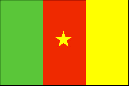
flaglink
maplink
cmcolor.gif
outlinemaplink
cmout.gif
visapassenger
-1
maincities
Douala, N'kongsamba, Maroua, Garoua, Bafoussam, Kumba, Bamenda, Foumban.
largestcity
Douala
largestcitypopulation
1 320 000
rankpopulation
57
Population
16 087 000
rankgdp
86
gdp
12491000000
rankgdpppp
79
gdpppp
34077000000
rankgni
92
gni
10139000000
rankincomeorigin
154
rankincome
168
income
630
rankincomeppp
161
incomeppp
1990
lifeexpectation
48.05
alphabetizationrate
0.541
natalityrate
0.03549
mortalityrate
0.0153
mortalityrateinfantile
0.07012
hdi
0.528
nationalevent
Republic Day (National Day)
nationaleventfr
Jour de la République (Jour National)
nationalholiday
20 May (1972)
Date de naissance aaaa-mm-jj
1972-05-20 00:00:00
9
1
location
Western Africa, bordering the Bight of Biafra, between Equatorial Guinea and Nigeria
terrain
diverse, with coastal plain in southwest, dissected plateau in center, mountains in west, plains in north
naturalresources
petroleum, bauxite, iron ore, timber, hydropower
cooking
Magnoc.
9
Web
rgbback
16777215
todate
1
Notes
Magnoc.

Plus+
A | B | C | D | E | F | G | H | I | J | K | L | M | N | O | P | Q | R | S | T | U | V | W | X | Y | Z
 

Envoyez vos commentaires (37)

37. Visiteur *.*.164.* - 2022-03-16 17:43:29
Buenas recomendaciones y todo lo que lleva el contenido de la web es increíble!
36. Visiteur *.*.222.* - 2022-02-09 12:45:33
Los materiales que se utilizan para realizar este tipo de prácticas están todos hechos de madera!
35. Visiteur *.*.225.* - 2022-01-24 16:55:06
Buenas ideas sabemos como podemos inspirarnos gracias a links así!
34. Visiteur *.*.32.* - 2022-01-19 19:32:41
Los sitios web de esta manera me inspiran a seguir trabajando duro!
33. Visiteur *.*.146.* - 2021-11-26 15:19:37
Excellent information on your content, thank you for taking the time to share with us.
Email Web

Veuillez recopier la chaîne :
Texte à recopier.

Chaussures Chinoises > Burkina Faso 布基纳法索 => Indonésie 印度尼西亚 => Pays de Beau Bois
  

Envie de venir ? | Appelez-nous 7/704 67 79 04 87 (Service Epices)

Fenêtre contextuelle    Fermer
Veuillez patienter...