Pays/Territoires
Mise à jour 2021-01-12 18:58:07
Les noms des pays/territoires du monde sont donnés en Français et Chinois. Cette collection des précieuses terres fermes du monde que toute l'humanité partage inclut non seulement les pays indépendants, mais aussi des régions spécifiques qui ne sont pas membre de l'ONUOrganisation des Nations Unies: Nous, peuples des Nations Unies ... Une ONU plus forte pour un monde meilleur. Veuillez aussi consulter les noms des pays en masculin et féminin en Français.
GéoPays Fermer
101
id
Pays
Pays en Anglais
Guinea
Pays
Guinée
countryucasefr
GUINEE
Pays en Chinois
Pays en Espagnol
Guinea
Pays en Italien
Guinea
Pays en Portugais
Guinea
Pays en Allemand
Guine
countrypy
ji1 nei4 ya4
countrylocal
Guinee
countryfull
Guinea
countrynm
Guinea
ISO2
GN
ISO3
GIN
countrycodeisono
324
countrycodevehicle
RG
countrycodeolympic
GUI
countrycodeirs
GV
countrycodeirsfr
GV
countrycodeirsmixt
GV
♀Féminin
15
4
57
languagesfr
Français
138
currency
syli
currencyfr
franc guinéen
currencyisocode
GNS
currencyisocodefull
GNS 324
currencypxcode
GNF
currencysymbol
FG
currencysubdivision
10 francs, 1 franc = 100 centimes
currencyregime
m.float
currencyvalue
0.0003
nationalityfr
Guinéenne
Capitale
Conakry
capitalfr
Gonakry
Préfixe Tél.
224
Superficie km2
245 860
arealand
245 857
landarablerate
0.036
landforestrate
0.282
coastline
320
summit
Mont Nimba 1 752 m.
boundarycountries
Guinée Bissau, Côte d'Ivoire, Sénégal, Mali, Libéria, Sierra Leone.
flaglink
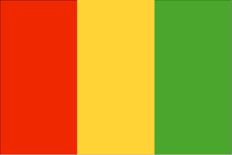
maplink
gncolor.gif
outlinemaplink
gnout.gif
visapassenger
-1
maincities
Kankan, Labé, Nzerékoré.
largestcity
Conakry
largestcitypopulation
1 558 000
rankpopulation
89
Population
7 909 000
rankgdp
129
gdp
3630000000
rankgdpppp
105
gdpppp
16582000000
rankgni
138
gni
3384000000
rankincomeorigin
171
rankincome
185
income
430
rankincomeppp
158
incomeppp
2080
lifeexpectation
49.7
alphabetizationrate
0.4105
natalityrate
0.04226
mortalityrate
0.01553
mortalityrateinfantile
0.09182
hdi
0.425
urbanization
0.279
precipitation
3784
nationalevent
Independence Day
nationaleventfr
Jour de l'Indépendance
nationalholiday
2 October (1958)
Date de naissance aaaa-mm-jj
1958-10-02 00:00:00
5
11
location
Western Africa, bordering the North Atlantic Ocean, between Guinea-Bissau and Sierra Leone
terrain
generally flat coastal plain, hilly to mountainous interior
naturalresources
bauxite, iron ore, diamonds, gold, uranium, hydrop
9
Web
rgbback
16777215
todate
1
102
id
Pays
Pays en Anglais
Guinea-Bissau
Pays
Guinée-Bissau
countryucasefr
GUINEE-BISSAU
Pays en Chinois
Pays en Espagnol
Guinea-Bissau
Pays en Italien
La Guinea-Bissau
Pays en Portugais
Guiné-Bissau
Pays en Allemand
Guinea-Bissau
countryfull
Guinea-Bissau
countrynm
Guinea-Bissau
ISO2
GW
ISO3
GNB
countrycodeisono
624
countrycodeolympic
GBS
countrycodeirs
PU
countrycodeirsfr
PU
countrycodeirsmixt
PU
♀Féminin
15
6
114
languagesfr
Portugais
139
currency
franc
currencyfr
peso
currencyisocode
XOF
currencyisocodefull
XOF 952
currencypxcode
XOF
currencysymbol
CFAF
currencysubdivision
100 centimes [*]
currencyregime
Euro (655.957)
currencyvalue
0.00186
nationalityfr
Guinéenne
Capitale
Bissau
capitalfr
Bissau
Préfixe Tél.
245
Superficie km2
36 120
arealand
28 000
areawater
8 120
landarablerate
0.1067
landforestrate
0.605
coastline
350
summit
300 m.
boundarycountries
Sénégal, Guinée.
flaglink
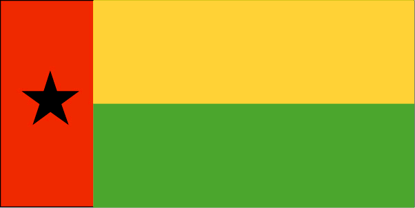
maplink
gwcolor.gif
outlinemaplink
gwout.gif
visapassenger
-1
maincities
Bafatá, Gabu, Mansôa, Catió, Canchungo, Farim.
largestcity
Bissau
largestcitypopulation
233 000
rankpopulation
145
Population
1 489 000
rankgdp
180
gdp
239000000
rankgdpppp
155
gdpppp
1058000000
rankgni
203
gni
202000000
rankincomeorigin
202
rankincome
217
income
140
rankincomeppp
202
incomeppp
680
lifeexpectation
46.98
alphabetizationrate
0.4145
natalityrate
0.03803
mortalityrate
0.01657
mortalityrateinfantile
0.10872
hdi
0.373
urbanization
0.323
nationalevent
Independence Day
nationaleventfr
Jour de l'Indépendance
nationalholiday
24 September (1973)
Date de naissance aaaa-mm-jj
1973-09-24 00:00:00
10
2
location
Western Africa, bordering the North Atlantic Ocean, between Guinea and Senegal
terrain
mostly low coastal plain rising to savanna in east
naturalresources
fish, timber, phosphates, bauxite, unexploited dep
9
Web
rgbback
16777215
todate
1
103
id
Pays
Pays en Anglais
Guyana
Pays
Guyana
countryucasefr
GUYANA
Pays en Chinois
Pays en Espagnol
Guyana
Pays en Italien
La Guyana
Pays en Portugais
Guyana
Pays en Allemand
Guyana
countrypy
gui1 ya4 na4
countrylocal
Guyana
countryfull
Guyana
countrynm
Guyana
ISO2
GY
ISO3
GUY
countrycodeisono
328
countrycodevehicle
GUY
countrycodeolympic
GUY
countrycodeirs
GY
countrycodeirsfr
GY
countrycodeirsmixt
GY
♂Masulin
15
6
51
languagesfr
Anglais
45
currency
dollar
currencyfr
dollar de Guyana
currencyisocode
GYD
currencyisocodefull
GYD 328
currencypxcode
GYD
currencysymbol
G$
currencysubdivision
100 cents
currencyregime
float
currencyvalue
0.0056
nationalityfr
Guyanaise
Capitale
Georgetown
capitalfr
Georgetown
Préfixe Tél.
592
Superficie km2
214 970
arealand
196 850
areawater
18 120
landarablerate
0.0244
landforestrate
0.785
coastline
459
summit
Mount Roraima 2 772 m.
boundarycountries
Vénézuéla, Surinam, Brésil .
timezonedeltabegin
-3
flaglink
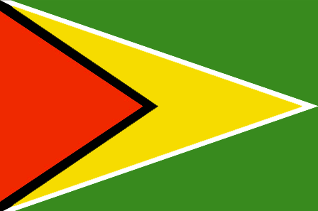
maplink
gycolor.gif
outlinemaplink
gy.gif
visapassenger
-1
maincities
Linden, New Amsterdam, Corriverton, Mahaicony.
largestcity
Georgetown
largestcitypopulation
254 000
rankpopulation
156
Population
769 000
rankgdp
161
gdp
742000000
rankgdpppp
149
gdpppp
3253000000
rankgni
182
gni
689000000
rankincomeorigin
142
rankincome
155
income
900
rankincomeppp
131
incomeppp
3980
lifeexpectation
62.43
alphabetizationrate
0.9865
natalityrate
0.01785
mortalityrate
0.00971
mortalityrateinfantile
0.03722
hdi
0.74
urbanization
0.00467
precipitation
2262
nationalevent
Republic Day
nationaleventfr
Jour de la République
nationalholiday
23 February (1970)
Date de naissance aaaa-mm-jj
1970-02-23 00:00:00
7
11
location
Northern South America, bordering the North Atlantic Ocean, between Suriname and Venezuela
terrain
mostly rolling highlands; low coastal plain; savanna in south
naturalresources
bauxite, gold, diamonds, hardwood timber, shrimp,
cooking
Sucre.
9
rgbback
16777215
todate
1
Notes
Sucre.
104
id
Pays
Pays en Anglais
Haiti
Pays
Haïti
countryucasefr
HAITI
Pays en Chinois
Pays en Espagnol
Haití
Pays en Italien
L'Haiti
Pays en Portugais
Haiti
Pays en Allemand
Haiti
countrypy
hai3 di4
countrylocal
Haiti
countryfull
Haiti
countrynm
Haiti
ISO2
HT
ISO3
HTI
countrycodeisono
332
countrycodevehicle
RH
countrycodeolympic
HAI
countrycodeirs
HA
countrycodeirsfr
HA
countrycodeirsmixt
HA
8
57
languagesfr
Français, créole.
140
currency
gourde
currencyfr
gourde
currencyisocode
HTG
currencyisocodefull
HTG 332
currencypxcode
HTG
currencysymbol
G
currencysubdivision
100 centimes
currencyregime
float
currencyvalue
0.0274
nationalityfr
Haïtienne
Capitale
Port-au-Prince
capitalfr
Port-au-Prince
Préfixe Tél.
509
Superficie km2
247,50
arealand
27 560
areawater
190
landarablerate
0.2032
landforestrate
0.032
coastline
1771
summit
Pic La Selle 2 674 m.
boundarycountries
République Dominicaine.
timezonedeltabegin
-5
flaglink
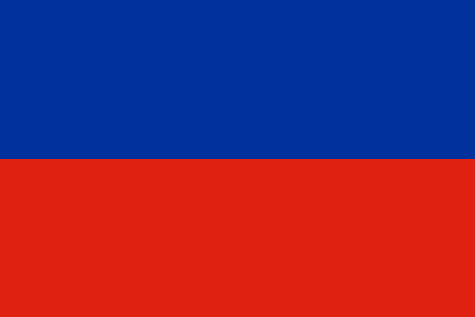
maplink
htcolor.gif
outlinemaplink
ht.gif
visapassenger
-1
maincities
Cap Haïtien, Pétionville, Gonaives, Les Cayes, Port-de-Paix.
largestcity
Port-au-Prince
largestcitypopulation
1 461 000
rankpopulation
84
Population
8 440 000
rankgdp
134
gdp
2921000000
rankgdpppp
107
gdpppp
14703000000
rankgni
139
gni
3342000000
rankincomeorigin
173
rankincome
187
income
400
rankincomeppp
170
incomeppp
1730
lifeexpectation
51.78
alphabetizationrate
0.5195
natalityrate
0.03376
mortalityrate
0.01321
mortalityrateinfantile
0.07438
hdi
0.467
urbanization
0.363
nationalevent
Independence Day
nationaleventfr
Jour de l'Indépendance
nationalholiday
1 January (1804)
Date de naissance aaaa-mm-jj
1804-01-01 00:00:00
10
12
location
Caribbean, western one-third of the island of Hispaniola, between the Caribbean Sea and the North Atlantic Ocean, west of the Dominican Republic
terrain
mostly rough and mountainous
naturalresources
bauxite, copper, calcium carbonate, gold, marble,
9
Web
rgbback
16777215
todate
1
105
id
Pays
Pays en Anglais
Heard Island and McDonald Islands
Pays
Ile Heard & Iles McDonald
countryucasefr
ILE HEARD & ILES MCDONALD
Pays en Chinois
Pays en Espagnol
Isla Y Islas Oídas De McDonald
Pays en Italien
Isola & Isole Sentite Di McDonald
Pays en Portugais
Console & Consoles Ouvidos De McDonald
Pays en Allemand
Gehörte Insel U. Inseln McDonald
countryfull
Heard Island and McDonald Islands
countrynm
Heard Island and McDonald Islands
ISO2
HM
ISO3
HMD
countrycodeisono
334
countrycodeirs
HM
countrycodeirsfr
HM
countrycodeirsmixt
HM
♀Féminin
12
7
51
10
currency
dollar
currencyisocode
AUD
currencyisocodefull
AUD 036
currencypxcode
AUD
currencysymbol
A$
currencysubdivision
100 cents
currencyregime
float
currencyvalue
0.7485
Superficie km2
412
arealand
412
coastline
101.9
timezonedeltabegin
5
flaglink
maplink
heard.gif
visapassenger
-1
rankincome
222
president
Reine Elizabeth II
location
islands in the Indian Ocean, about two-thirds of the way from Madagascar to Antarctica
terrain
Heard Island - 80% ice-covered, bleak and mountainous, dominated by a large massif (Big Ben) and an active volcano (Mawson Peak); McDonald Islands - small and rocky
naturalresources
fish
9
rgbback
16777215
todate
1
106
id
Pays
Pays en Anglais
Honduras
Pays
Honduras
countryucasefr
HONDURAS
Pays en Chinois
Pays en Espagnol
Honduras
Pays en Italien
L'Honduras
Pays en Portugais
Honduras
Pays en Allemand
Honduras
countrypy
hong2 du1 la1 si1
countrylocal
Honduras
countryfull
Honduras
countrynm
Honduras
ISO2
HN
ISO3
HND
countrycodeisono
340
countrycodeolympic
HON
countrycodeirs
HO
countrycodeirsfr
HO
countrycodeirsmixt
HO
countrycode
504
♂Masulin
19
6
131
languagesfr
Espagnol
46
currency
lempira
currencyfr
lempira
currencyisocode
HNL
currencyisocodefull
HNL 340
currencypxcode
HNL
currencysymbol
L
currencysubdivision
100 centavos
currencyregime
m.float
currencyvalue
0.05549
Capitale
Tegucigalpa
capitalfr
Tegucigalpa
Préfixe Tél.
504
Superficie km2
112 088
arealand
111 890
areawater
200
landarablerate
0.1515
landforestrate
0.481
coastline
820
summit
Cerro Las Minas 2 865
boundarycountries
Guatémala, El Salvador, Nicaragua.
timezonedeltabegin
-6
flaglink
maplink
hncolor.gif
outlinemaplink
hnoutl.gif
visapassenger
-1
maincities
San Pedro Sula, La Ceiba, Choluteca, El Progeso, Puerto Cortés, Comayagua, Tela, Siguatepeque.
largestcity
Tegucigalpa
largestcitypopulation
995 000
rankpopulation
93
Population
6 969 000
rankgdp
103
gdp
6978000000
rankgdpppp
100
gdpppp
18572000000
rankgni
103
gni
6760000000
rankincomeorigin
137
rankincome
148
income
970
rankincomeppp
149
incomeppp
2590
lifeexpectation
66.15
alphabetizationrate
0.7565
natalityrate
0.03104
mortalityrate
0.00664
mortalityrateinfantile
0.02964
hdi
0.667
urbanization
0.537
precipitation
873
nationalevent
Independence Day
nationaleventfr
Jour de l'Indépendance
nationalholiday
15 September (1821)
Date de naissance aaaa-mm-jj
1821-09-15 00:00:00
8
6
location
Middle America, bordering the Caribbean Sea, between Guatemala and Nicaragua and bordering the Gulf of Fonseca (North Pacific Ocean), between El Salvador and Nicaragua
terrain
mostly mountains in interior, narrow coastal plains
naturalresources
timber, gold, silver, copper, lead, zinc, iron ore
cooking
Fruits de Mer
9
Web
rgbback
16777215
todate
1
Notes
Fruits de Mer
107
id
Pays
Pays en Anglais
Hong Kong
Pays
Hong Kong
countryucasefr
HONG KONG
Pays en Chinois
Pays en Espagnol
Hong Kong
Pays en Italien
Hong Kong
Pays en Portugais
Hong Kong
Pays en Allemand
Hong Kong
countrypy
xiang1 gang3
countrylocal
Xianggang
countryfull
Hong Kong
countrynm
Hong Kong
ISO2
HK
ISO3
HKG
countrycodeisono
344
countrycodeolympic
HKG
countrycodeirs
HK
countrycodeirsfr
HK
countrycodeirsmixt
HK
♂Masulin
8
1
163
languagesfr
Chinois, Anglais
47
currency
dollar
currencyfr
dollar de Hong Kong
currencyisocode
HKD
currencyisocodefull
HKD 344
currencypxcode
HKD
currencysymbol
HK$
currencysubdivision
100 cents
currencyregime
US-$ (7.73 central parity)
currencyvalue
0.1285
nationalityfr
Chinoise
Capitale
Hong Kong
capitalfr
Victoria
Préfixe Tél.
852
Superficie km2
1 040
arealand
1 042
areawater
50
landarablerate
0.0505
coastline
733
summit
Tai Mo Shan 958 m.
boundarycountries
Chine.
timezonedeltabegin
8
flaglink
maplink
hkcolor.gif
outlinemaplink
hkout.gif
visapassenger
-1
maincities
Kowloon, Kwun Tong, Aberdeen, New Kowloon, Tsuen Wani.
largestcity
Hong Kong
largestcitypopulation
6 816 000
rankpopulation
94
Population
6 816 000
rankgdp
30
gdp
156679000000
rankgdpppp
40
gdpppp
185250000000
rankgni
26
gni
176230000000
rankincomeorigin
19
rankincome
15
income
25860
rankincomeppp
16
incomeppp
28680
lifeexpectation
80.07
alphabetizationrate
0.916
natalityrate
0.01051
mortalityrate
0.00628
mortalityrateinfantile
0.00554
hdi
0.88
urbanization
1
nationalevent
National Day (Anniversary of the Founding of the People's Republic of China)
nationaleventfr
Jour National (Anniversaire de la Fondation de la République Populaire de Chine)
nationalholiday
1 October (1949)
Date de naissance aaaa-mm-jj
1949-10-01 00:00:00
6
2
location
Eastern Asia, bordering the South China Sea and China
terrain
hilly to mountainous with steep slopes; lowlands in north
naturalresources
outstanding deepwater harbor, feldspar
cooking
Cuisines des Cinq Continents.
8
Web
rgbback
16777215
todate
1
Notes
Cuisines des Cinq Continents.
108
id
Pays
Pays en Anglais
Howland Island
Pays
Ile Howland
countryucasefr
ILE HOWLAND
Pays en Chinois
Pays en Espagnol
Isla De Howland
Pays en Italien
Isola Di Howland
Pays en Portugais
Console De Howland
Pays en Allemand
Insel Howland
countryfull
Howland Island
countrynm
Howland Island
ISO2
UMI8
ISO3
UMI8
countrycodeisono
581
countrycodeirs
HQ
countrycodeirsfr
HQ
countrycodeirsmixt
HQ
♀Féminin
17
7
51
1
currencypxcode
USD
Superficie km2
1,84
arealand
1,60
coastline
6.4
timezonedeltabegin
-12
flaglink
maplink
howland.gif
visapassenger
-1
rankincome
222
location
Oceania, island in the North Pacific Ocean, about half way between Hawaii and Australia
terrain
low-lying, nearly level, sandy, coral island surrounded by a narrow fringing reef; depressed central area
naturalresources
guano (deposits worked until late 1800s), terrestr
cooking
Oceania, island in the North Pacific Ocean, about half way between Hawaii and Australia
9
rgbback
16777215
todate
1
109
id
Pays
Pays en Anglais
Hungary
Pays
Hongrie
countryucasefr
HONGRIE
Pays en Chinois
Pays en Espagnol
Hungría
Pays en Italien
L'Ungheria
Pays en Portugais
Hungria
Pays en Allemand
Ungarn
countrypy
xiong1 ya2 li4
countrylocal
Magyarorszag
countryfull
Hungary
countrynm
Hungary
ISO2
HU
ISO3
HUN
countrycodeisono
348
countrycodevehicle
H
countrycodeolympic
HUN
countrycodeirs
HU
countrycodeirsfr
HU
countrycodeirsmixt
HON
♀Féminin
18
6
81
languagesfr
Hongrois
48
currency
forint
currencyfr
forint
currencyisocode
HUF
currencyisocodefull
HUF 348
currencypxcode
HUF
currencysymbol
Ft
currencysubdivision
-none-
currencyregime
composite
currencyvalue
0.00482
nationalityfr
Hongroises
Capitale
Budapest
capitalfr
Budapest
Préfixe Tél.
36
Superficie km2
93 030
arealand
92 340
areawater
690
landarablerate
0.522
landforestrate
0.199
summit
Kékes 1 015 m.
boundarycountries
Autriche, Slovaquie, Ukraine, Roumanie, Yougoslavie, Croatie, Slovénie.
timezonedeltabegin
1
flaglink
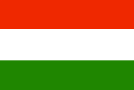
maplink
hu-map.gif
outlinemaplink
hu.gif
visapassenger
-1
maincities
Debrecen, Miskolc, Szeged, Pécs, Györ, Nyîregyháza, Szekesfehérvár, Kecskemét, Szombathely, Szolmok.
largestcity
Budapest
largestcitypopulation
2 017 000
rankpopulation
76
Population
10 128 000
rankgdp
41
gdp
82732000000
rankgdpppp
47
gdpppp
147705000000
rankgni
47
gni
64302000000
rankincomeorigin
67
rankincome
74
income
6350
rankincomeppp
58
incomeppp
13840
lifeexpectation
72.25
alphabetizationrate
1
natalityrate
0.00977
mortalityrate
0.01316
mortalityrateinfantile
0.00868
hdi
0.837
urbanization
0.648
precipitation
563
nationalevent
Saint Stephen's Day
nationaleventfr
Jour de Saint Stephen
nationalholiday
20 August
Date de naissance aaaa-mm-jj
2000-08-20 00:00:00
7
5
location
Central Europe, northwest of Romania
terrain
mostly flat to rolling plains; hills and low mountains on the Slovakian border
naturalresources
bauxite, coal, natural gas, fertile soils, arable
6
Web
rgbback
16777215
todate
1
110
id
Pays
Pays en Anglais
Iceland
Pays
Islande
countryucasefr
ISLANDE
Pays en Chinois
Pays en Espagnol
Islandia
Pays en Italien
L'Islanda
Pays en Portugais
Islândia
Pays en Allemand
Island
countrypy
bing1 dao3
countrylocal
Lyoveldio Island
countryfull
Iceland
countrynm
Iceland
ISO2
IS
ISO3
ISL
countrycodeisono
352
countrycodevehicle
IS
countrycodeolympic
ISL
countrycodeirs
IC
countrycodeirsfr
IC
countrycodeirsmixt
IC
countrycode
354
♀Féminin
15
6
82
languagesfr
Islandais
49
currency
króna
currencyfr
couronne islandaise
currencyisocode
ISK
currencyisocodefull
ISK 352
currencypxcode
ISK
currencysymbol
IKr
currencysubdivision
100 aurar (sg. aur)
currencyregime
composite
currencyvalue
0.01541
nationalityfr
Icelandaise
Capitale
Reykjavik
capitalfr
Reykjavik
Préfixe Tél.
354
Superficie km2
103 000
arealand
100 250
areawater
2 750
landarablerate
0.01
landforestrate
0.003
coastline
4988
summit
Hvannadalshnúkur 2 119 m.
flaglink
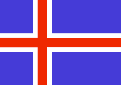
maplink
iscolor.gif
outlinemaplink
is.gif
visapassenger
-1
maincities
Kópavogur, Hafnarfjörður, Akureyri, Keflavík, Akranes, Isafjörður, Húsavík, Neskaupstaður, Siglufjörður
largestcity
Reykjavik
largestcitypopulation
156 000
rankpopulation
171
Population
289 000
rankgdp
91
gdp
10513000000
rankgdpppp
127
gdpppp
9029000000
rankgni
97
gni
8932000000
rankincomeorigin
10
rankincome
7
income
30910
rankincomeppp
10
incomeppp
30570
lifeexpectation
80.18
alphabetizationrate
1
natalityrate
0.01383
fecondity
1.95
mortalityrate
0.00657
mortalityrateinfantile
0.00331
growthrate
0.00965
hdi
0.942
urbanization
0.927
precipitation
801
nationalevent
Independence Day
nationaleventfr
Jour de l'Indépendance
nationalholiday
17 June (1944)
Date de naissance aaaa-mm-jj
1944-06-17 00:00:00
1
9
location
Northern Europe, island between the Greenland Sea and the North Atlantic Ocean, northwest of the UK
terrain
mostly plateau interspersed with mountain peaks, icefields; coast deeply indented by bays and fiords
naturalresources
fish, hydropower, geothermal power, diatomite
cooking
Fruits de Mer
7
Web
rgbback
16777215
todate
1
Notes
Fruits de Mer
| Pays/Territoires | Régions en Chine | Provinces de Chine | Régions en France | Départements de France | Provinces du Monde | Villes/Villages | Localités | Continents du Monde | Vins AOP
