Pays/Territoires
Mise à jour 2021-01-12 18:58:07
Les noms des pays/territoires du monde sont donnés en Français et Chinois. Cette collection des précieuses terres fermes du monde que toute l'humanité partage inclut non seulement les pays indépendants, mais aussi des régions spécifiques qui ne sont pas membre de l'ONUOrganisation des Nations Unies: Nous, peuples des Nations Unies ... Une ONU plus forte pour un monde meilleur. Veuillez aussi consulter les noms des pays en masculin et féminin en Français.
GéoPays Fermer
121
id
Pays
Pays en Anglais
Japan
Pays
Japon
countryucasefr
JAPON
Pays en Chinois
Pays en Espagnol
Japón
Pays en Italien
Il Giappone
Pays en Portugais
Japão
Pays en Allemand
Japan
countrypy
ri4 ben3
countrylocal
Nippon
countryfull
Japan
countrynm
Japan
ISO2
JP
ISO3
JPN
countrycodeisono
392
countrycodevehicle
J
countrycodeolympic
JPN
countrycodeirs
JA
countrycodeirsfr
JP
countrycodeirsmixt
JP
countrycode
81
♂Masulin
12
6
85
languagesfr
Japonais
4
currency
yen
currencyfr
Yen
currencyisocode
JPY
currencyisocodefull
JPY 392
currencypxcode
JPY
currencysymbol
¥
currencysubdivision
100 sen (not used)
currencyregime
float
currencyvalue
0.0092
nationality
Japanese
nationalityfr
Japonaise
Capitale
Tokyo
capitalfr
Tokyo
Préfixe Tél.
81
Superficie km2
377 835
arealand
374 744
areawater
3 091
landarablerate
0.1213
landforestrate
0.64
coastline
29751
summit
Fujisan 3 776 m.
timezonedeltabegin
9
flaglink
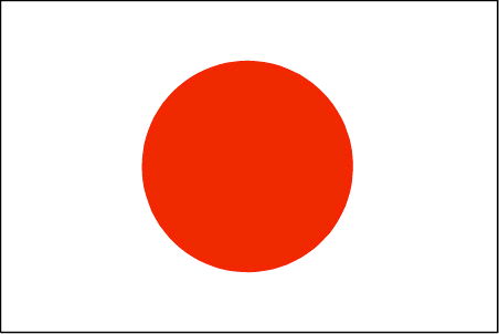
maplink
jpcolor.gif
outlinemaplink
jpout.gif
maincities
Yokohama, Osaka, Nagoya, Sapporo, Kyoto, Kobe, Fukuoka, Kawasaki, Hiroshima, Kita-Kyushu, Sendai, Kagoshima, Niigata.
largestcity
Tokyo
largestcitypopulation
26 959 000
rankpopulation
10
Population
127 573 000
rankgdp
2
gdp
4300858000000
rankgdpppp
3
gdpppp
3567804000000
rankgni
2
gni
4360824000000
rankincomeorigin
7
rankincome
5
income
34180
rankincomeppp
19
incomeppp
28450
lifeexpectation
81
alphabetizationrate
0.99
mortalityrate
0.003
precipitation
1406
nationalevent
Birthday of Emperor AKIHITO
nationaleventfr
Anniversaire de l'Empereur AKIHITO
nationalholiday
23 December (1933)
Date de naissance aaaa-mm-jj
1933-12-23 00:00:00
10
10
location
Eastern Asia, island chain between the North Pacific Ocean and the Sea of Japan, east of the Korean Peninsula
terrain
mostly rugged and mountainous
naturalresources
negligible mineral resources, fish
cooking
Sushi, Sake - Alcool de Riz très fin.
8
Web
rgbback
16777215
todate
1
Notes
Sushi, Sake - Alcool de Riz très fin.
122
id
Pays
Pays en Anglais
Jersey
Pays
Jersey
countryucasefr
JERSEY
Pays en Chinois
Pays en Espagnol
Jersey
Pays en Italien
La Jersey
Pays en Portugais
Jersey
Pays en Allemand
Jersey
countryfull
Jersey
countrynm
Jersey
ISO2
JE
ISO3
JEY
countrycodeisono
826
countrycodeolympic
GBR
countrycodeirs
JE
countrycodeirsfr
JE
countrycodeirsmixt
JE
♂Masulin
12
6
51
languagesfr
Anglais
22
currency
pound
currencyfr
Saint-Hélier
currencyisocode
GBP
currencyisocodefull
GBP 826
currencypxcode
GBP
currencysymbol
£
currencysubdivision
100 pence
currencyregime
float
currencyvalue
1.8091
nationalityfr
Anglaise
Capitale
Saint-Hélier
capitalfr
Saint-Hélier
Préfixe Tél.
44
Superficie km2
116
arealand
116
coastline
70
summit
Mont Orgueil 148 m.
flaglink

maplink
channelcolor.gif
visapassenger
-1
maincities
Saint Aubin
largestcity
Saint-Hélier
rankpopulation
183
Population
149 000
rankincomeorigin
9
rankincome
222
rankincomeppp
6
nationalevent
Liberation Day
nationaleventfr
Jour de la Libération
nationalholiday
9 May (1945)
Date de naissance aaaa-mm-jj
1945-05-09 00:00:00
2
10
president
Reine Elizabeth II
location
Western Europe, island in the English Channel, northwest of France
terrain
gently rolling plain with low, rugged hills along north coast
naturalresources
arable land
7
Web
rgbback
16777215
todate
1
123
id
Pays
Pays en Anglais
Johnston Atoll
Pays
Atoll Johnston
countryucasefr
ATOLL JOHNSTON
Pays en Chinois
Pays en Espagnol
Johnston Atoll
Pays en Italien
Johnston Atoll
Pays en Portugais
Johnston Atoll
Pays en Allemand
Johnston Atoll
countryfull
Johnston Atoll
countrynm
Johnston Atoll
ISO2
UMI7
ISO3
UMI7
countrycodeisono
581
countrycodeirs
JQ
countrycodeirsfr
JQ
countrycodeirsmixt
JQ
♂Masulin
17
7
51
6
currency
dollar
currencyisocode
USD
currencyisocodefull
USD 840
currencypxcode
USD
currencysymbol
$
currencysubdivision
100 cents
currencyregime
float
currencyvalue
1
Superficie km2
2,80
arealand
2,80
coastline
34
timezonedeltabegin
-10
flaglink
maplink
jq-map.gif
visapassenger
-1
rankincome
222
location
Oceania, atoll in the North Pacific Ocean 717 NM (1328 km) southwest of Honolulu, Hawaii, about one-third of the way from Hawaii to the Marshall Islands
terrain
mostly flat
naturalresources
guano deposits worked until depletion about 1890,
cooking
Oceania, atoll in the North Pacific Ocean 717 NM (1328 km) southwest of Honolulu, Hawaii, about one-third of the way from Hawaii to the Marshall Islands
9
rgbback
16777215
todate
1
124
id
Pays
Pays en Anglais
Jordan
Pays
Jordanie
countryucasefr
JORDANIE
Pays en Chinois
Pays en Espagnol
Jordania
Pays en Italien
Il Giordano
Pays en Portugais
Jordão
Pays en Allemand
Jordanien
countrypy
yue1 dan4
countrylocal
Al Urdun
countryfull
Jordan
countrynm
Jordan
ISO2
JO
ISO3
JOR
countrycodeisono
400
countrycodevehicle
HKJ
countrycodeolympic
JOR
countrycodeirs
JO
countrycodeirsfr
JO
countrycodeirsmixt
JO
countrycode
962
♀Féminin
12
4
3
languagesfr
Arabe
142
currency
dinar
currencyfr
dinar jordanien
currencyisocode
JOD
currencyisocodefull
JOD 400
currencypxcode
JOD
currencysymbol
JD
currencysubdivision
1,000 fils
currencyregime
composite
currencyvalue
1.4217
nationalityfr
Jordanienne
Capitale
Amman
capitalfr
Amman
Préfixe Tél.
962
Superficie km2
89 213
arealand
91 971
areawater
329
landarablerate
0.0287
landforestrate
0.01
coastline
26
summit
Jabal Ramm 1 754 m.
boundarycountries
Arabie Saoudite, Israël, Palestine, Syrie, Irak.
timezonedeltabegin
2
flaglink
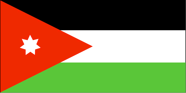
maplink
jocolor.gif
outlinemaplink
joout.gif
visapassenger
-1
maincities
Zarqa, Irbid, Aqqaba, Salt, Ajlun, Jerash, Madaba, Ma'an, Kerak, Mafraq, Tafilaa.
largestcity
Amman
largestcitypopulation
1 183 000
rankpopulation
107
Population
5 308 000
rankgdp
95
gdp
9860000000
rankgdpppp
94
gdpppp
22929000000
rankgni
95
gni
9800000000
rankincomeorigin
116
rankincome
127
income
1850
rankincomeppp
129
incomeppp
4290
lifeexpectation
77.88
alphabetizationrate
0.891
natalityrate
0.02368
mortalityrate
0.00262
mortalityrateinfantile
0.01886
precipitation
271
nationalevent
Independence Day
nationaleventfr
Jour de l'Indépendance
nationalholiday
25 May (1946)
Date de naissance aaaa-mm-jj
1946-05-25 00:00:00
3
11
location
Middle East, northwest of Saudi Arabia
terrain
mostly desert plateau in east, highland area in west; Great Rift Valley separates East and West Banks of the Jordan River
naturalresources
phosphates, potash, shale oil
9
Web
rgbback
16777215
todate
1
125
id
Pays
Pays en Anglais
Juan de Nova Island
Pays
Ile Juan de Nova
countryucasefr
ILE JUAN DE NOVA
Pays en Chinois
Pays en Espagnol
Juan de Nova Island
Pays en Italien
Juan de Nova Island
Pays en Portugais
Juan de Nova Console
Pays en Allemand
Juan de Nova Island
countryfull
Juan de Nova Island
countrynm
Juan de Nova Island
ISO2
REUJ
ISO3
REUJ
countrycodeisono
638
countrycodeirs
JU
countrycodeirsfr
JU
countrycodeirsmixt
JU
♀Féminin
15
6
57
2
currencypxcode
EUR
Préfixe Tél.
262
Superficie km2
4,40
arealand
4,40
coastline
24.1
timezonedeltabegin
3
flaglink
maplink
ju-map.gif
visapassenger
-1
rankincome
222
location
Southern Africa, island in the Mozambique Channel, about one-third of the way between Madagascar and Mozambique
terrain
low and flat
naturalresources
guano deposits and other fertilizers
cooking
Southern Africa, island in the Mozambique Channel, about one-third of the way between Madagascar and Mozambique
9
rgbback
16777215
todate
1
126
id
Pays
Pays en Anglais
Kazakhstan
Pays
Kazakhstan
countryucasefr
KAZAKHSTAN
Pays en Chinois
Pays en Espagnol
Kazakhstan
Pays en Italien
Kazakhstan
Pays en Portugais
Kazakhstan
Pays en Allemand
Kazakhstan
countrypy
ha1 sa4 ke4 si1 tan3
countrylocal
Qazaqstan
countryfull
Kazakhstan
countrynm
Kazakhstan
ISO2
KZ
ISO3
KAZ
countrycodeisono
398
countrycodevehicle
KZ
countrycodeolympic
KAZ
countrycodeirs
KZ
countrycodeirsfr
KZ
countrycodeirsmixt
KZ
♂Masulin
15
4
190
languagesfr
Kazakh
57
currency
tenge
currencyfr
rouble
currencyisocode
KZT
currencyisocodefull
KZT 398
currencypxcode
KZT
currencysubdivision
100 tiyn
currencyregime
float
currencyvalue
0.00759
nationalityfr
Kazakh
Capitale
Astana
capitalfr
Alma-Ata
Préfixe Tél.
7
Superficie km2
2 717 300
arealand
2 669 800
areawater
47 500
landarablerate
0.1123
landforestrate
0.045
summit
Zhengis Shingy 7 439 m.
boundarycountries
Russie, Chine, Kirghizstan, Ouzbekistan, Turkmenistan.
timezonedeltabegin
6
flaglink
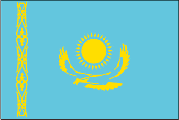
maplink
kzcolor.gif
outlinemaplink
kzout.gif
visapassenger
-1
maincities
Alma Ata, Karaganda, Chimkent, Semipalatinsk, Pavlodar, Dzhambul, Ust-Kamenogorsk, Tselinograd, Aktyubinsk, Petropavlovsk, Kustanay, Ural'sk, Shevshenko.
largestcity
Astana
rankpopulation
59
Population
14 878 000
rankgdp
60
gdp
29749000000
rankgdpppp
55
gdpppp
99254000000
rankgni
62
gni
26535000000
rankincomeorigin
119
rankincome
131
income
1780
rankincomeppp
100
incomeppp
6280
lifeexpectation
63.48
alphabetizationrate
0.9778
natalityrate
0.01402
mortalityrate
0.01059
mortalityrateinfantile
0.01886
hdi
0.742
precipitation
264
nationalevent
Republic Day
nationaleventfr
Jour de la République
nationalholiday
25 October (1990)
Date de naissance aaaa-mm-jj
1990-10-25 00:00:00
7
7
location
Central Asia, northwest of China; a small portion west of the Ural River in eastern-most Europe
terrain
extends from the Volga to the Altai Mountains and from the plains in western Siberia to oases and desert in Central Asia
naturalresources
major deposits of petroleum, natural gas, coal, ir
9
Web
rgbback
16777215
todate
1
127
id
Pays
Pays en Anglais
Kenya
Pays
Kenya
countryucasefr
KENYA
Pays en Chinois
Pays en Espagnol
Kenia
Pays en Italien
Il Kenia
Pays en Portugais
Kenya
Pays en Allemand
Kenia
countrypy
ken3 ni2 ya4
countrylocal
Kenya
countryfull
Kenya
countrynm
Kenya
ISO2
KE
ISO3
KEN
countrycodeisono
404
countrycodevehicle
EAK
countrycodeolympic
KEN
countrycodeirs
KE
countrycodeirsfr
KE
countrycodeirsmixt
KE
countrycode
254
♂Masulin
15
6
151
languagesfr
Swahili, Anglais
143
currency
shilling
currencyfr
shilling du Kenya
currencyisocode
KES
currencyisocodefull
KES 404
currencypxcode
KES
currencysymbol
K Sh
currencysubdivision
100 cents
currencyregime
float
currencyvalue
0.013
nationalityfr
Kenyane
Capitale
Nairobi
capitalfr
Naïrobi
Préfixe Tél.
254
Superficie km2
582 646
arealand
569 250
areawater
13 400
landarablerate
0.0703
landforestrate
0.3
coastline
536
summit
Mount Kenya 5 199 m.
boundarycountries
Ouganda, Soudan, Ethiopie, Somalie, Tanzanie.
timezonedeltabegin
3
flaglink
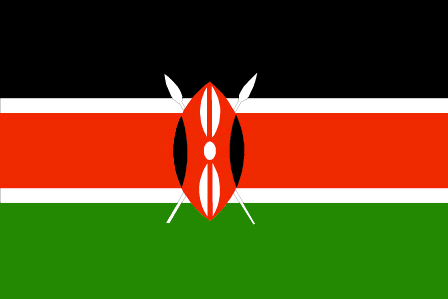
maplink
kecolor.gif
outlinemaplink
keout.gif
visapassenger
-1
maincities
Mombasa, Kisumi, Nakuru, Eldoret, Thika, Nyeri, Nanyuki, Kitale, Malindi, Kericho.
largestcity
Nairobi
largestcitypopulation
3 639 362
rankpopulation
34
Population
31 916 000
rankgdp
82
gdp
14376000000
rankgdpppp
81
gdpppp
33099000000
rankgni
84
gni
12788000000
rankincomeorigin
173
rankincome
187
income
400
rankincomeppp
189
incomeppp
1030
lifeexpectation
44.94
alphabetizationrate
0.8425
natalityrate
0.02782
fecondity
4
mortalityrate
0.01631
mortalityrateinfantile
0.06262
hdi
0.489
urbanization
0.925
precipitation
1063
nationalevent
Independence Day
nationaleventfr
Jour de l'Indépendance
nationalholiday
12 December (1963)
Date de naissance aaaa-mm-jj
1963-12-12 00:00:00
10
4
location
Eastern Africa, bordering the Indian Ocean, between Somalia and Tanzania
terrain
low plains rise to central highlands bisected by Great Rift Valley; fertile plateau in west
naturalresources
gold, limestone, soda ash, salt, rubies, fluorspar
9
Web
rgbback
16777215
todate
1
128
id
Pays
Pays en Anglais
Kingman Reef
Pays
Récif Kingman
countryucasefr
RECIF KINGMAN
Pays en Chinois
Pays en Espagnol
Filón De Kingman
Pays en Italien
Reef Di Kingman
Pays en Portugais
Recife De Kingman
Pays en Allemand
Reef Kingman
countryfull
Kingman Reef
countrynm
Kingman Reef
ISO2
UMI9
ISO3
UMI9
countrycodeisono
581
countrycodeirs
KQ
countrycodeirsfr
KQ
countrycodeirsmixt
KQ
♂Masulin
17
7
51
1
currencypxcode
USD
Superficie km2
1
arealand
1
coastline
3
timezonedeltabegin
-11
flaglink

maplink
kq-map.gif
visapassenger
-1
rankincome
222
location
Oceania, reef in the North Pacific Ocean, about half way between Hawaii and American Samoa
terrain
low and nearly level
naturalresources
terrestrial and aquatic wildlife
cooking
Oceania, reef in the North Pacific Ocean, about half way between Hawaii and American Samoa
9
rgbback
16777215
todate
1
129
id
Pays
Pays en Anglais
Kiribati
Pays
Kiribati
countryucasefr
KIRIBATI
Pays en Chinois
Pays en Espagnol
Kiribati
Pays en Italien
Kiribati
Pays en Portugais
Kiribati
Pays en Allemand
Kiribati
countrypy
ji2 li3 ba1 si1
countrylocal
Kiribati, Kiribas
countryfull
Kiribati
countrynm
Kiribati
ISO2
KI
ISO3
KIR
countrycodeisono
296
countrycodeolympic
KIR
countrycodeirs
KR
countrycodeirsfr
KR
countrycodeirsmixt
KRB
♂Masulin
15
6
51
languagesfr
Anglais
10
currency
dollar
currencyfr
dollar australien
currencyisocode
AUD
currencyisocodefull
AUD 036
currencypxcode
AUD
currencysymbol
A$
currencysubdivision
100 cents
currencyregime
float
currencyvalue
0.7485
Capitale
Tarawa
capitalfr
Tarawa
Préfixe Tél.
686
Superficie km2
717
arealand
811
landforestrate
0.384
coastline
1143
summit
Joes Hill 81 m.
timezonedeltabegin
12
flaglink
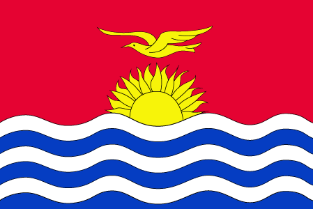
maplink
kicolor.gif
visapassenger
-1
maincities
Ooma.
largestcity
Tarawa
rankpopulation
190
Population
96 000
rankgdp
185
gdp
55000000
rankgni
207
gni
83000000
rankincomeorigin
144
rankincome
157
income
860
lifeexpectation
61.32
natalityrate
0.03099
fecondity
3.6
mortalityrate
0.00849
mortalityrateinfantile
0.0499
growthrate
0.0225
nationalevent
Independence Day
nationaleventfr
Jour de l'Indépendance
nationalholiday
12 July (1979)
Date de naissance aaaa-mm-jj
1979-07-12 00:00:00
6
8
location
Oceania, group of 33 coral atolls in the Pacific Ocean, straddling the equator; the capital Tarawa is about one-half of the way from Hawaii to Australia; note - on 1 January 1995, Kiribati proclaimed that all of its territory lies in the same time zone as
terrain
mostly low-lying coral atolls surrounded by extensive reefs
naturalresources
phosphate (production discontinued in 1979)
9
rgbback
16777215
todate
1
130
id
Pays
Pays en Anglais
Korea, North
Pays
Corée du Nord
countryucasefr
COREE DU NORD
Pays en Chinois
Pays en Espagnol
Corea, Del norte (Representante Democrático De la Gente)
Pays en Italien
La Corea, Del nord (Rappresentante Democratico Della Gente)
Pays en Portugais
Coreia, Norte (Representante Democrático Dos Povos)
Pays en Allemand
Korea, Nord (Demokratischer VölkercRepräsentant)
countrypy
bei3 han2, bei3 chao2 xian3
countrylocal
Choson
countryfull
Korea, North
countrynm
Korea, North
ISO2
KP
ISO3
PRK
countrycodeisono
408
countrycodeolympic
PRK
countrycodeirs
KN
countrycodeirsfr
KN
countrycodeirsmixt
KN
♀Féminin
6
1
92
languagesfr
Coréen
58
currency
won
currencyfr
won
currencyisocode
KPW
currencyisocodefull
KPW 408
currencypxcode
KPW
currencysymbol
Wn
currencysubdivision
100 chon
currencyvalue
0.4545
nationalityfr
Coréenne
Capitale
Pyongyang
capitalfr
Pyongyang
Préfixe Tél.
850
Superficie km2
120 540
arealand
120 410
areawater
130
landarablerate
0.1412
landforestrate
0.682
coastline
2495
summit
Paektu-san 2 744 m.
boundarycountries
Chine, Corée du Sud.
timezonedeltabegin
9
flaglink
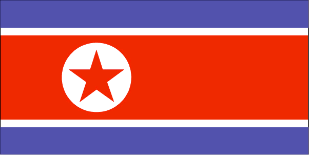
maplink
kpcolor.gif
outlinemaplink
kpout.gif
visapassenger
-1
maincities
Ch'ongjin, Chinnamp'o, Sinuiju, Hungnam, Wonsan, Kaesong, Hamhung, Kimch'aek, Haeju, Sariwon.
largestcity
Pyongyang
largestcitypopulation
3 245 305
rankpopulation
45
Population
22 612 000
rankincome
164
income
735
lifeexpectation
70.79
alphabetizationrate
0.999
natalityrate
0.01761
mortalityrate
0.00693
mortalityrateinfantile
0.02566
precipitation
1001
nationalevent
Founding of the Democratic People's Republic of Korea (DPRK)
nationaleventfr
Création de la République Populaire de Corée
nationalholiday
9 September (1948)
Date de naissance aaaa-mm-jj
1948-09-09 00:00:00
5
1
location
Eastern Asia, northern half of the Korean Peninsula bordering the Korea Bay and the Sea of Japan, between China and South Korea
terrain
mostly hills and mountains separated by deep, narrow valleys; coastal plains wide in west, discontinuous in east
naturalresources
coal, lead, tungsten, zinc, graphite, magnesite, i
9
rgbback
16777215
todate
1
| Pays/Territoires | Régions en Chine | Provinces de Chine | Régions en France | Départements de France | Provinces du Monde | Villes/Villages | Localités | Continents du Monde | Vins AOP
