Pays/Territoires
Mise à jour 2021-01-12 18:58:07
Les noms des pays/territoires du monde sont donnés en Français et Chinois. Cette collection des précieuses terres fermes du monde que toute l'humanité partage inclut non seulement les pays indépendants, mais aussi des régions spécifiques qui ne sont pas membre de l'ONUOrganisation des Nations Unies: Nous, peuples des Nations Unies ... Une ONU plus forte pour un monde meilleur. Veuillez aussi consulter les noms des pays en masculin et féminin en Français.
GéoPays Fermer
131
id
Pays
Pays en Anglais
Korea, South
Pays
Corée du Sud
countryucasefr
COREE DU SUD
Pays en Chinois
Pays en Espagnol
Corea, del sur (república de)
Pays en Italien
La Corea, del sud (Repubblica di)
Pays en Portugais
Coreia, sul (república de)
Pays en Allemand
Korea, Süd (Republik von)
countrypy
han2 guo2, guang1 zhou1
countrylocal
Han-guk
countryfull
Korea, South
countrynm
Korea, South
ISO2
KR
ISO3
KOR
countrycodeisono
410
countrycodevehicle
ROK
countrycodeolympic
KOR
countrycodeirs
KS
countrycodeirsfr
CR
countrycodeirsmixt
KR
countrycode
82
♀Féminin
15
6
92
languagesfr
Coréen
59
currency
won
currencyfr
won
currencyisocode
KRW
currencyisocodefull
KRW 410
currencypxcode
KRW
currencysymbol
W
currencysubdivision
100 chon [*]
currencyregime
float
currencyvalue
0.00099
nationalityfr
Coréenne
Capitale
Soul
capitalfr
Séoul
Préfixe Tél.
82
Superficie km2
98 992
arealand
98 190
areawater
290
landarablerate
0.1744
landforestrate
0.633
coastline
2413
summit
Halla-san 1 950 m.
boundarycountries
Corée du Nord.
timezonedeltabegin
9
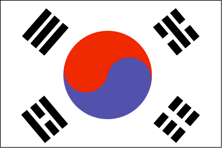
flaglink
maplink
krcolor.gif
outlinemaplink
krout.gif
maincities
Pusan, Taegu, Inch'on, Kwangju, Taejon, Ulsan, Masan, Sunwon, Chonju.
largestcity
Soul
largestcitypopulation
21 738 345
rankpopulation
26
Population
47 912 000
rankgdp
11
gdp
605331000000
rankgdpppp
14
gdpppp
861042000000
rankgni
11
gni
576426000000
rankincomeorigin
49
rankincome
49
income
12030
rankincomeppp
47
incomeppp
18000
lifeexpectation
75.36
alphabetizationrate
0.9796
natalityrate
0.0126
mortalityrate
0.00603
mortalityrateinfantile
0.00731
precipitation
1371
nationalevent
Liberation Day
nationaleventfr
Jour de la Libération
nationalholiday
15 August (1945)
Date de naissance aaaa-mm-jj
1945-08-15 00:00:00
2
10
location
Eastern Asia, southern half of the Korean Peninsula bordering the Sea of Japan and the Yellow Sea
terrain
mostly hills and mountains; wide coastal plains in west and south
naturalresources
coal, tungsten, graphite, molybdenum, lead, hydrop
cooking
Nouilles Piquantes: Climant froid.
8
Web
rgbback
16777215
todate
1
Notes
Nouilles Piquantes: Climant froid.
132
id
Pays
Pays en Anglais
Kuwait
Pays
Koweït
countryucasefr
KOWEIT
Pays en Chinois
Pays en Espagnol
Kuwait
Pays en Italien
Il Kuwait
Pays en Portugais
Kuwait
Pays en Allemand
Kuwait
countrypy
ke1 wei1 te4
countrylocal
Al Kuwayt
countryfull
Kuwait
countrynm
Kuwait
ISO2
KW
ISO3
KWT
countrycodeisono
414
countrycodevehicle
KWT
countrycodeolympic
KUW
countrycodeirs
KU
countrycodeirsfr
KU
countrycodeirsmixt
KU
countrycode
965
♂Masulin
12
4
3
languagesfr
Arabe
144
currency
dinar
currencyfr
dinar koweïtien
currencyisocode
KWD
currencyisocodefull
KWD 414
currencypxcode
KWD
currencysymbol
KD
currencysubdivision
1,000 fils
currencyregime
composite
currencyvalue
3.4258
nationalityfr
Kowaïtienne
Capitale
Kuwait City
capitalfr
Koweït city
Préfixe Tél.
965
Superficie km2
17 818
arealand
17 820
landarablerate
0.0034
landforestrate
0.003
coastline
499
summit
306 m.
boundarycountries
Iraq, Arabie Saoudite.
timezonedeltabegin
3
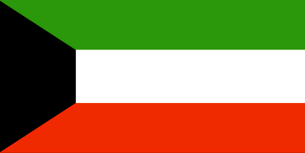
flaglink
maplink
kwcolor.gif
outlinemaplink
kwout.gif
visapassenger
-1
maincities
Salmiya, Hawalli, Al Jahra, Mina Ahmadi, Al Ahmadi.
largestcity
Kuwait City
largestcitypopulation
2 388 688
rankpopulation
138
Population
2 396 000
rankgdp
57
gdp
41748000000
rankgdpppp
72
gdpppp
43248000000
rankgni
56
gni
43048000000
rankincomeorigin
34
rankincome
29
income
17960
rankincomeppp
43
incomeppp
19480
lifeexpectation
76.65
alphabetizationrate
0.73
natalityrate
0.02183
mortalityrate
0.00245
mortalityrateinfantile
0.01057
precipitation
108
nationalevent
National Day
nationaleventfr
Jour National
nationalholiday
25 February (1950)
Date de naissance aaaa-mm-jj
1950-02-25 00:00:00
7
3
location
Middle East, bordering the Persian Gulf, between Iraq and Saudi Arabia
terrain
flat to slightly undulating desert plain
naturalresources
petroleum, fish, shrimp, natural gas
9
Web
rgbback
16777215
todate
1
133
id
Pays
Pays en Anglais
Kyrgyzstan
Pays
Kirghizstan
countryucasefr
KIRGHIZSTAN
Pays en Chinois
Pays en Espagnol
Kyrgyzstan
Pays en Italien
Kyrgyzstan
Pays en Portugais
Kyrgyzstan
Pays en Allemand
Kyrgyzstan
countrypy
ji2 er3 ji2 si1 si1 tan3
countrylocal
Kyrgyz Respublikasy
countryfull
Kyrgyzstan
countrynm
Kyrgyzstan
ISO2
KG
ISO3
KGZ
countrycodeisono
417
countrycodevehicle
KS
countrycodeolympic
KGZ
countrycodeirs
KG
countrycodeirsfr
KG
countrycodeirsmixt
KG
♂Masulin
15
4
90
languagesfr
Kirghiz
60
currency
som
currencyfr
rouble
currencyisocode
KGS
currencyisocodefull
KGS 417
currencypxcode
KGS
currencysubdivision
100 tyyn
currencyregime
float
nationalityfr
Kyrgyz
Capitale
Bishkek
capitalfr
Bichpek
Préfixe Tél.
996
Superficie km2
198 500
arealand
191 300
areawater
7 200
landarablerate
0.0704
landforestrate
0.052
summit
Jengish Chokusu 7 439 m.
boundarycountries
Ouzbekistan, Kazakhstan, Chine, Tadjikistan
timezonedeltabegin
5
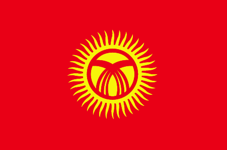
flaglink
maplink
kgcolor.gif
outlinemaplink
kgout.gif
visapassenger
-1
maincities
Osh, Dzhalal-Abad, Przheval'sk, Kyzyl-Kiya, Naryn.
largestcity
Bishkek
largestcitypopulation
896 259
rankpopulation
110
Population
5 052 000
rankgdp
143
gdp
1909000000
rankgdpppp
129
gdpppp
8845000000
rankgni
156
gni
1717000000
rankincomeorigin
179
rankincome
193
income
340
rankincomeppp
175
incomeppp
1690
lifeexpectation
67.84
alphabetizationrate
0.97
natalityrate
0.02213
mortalityrate
0.00719
mortalityrateinfantile
0.03681
hdi
0.727
urbanization
0.343
precipitation
443
nationalevent
Independence Day
nationaleventfr
Jour de l'Indépendance
nationalholiday
31 August (1991)
Date de naissance aaaa-mm-jj
1991-08-31 00:00:00
8
8
location
Central Asia, west of China
terrain
peaks of Tien Shan and associated valleys and basins encompass entire nation
naturalresources
abundant hydropower; significant deposits of gold
9
Web
rgbback
16777215
todate
1
134
id
Pays
Pays en Anglais
Laos
Pays
Laos
countryucasefr
LAOS
Pays en Chinois
Pays en Espagnol
Laos
Pays en Italien
Il Laos
Pays en Portugais
Laos
Pays en Allemand
Laos
countrypy
lao3 wo1
countrylocal
Lao
countryfull
Laos
countrynm
Laos
ISO2
LA
ISO3
LAO
countrycodeisono
418
countrycodevehicle
LAO
countrycodeolympic
LAO
countrycodeirs
LA
countrycodeirsfr
LA
countrycodeirsmixt
LA
♂Masulin
5
1
93
languagesfr
Laotien
61
currency
new kip
currencyfr
kip
currencyisocode
LAK
currencyisocodefull
LAK 418
currencypxcode
LAK
currencysymbol
KN
currencysubdivision
100 at [*]
currencyregime
m.float
currencyvalue
0.0001
nationalityfr
Laotienne
Capitale
Vientiane
capitalfr
Vientiane
Préfixe Tél.
856
Superficie km2
236 804
arealand
230 800
areawater
6 000
landarablerate
0.0347
landforestrate
0.544
summit
Phou Bia 2 817 m.
boundarycountries
Thaïlande, Myanmar, Chine, Vietnam, Cambodge.
timezonedeltabegin
7
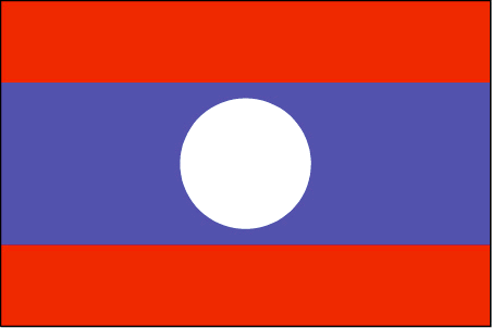
flaglink
maplink
la.jpg
visapassenger
-1
maincities
Luang Prabang, Savannakhet, Pakse, Sayaboury, Khammouane.
largestcity
Vientiane
largestcitypopulation
534 000
rankpopulation
99
Population
5 660 000
rankgdp
140
gdp
2122000000
rankgdpppp
124
gdpppp
9954000000
rankgni
152
gni
1945000000
rankincomeorigin
179
rankincome
193
income
340
rankincomeppp
170
incomeppp
1730
lifeexpectation
54.69
alphabetizationrate
0.514
natalityrate
0.03647
mortalityrate
0.0121
mortalityrateinfantile
0.08706
hdi
0.525
urbanization
0.197
precipitation
1651
nationalevent
Republic Day
nationaleventfr
Jour de la République
nationalholiday
2 December (1975)
Date de naissance aaaa-mm-jj
1975-12-02 00:00:00
2
4
location
Southeastern Asia, northeast of Thailand, west of Vietnam
terrain
mostly rugged mountains; some plains and plateaus
naturalresources
timber, hydropower, gypsum, tin, gold, gemstones
9
Web
rgbback
16777215
todate
1
135
id
Pays
Pays en Anglais
Latvia
Pays
Lettonie
countryucasefr
LETTONIE
Pays en Chinois
Pays en Espagnol
Latvia
Pays en Italien
Latvia
Pays en Portugais
Latvia
Pays en Allemand
Latvia
countrypy
la1 tuo1 wei2 ya4
countrylocal
Latvija
countryfull
Latvia
countrynm
Latvia
ISO2
LV
ISO3
LVA
countrycodeisono
428
countrycodevehicle
LV
countrycodeolympic
LAT
countrycodeirs
LG
countrycodeirsfr
LG
countrycodeirsmixt
LG
♀Féminin
18
6
94
languagesfr
Letton
62
currency
lat
currencyfr
lats
currencyisocode
LVL
currencyisocodefull
LVL 428
currencypxcode
LVL
currencysymbol
Ls
currencysubdivision
100 santims
currencyregime
SDR
currencyvalue
1.7541
Capitale
Riga
capitalfr
Riga
Préfixe Tél.
371
Superficie km2
64 589
arealand
63 589
areawater
1 000
landarablerate
0.2901
landforestrate
0.471
coastline
531
summit
Gaizinkalns 312 m.
boundarycountries
Estonie, Russie, Biélorussie, Lituanie.
timezonedeltabegin
2
flaglink
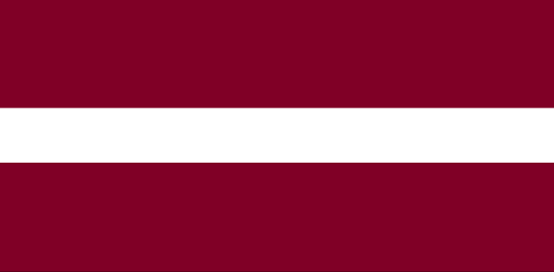
maplink
lg-map.gif
outlinemaplink
lv.gif
visapassenger
-1
maincities
Daugavpils, Liepaja, Jelgava, Jurmala, Ventspils, Rezekne.
largestcity
Riga
largestcitypopulation
921 000
rankpopulation
139
Population
2 321 000
rankgdp
89
gdp
11073000000
rankgdpppp
93
gdpppp
23836000000
rankgni
91
gni
10215000000
rankincomeorigin
75
rankincome
82
income
4400
rankincomeppp
75
incomeppp
10210
lifeexpectation
69.62
alphabetizationrate
0.98
natalityrate
0.00886
mortalityrate
0.01466
mortalityrateinfantile
0.01421
hdi
0.811
urbanization
0.598
precipitation
636
nationalevent
Independence Day
nationaleventfr
Jour de l'Indépendance
nationalholiday
18 November (1918)
Date de naissance aaaa-mm-jj
1918-11-18 00:00:00
5
7
location
Eastern Europe, bordering the Baltic Sea, between Estonia and Lithuania
terrain
low plain
naturalresources
peat, limestone, dolomite, amber, hydropower, wood
6
rgbback
16777215
todate
1
136
id
Pays
Pays en Anglais
Lebanon
Pays
Liban
countryucasefr
LIBAN
Pays en Chinois
Pays en Espagnol
Líbano
Pays en Italien
Il Libano
Pays en Portugais
Líbano
Pays en Allemand
Der Libanon
countrypy
li2 ba1 nen4
countrylocal
Lubnan
countryfull
Lebanon
countrynm
Lebanon
ISO2
LB
ISO3
LBN
countrycodeisono
422
countrycodevehicle
RL
countrycodeolympic
LIB
countrycodeirs
LE
countrycodeirsfr
LE
countrycodeirsmixt
LE
♂Masulin
15
4
3
languagesfr
Arabe
63
currency
pound (livre)
currencyfr
livre libanaise
currencyisocode
LBP
currencyisocodefull
LBP 422
currencypxcode
LBP
currencysymbol
L.L.
currencysubdivision
100 piastres
currencyregime
float
currencyvalue
0.00066
nationalityfr
Libanaise
Capitale
Bayrut
capitalfr
Beyrouth
Préfixe Tél.
961
Superficie km2
10 400
arealand
10 230
areawater
170
landarablerate
0.176
landforestrate
0.035
coastline
225
summit
Qurnat as-Sawda' 3 083 m.
boundarycountries
Syrie, Israël.
timezonedeltabegin
2
flaglink
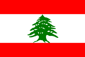
maplink
lbcolor.gif
outlinemaplink
lbout.gif
visapassenger
-1
maincities
Tripoli, Zahle, Saïda, Tyr.
largestcity
Beirut
largestcitypopulation
1 826 000
rankpopulation
114
Population
4 498 000
rankgdp
72
gdp
19000000000
rankgdpppp
95
gdpppp
22820000000
rankgni
73
gni
18187000000
rankincomeorigin
81
rankincome
89
income
4040
rankincomeppp
124
incomeppp
4840
lifeexpectation
72.35
alphabetizationrate
0.8715
natalityrate
0.01931
mortalityrate
0.00628
mortalityrateinfantile
0.02548
hdi
0.752
urbanization
0.901
precipitation
825
nationalevent
Independence Day
nationaleventfr
Jour de l'Indépendance
nationalholiday
22 November (1943)
Date de naissance aaaa-mm-jj
1943-11-22 00:00:00
10
8
location
Middle East, bordering the Mediterranean Sea, between Israel and Syria
terrain
narrow coastal plain; El Beqaa (Bekaa Valley) separates Lebanon and Anti-Lebanon Mountains
naturalresources
limestone, iron ore, salt, water-surplus state in
9
Web
rgbback
16777215
todate
1
137
id
Pays
Pays en Anglais
Lesotho
Pays
Lesotho
countryucasefr
LESOTHO
Pays en Chinois
Pays en Espagnol
Lesotho
Pays en Italien
Il Lesoto
Pays en Portugais
Lesotho
Pays en Allemand
Lesotho
countrypy
lai4 suo3 tuo1
countrylocal
Lesotho
countryfull
Lesotho
countrynm
Lesotho
ISO2
LS
ISO3
LSO
countrycodeisono
426
countrycodevehicle
LS
countrycodeolympic
LES
countrycodeirs
LT
countrycodeirsfr
LT
countrycodeirsmixt
LT
♂Masulin
12
6
192
languagesfr
Sotho, Anglais
145
currency
loti, pl., maloti
currencyfr
loti
currencyisocode
LSL
currencyisocodefull
LSL 426
currencypxcode
LSL
currencysymbol
L, pl., M
currencysubdivision
100 lisente
currencyregime
South African Rand (1.0)
currencyvalue
0.1453
Capitale
Maseru
capitalfr
Maseru
Préfixe Tél.
266
Superficie km2
30 350
arealand
30 355
landarablerate
0.1071
landforestrate
0.005
summit
Thabana Ntlenyana 3 482 m.
boundarycountries
Afrique du Sud.
timezonedeltabegin
2
flaglink
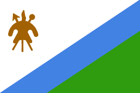
maplink
lscolor.gif
outlinemaplink
lsout.gif
visapassenger
-1
maincities
Teyateyaneng, Leribe, Mafeteng.
largestcity
Maseru
largestcitypopulation
297 000
rankpopulation
143
Population
1 793 000
rankgdp
153
gdp
1139000000
rankgdpppp
143
gdpppp
4591000000
rankgni
169
gni
1089000000
rankincomeorigin
156
rankincome
170
income
610
rankincomeppp
144
incomeppp
3100
lifeexpectation
36.81
alphabetizationrate
0.84
natalityrate
0.02691
mortalityrate
0.02479
mortalityrateinfantile
0.08522
hdi
0.51
nationalevent
Independence Day
nationaleventfr
Jour de l'Indépendance
nationalholiday
4 October (1966)
Date de naissance aaaa-mm-jj
1966-10-04 00:00:00
3
7
location
Southern Africa, an enclave of South Africa
terrain
mostly highland with plateaus, hills, and mountains
naturalresources
water, agricultural and grazing land, some diamond
9
Web
rgbback
16777215
todate
1
138
id
Pays
Pays en Anglais
Liberia
Pays
Liberia
countryucasefr
LIBERIA
Pays en Chinois
Pays en Espagnol
Liberia
Pays en Italien
La Liberia
Pays en Portugais
Liberia
Pays en Allemand
Liberia
countrypy
li4 bi3 li3 ya4
countrylocal
Liberia
countryfull
Liberia
countrynm
Liberia
ISO2
LR
ISO3
LBR
countrycodeisono
430
countrycodevehicle
LB
countrycodeolympic
LBR
countrycodeirs
LI
countrycodeirsfr
LI
countrycodeirsmixt
LI
♂Masulin
15
4
51
languagesfr
Anglais
64
currency
dollar
currencyfr
dollar libérien
currencyisocode
LRD
currencyisocodefull
LRD 430
currencypxcode
LRD
currencysymbol
$
currencysubdivision
100 cents
currencyregime
US-$ (1.0)
currencyvalue
0.01754
nationalityfr
Libérienne
Capitale
Monrovia
capitalfr
Monrovia
Préfixe Tél.
231
Superficie km2
111 370
arealand
96 320
areawater
15 050
landarablerate
0.0197
landforestrate
0.313
coastline
579
summit
Mount Wuteve 1 381 m.
boundarycountries
Sierra Leone, Côte d'Ivoire, Guinée.
flaglink
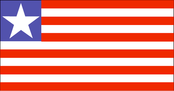
maplink
lrcolor.gif
outlinemaplink
lrout.gif
visapassenger
-1
maincities
Harbel, Buchanan, Harper, Tubmanburg.
largestcity
Monrovia
largestcitypopulation
962 000
rankpopulation
129
Population
3 374 000
rankgdp
168
gdp
442000000
rankgni
193
gni
355000000
rankincomeorigin
205
rankincome
218
income
110
lifeexpectation
48.15
alphabetizationrate
0.395
natalityrate
0.04528
mortalityrate
0.01784
mortalityrateinfantile
0.13218
hdi
0.325
nationalevent
Independence Day
nationaleventfr
Jour de l'Indépendance
nationalholiday
26 July (1847)
Date de naissance aaaa-mm-jj
1847-07-26 00:00:00
4
8
location
Western Africa, bordering the North Atlantic Ocean, between Cote d'Ivoire and Sierra Leone
terrain
mostly flat to rolling coastal plains rising to rolling plateau and low mountains in northeast
naturalresources
iron ore, timber, diamonds, gold, hydropower
9
rgbback
16777215
todate
1
139
id
Pays
Pays en Anglais
Libya
Pays
Libye
countryucasefr
LIBYE
Pays en Chinois
Pays en Espagnol
Libia
Pays en Italien
La Libia
Pays en Portugais
Líbia
Pays en Allemand
Libyen
countrypy
li4 bi3 ya4
countrylocal
Libiyah
countryfull
Libya
countrynm
Libya
ISO2
LY
ISO3
LBY
countrycodeisono
434
countrycodevehicle
LAR
countrycodeolympic
LBA
countrycodeirs
LY
countrycodeirsfr
LY
countrycodeirsmixt
LY
♀Féminin
2
1
3
languagesfr
Arabe
146
currency
dinar
currencyfr
dinar libyen
currencyisocode
LYD
currencyisocodefull
LYD 434
currencypxcode
LYD
currencysymbol
LD
currencysubdivision
1,000 dirhams
currencyregime
SDR (8.5085)
currencyvalue
0.8052
nationalityfr
Libienne
Capitale
Tripoli
capitalfr
Tripoli
Préfixe Tél.
218
Superficie km2
1 759 540
arealand
1 759 540
landarablerate
0.0103
landforestrate
0.002
coastline
1770
summit
Bikku Bitti 2 286 m.
boundarycountries
Algérie, Tunisie, Egypte, Soudan, Tchad, Niger.
timezonedeltabegin
2
flaglink

maplink
lycolor.gif
outlinemaplink
lyout.gif
visapassenger
-1
maincities
Benghazi, Misurata, El Beïda, Az Zawiyah, Agedabia, Darnah, Sebha, Tobrouk, Al Marj, Zelten.
largestcity
Tripoli
largestcitypopulation
1 682 000
rankpopulation
101
Population
5 559 000
rankgdp
71
gdp
19131000000
rankgni
55
gni
40500000000
rankincomeorigin
63
rankincome
65
income
7796
lifeexpectation
72.8
alphabetizationrate
0.8135
natalityrate
0.02743
mortalityrate
0.00349
mortalityrateinfantile
0.0207
hdi
0.783
nationalevent
Revolution Day
nationaleventfr
Jour de le Révolution
nationalholiday
1 September (1969)
Date de naissance aaaa-mm-jj
1969-09-01 00:00:00
6
10
location
Northern Africa, bordering the Mediterranean Sea, between Egypt and Tunisia
terrain
mostly barren, flat to undulating plains, plateaus, depressions
naturalresources
petroleum, natural gas, gypsum
9
Web
rgbback
16777215
todate
1
140
id
Pays
Pays en Anglais
Liechtenstein
Pays
Liechtenstein
countryucasefr
LIECHTENSTEIN
Pays en Chinois
Pays en Espagnol
Liechtenstein
Pays en Italien
Il Liechtenstein
Pays en Portugais
Liechtenstein
Pays en Allemand
Liechtenstein
countrypy
lie4 zhi1 dun1 si4 deng1
countrylocal
Liechtenstein
countryfull
Liechtenstein
countrynm
Liechtenstein
ISO2
LI
ISO3
LIE
countrycodeisono
438
countrycodevehicle
FL
countrycodeolympic
LIE
countrycodeirs
LS
countrycodeirsfr
LS
countrycodeirsmixt
LS
♂Masulin
12
6
73
languagesfr
Allemand
99
currency
franc
currencyfr
Franc suisse
currencyisocode
CHF
currencyisocodefull
CHF 756
currencypxcode
CHF
currencysymbol
SwF
currencysubdivision
100 rappen/centimes
currencyregime
float
currencyvalue
0.7966
Capitale
Vaduz
capitalfr
Vaduz
Préfixe Tél.
423
Superficie km2
160
arealand
160
landarablerate
0.25
landforestrate
0.467
summit
Grauspitz 2 599 m
boundarycountries
Suisse, Autriche.
timezonedeltabegin
1
flaglink
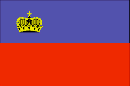
maplink
ls-map.gif
outlinemaplink
li.gif
visapassenger
-1
maincities
Schaan, Balzers, Triesen, Eschen, Mauren, Triesenberg.
largestcity
Vaduz
largestcitypopulation
6 000
rankpopulation
204
Population
33 000
rankgni
162
gni
1220000000
rankincomeorigin
6
rankincome
222
rankincomeppp
5
nationalevent
Assumption Day
nationaleventfr
Assomption
nationalholiday
15 August
Date de naissance aaaa-mm-jj
2000-08-15 00:00:00
7
5
location
Central Europe, between Austria and Switzerland
terrain
mostly mountainous (Alps) with Rhine Valley in western third
naturalresources
hydroelectric potential, arable land
7
rgbback
16777215
todate
1
| Pays/Territoires | Régions en Chine | Provinces de Chine | Régions en France | Départements de France | Provinces du Monde | Villes/Villages | Localités | Continents du Monde | Vins AOP
