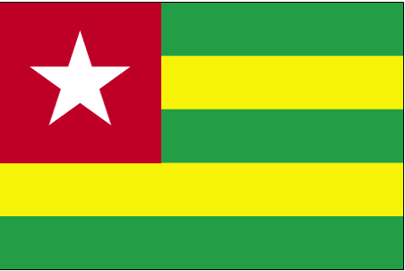
Pays/Territoires
Mise à jour 2021-01-12 18:58:07
Les noms des pays/territoires du monde sont donnés en Français et Chinois. Cette collection des précieuses terres fermes du monde que toute l'humanité partage inclut non seulement les pays indépendants, mais aussi des régions spécifiques qui ne sont pas membre de l'ONUOrganisation des Nations Unies: Nous, peuples des Nations Unies ... Une ONU plus forte pour un monde meilleur. Veuillez aussi consulter les noms des pays en masculin et féminin en Français.
GéoPays Fermer
1
id
Pays
Pays en Anglais
Togo
Pays
Togo
countryucasefr
TOGO
Pays en Chinois
Pays en Espagnol
Toga
Pays en Italien
Toga
Pays en Portugais
Toga
Pays en Allemand
Toga
countrypy
duo1 ge1
countrylocal
Republique Togolaise
countryfull
Togo
countrynm
Togo
ISO2
TG
ISO3
TGO
countrycodeisono
768
countrycodevehicle
TG
countrycodeolympic
TOG
countrycodeirs
TO
countrycodeirsfr
TO
countrycodeirsmixt
TO
♂Masulin
15
4
57
languagesfr
Français
119
currency
franc
currencyfr
franc C.F.A.
currencyisocode
XOF
currencyisocodefull
XOF 952
currencypxcode
XOF
currencysymbol
CFAF
currencysubdivision
100 centimes
currencyregime
Euro (655.957)
currencyvalue
0.00186
nationalityfr
Togalaise
Capitale
Lome
capitalfr
Lomé
Préfixe Tél.
228
Superficie km2
56 790
arealand
54 385
areawater
2 400
landarablerate
0.4137
landforestrate
0.094
coastline
56
summit
Pic Baumann 986 m.
boundarycountries
Ghana, Burkina Faso, Bénin.
flaglink

maplink
tgcolor.gif
outlinemaplink
tgout.gif
visapassenger
-1
maincities
Sokodé, Palimé, Atakpamé, Bassari, Tsévié, Anécho, Mango, Bafilo, Tabligbo.
largestcity
Lome
largestcitypopulation
662 000
rankpopulation
112
Population
4 861 000
rankgdp
146
gdp
1759000000
rankgdpppp
132
gdpppp
8247000000
rankgni
159
gni
1528000000
rankincomeorigin
182
rankincome
196
income
310
rankincomeppp
176
incomeppp
1640
lifeexpectation
53.43
alphabetizationrate
0.433
natalityrate
0.03523
mortalityrate
0.01151
mortalityrateinfantile
0.06873
hdi
0.489
precipitation
878
nationalevent
Independence Day
nationaleventfr
Jour de l'Indépendance
nationalholiday
27 April (1960)
Date de naissance aaaa-mm-jj
1960-04-27 00:00:00
7
1
location
Western Africa, bordering the Bight of Benin, between Benin and Ghana
terrain
gently rolling savanna in north; central hills; southern plateau; low coastal plain with extensive lagoons and marshes
naturalresources
phosphates, limestone, marble, arable land
9
Web
rgbback
16777215
todate
1
| Pays/Territoires | Régions en Chine | Provinces de Chine | Régions en France | Départements de France | Provinces du Monde | Villes/Villages | Localités | Continents du Monde | Vins AOP
