Countries/Territories
Updated 2021-01-12 18:58:07
The names of countries/territories of the world are taught in English and Chinese. This collection of precious dry lands that shares the whole mankind includes not only the world's independent countries, but also specific areas that are not a UNUnited Nations: We the peoples...A stronger UN for a better world. member. Please visit the table of male and female genders of country names in French.
Countries/locations Close
41
id
Country
Country
Cote d'Ivory
Country in French
Côte d'Ivoire
countryucasefr
COTE D'IVOIRE
Country in Chinese
Country in Spanish
Cote D'Ivoire (Costa de Marfil)
Country in Italian
Cote D'Ivoire (Costa D'avorio)
Country in Portuguese
Cote D'Ivoire (Costa De Marfim)
Country in Germain
Cote D'Ivoire (Die Elfenbeinküste)
countrypy
ke1 te4 di2 wa3
countrylocal
Cote d'Ivoire
countryfull
Cote d'Ivoire
countrynm
Cote d'Ivoire
ISO2
CI
ISO3
CIV
countrycodeisono
384
countrycodevehicle
CI
countrycodeolympic
CIV
countrycodeirs
IV
countrycodeirsfr
IV
countrycodeirsmixt
IV
countrycode
225
♀Female
15
4
57
languagesfr
Français
119
currency
franc
currencyfr
franc C.F.A.
currencyisocode
XOF
currencyisocodefull
XOF 952
currencypxcode
XOF
currencysymbol
CFAF
currencysubdivision
100 centimes
currencyregime
Euro (655.957)
currencyvalue
0.00186
nationality
Côte d'Ivoire
nationalityfr
Ivoirienne
Capital
Yamoussoukro
capitalfr
Yamoussoukro
Phone Prefix
225
Area km2
322 462
arealand
318 000
areawater
4 460
landarablerate
0.0928
landforestrate
0.224
coastline
515
summit
Mont Nimba 1 752 m.
boundarycountries
Burkina Faso, Liberia, Guinée, Mali, Ghana.
flaglink

maplink
cicolor.gif
outlinemaplink
ciout.gif
visapassenger
-1
maincities
Abidjan, Bouaké, Daloa, Man, Danané, Korhogo, Gagnoa.
largestcity
Yamoussoukro
largestcitypopulation
2 793 000
rankpopulation
55
Population
16 835 000
rankgdp
83
gdp
13734000000
rankgdpppp
91
gdpppp
24857000000
rankgni
86
gni
11124000000
rankincomeorigin
152
rankincome
166
income
660
rankincomeppp
180
incomeppp
1400
lifeexpectation
44.72
alphabetizationrate
0.538
natalityrate
0.03999
mortalityrate
0.01674
mortalityrateinfantile
0.09223
nationalevent
Independence Day
nationaleventfr
Jour de l'Indépendance
nationalholiday
7 August (1960)
Birthday yyyy-mm-dd
1960-08-07 00:00:00
7
1
location
Western Africa, bordering the North Atlantic Ocean, between Ghana and Liberia
terrain
mostly flat to undulating plains; mountains in northwest
naturalresources
petroleum, natural gas, diamonds, manganese, iron
cooking
Fruits Tropicaux.
9
Web
rgbback
16777215
todate
1
Notes
Fruits Tropicaux. Capital noted is official, Abidjan (de facto)
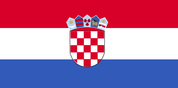
42
id
Country
Country
Croatia
Country in French
Croatie
countryucasefr
CROATIE
Country in Chinese
Country in Spanish
Croatia
Country in Italian
Croatia
Country in Portuguese
Croatia
Country in Germain
Croatia
countrypy
ke4 luo2 di4 ya4
countrylocal
Hrvatska
countryfull
Croatia
countrynm
Croatia
ISO2
HR
ISO3
HRV
countrycodeisono
191
countrycodevehicle
HR
countrycodeolympic
CRO
countrycodeirs
HR
countrycodeirsfr
HR
countrycodeirsmixt
HR
♀Female
18
6
36
languagesfr
Croate
30
currency
kuna
currencyfr
kuna
currencyisocode
HRK
currencyisocodefull
HRK 191
currencypxcode
HRK
currencysymbol
HRK
currencysubdivision
100 lipas
currencyregime
float
currencyvalue
0.167
nationalityfr
Croate
Capital
Zagreb
capitalfr
Zagreb
Phone Prefix
385
Area km2
56 538
arealand
56 414
areawater
128
landarablerate
0.2355
landforestrate
0.319
coastline
5835
summit
Veliki Troglav 1 913 m.
boundarycountries
Slovénie, Hongrie, Yougoslavie, Bosnie-Herzégovine
timezonedeltabegin
1
flaglink
maplink
hr-map.gif
outlinemaplink
hr.gif
visapassenger
-1
maincities
Rijeka, Split, Osijek, Zadar, Brod, Vukovar, Dubrovnik.
largestcity
Zagreb
largestcitypopulation
981 000
rankpopulation
115
Population
4 445 000
rankgdp
61
gdp
28797000000
rankgdpppp
67
gdpppp
49249000000
rankgni
64
gni
23875000000
rankincomeorigin
71
rankincome
78
income
5370
rankincomeppp
73
incomeppp
10610
lifeexpectation
74.14
alphabetizationrate
0.985
natalityrate
0.00951
mortalityrate
0.0113
mortalityrateinfantile
0.00696
hdi
0.818
urbanization
0.581
nationalevent
Statehood Day
nationaleventfr
Jour de l'Etat
nationalholiday
25 June (1991)
Birthday yyyy-mm-dd
1991-06-25 00:00:00
8
8
location
Southeastern Europe, bordering the Adriatic Sea, between Bosnia and Herzegovina and Slovenia
terrain
geographically diverse; flat plains along Hungarian border, low mountains and highlands near Adriatic coastline and islands
naturalresources
oil, some coal, bauxite, low-grade iron ore, calci
7
Web
rgbback
16777215
todate
1
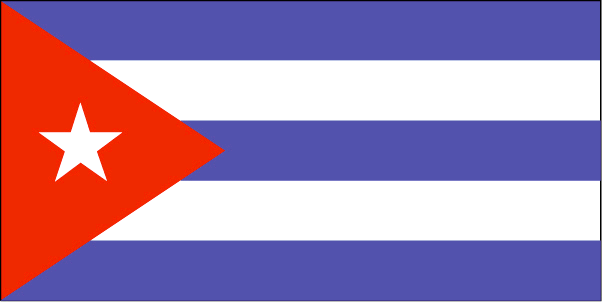
43
id
Country
Country
Cuba
Country in French
Cuba
countryucasefr
CUBA
Country in Chinese
Country in Spanish
Cuba
Country in Italian
La Cuba
Country in Portuguese
Cuba
Country in Germain
Kuba
countrypy
gu3 ba1
countrylocal
Cuba
countryfull
Cuba
countrynm
Cuba
ISO2
CU
ISO3
CUB
countrycodeisono
192
countrycodevehicle
CU
countrycodeolympic
CUB
countrycodeirs
CU
countrycodeirsfr
CU
countrycodeirsmixt
CU
5
1
131
languagesfr
Espagnol
31
currency
peso
currencyfr
peso cubain
currencyisocode
CUP
currencyisocodefull
CUP 192
currencypxcode
CUP
currencysymbol
Cu$
currencysubdivision
100 centavos
currencyregime
US-$ (1.0)
currencyvalue
0.04762
nationalityfr
Cubaine
Capital
Havana
capitalfr
La Havane
Phone Prefix
53
Area km2
110 860
arealand
110 860
landarablerate
0.3304
landforestrate
0.214
coastline
3735
summit
Pico Turquino 1 994 m.
timezonedeltabegin
-5
flaglink
maplink
cuba.gif
visapassenger
-1
maincities
Santiago de Cuba, Camagüey, Holguín, Guantanámo, Santa Clara, Bayamo, Cienfuegos, Pinar del Rio, Las Tunas.
largestcity
Havana
largestcitypopulation
2 221 000
rankpopulation
68
Population
11 326 000
rankgni
86
gni
10600000000
rankincomeorigin
148
rankincome
151
income
942
lifeexpectation
75.5
alphabetizationrate
0.96
mortalityrate
0.0071
nationalevent
Independence Day
nationaleventfr
Jour de l'Indépendance
nationalholiday
10 December (1898)
Birthday yyyy-mm-dd
1898-12-10 00:00:00
5
11
location
Caribbean, island between the Caribbean Sea and the North Atlantic Ocean, 150 km south of Key West, Florida
terrain
mostly flat to rolling plains, with rugged hills and mountains in the southeast
naturalresources
cobalt, nickel, iron ore, copper, manganese, salt,
9
Web
rgbback
16777215
todate
1
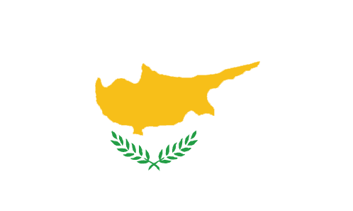
44
id
Country
Country
Cyprus
Country in French
Chypre
countryucasefr
CHYPRE
Country in Chinese
Country in Spanish
Chipre
Country in Italian
La Cipro
Country in Portuguese
Chipre
Country in Germain
Zypern
countrypy
se4 pu3 lu4 si1
countrylocal
Kibris, Kypros
countryfull
Cyprus
countrynm
Cyprus
ISO2
CY
ISO3
CYP
countrycodeisono
196
countrycodevehicle
CY
countrycodeolympic
CYP
countrycodeirs
CY
countrycodeirsfr
CY
countrycodeirsmixt
CY
♂Male
15
6
77
languagesfr
Grec, Turc
2
currency
pound
currencyfr
livre cypriote
currencyisocode
CYP
currencyisocodefull
CYP 196
currencypxcode
CYP
currencysymbol
£C
currencysubdivision
100 cents
currencyregime
1.7086 EUR/CYP +/- 2.25%
currencyvalue
2.1246
nationalityfr
Cypriote
Capital
Nicosia
capitalfr
Nicosie
Phone Prefix
357
Area km2
9 251
arealand
9 240
areawater
10
landarablerate
0.1061
landforestrate
0.186
coastline
648
summit
Olimbos 1 951 m.
timezonedeltabegin
2
flaglink
maplink
cy-map.gif
outlinemaplink
cy.gif
visapassenger
-1
maincities
Limassol, Larnaca, Famagusta
largestcity
Nicosia
largestcitypopulation
178 000
rankpopulation
155
Population
770 000
rankgdp
87
gdp
11385000000
rankgdpppp
113
gdpppp
13813000000
rankgni
96
gni
9373000000
rankincomeorigin
47
rankincome
46
income
12320
rankincomeppp
42
incomeppp
19600
lifeexpectation
77.46
alphabetizationrate
0.975
natalityrate
0.01266
mortalityrate
0.00763
mortalityrateinfantile
0.00736
hdi
0.891
urbanization
0.691
precipitation
320
nationalevent
Independence Day
nationaleventfr
Jour de l'Indépendance
nationalholiday
1 October (1960)
Birthday yyyy-mm-dd
1960-10-01 00:00:00
7
1
location
Middle East, island in the Mediterranean Sea, south of Turkey
terrain
central plain with mountains to north and south; scattered but significant plains along southern coast
naturalresources
copper, pyrites, asbestos, gypsum, timber, salt, m
7
Web
rgbback
16777215
todate
1
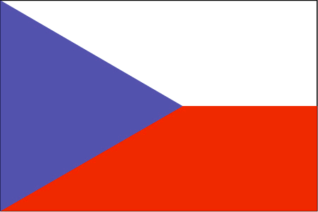
45
id
Country
Country
Czech Republic
Country in French
République Tchèque
countryucasefr
TCHEQUE (REPUBLIQUE)
Country in Chinese
Country in Spanish
República Checa
Country in Italian
Repubblica Ceca
Country in Portuguese
República Czech
Country in Germain
Tschechische Republik
countrypy
jie2 ke4 gong4 he2 guo2
countrylocal
Ceska Republika
countryfull
Czech Republic
countrynm
Czech Republic
ISO2
CZ
ISO3
CZE
countrycodeisono
203
countrycodevehicle
CZ
countrycodeolympic
CZE
countrycodeirs
CZ
countrycodeirsfr
CZ
countrycodeirsmixt
CZ
countrycode
42
♀Female
18
6
37
languagesfr
Tchèque
32
currency
koruna
currencyfr
couronne
currencyisocode
CZK
currencyisocodefull
CZK 203
currencypxcode
CZK
currencysymbol
Kc (with h
currencysubdivision
100 haleru
currencyregime
float
currencyvalue
0.04019
nationalityfr
Czech
Capital
Prague
capitalfr
Prague
Phone Prefix
420
Area km2
8 838
arealand
77 276
areawater
1 590
landarablerate
0.4
landforestrate
0.341
summit
Snezka 1 602 m.
boundarycountries
Allemagne, Pologne, Slovaquie, Autriche.
timezonedeltabegin
1
flaglink
maplink
ez-map.gif
outlinemaplink
cz.gif
visapassenger
-1
maincities
Brno, Ostrava, Plzen, Olomouc, Usti Nad Labem, Liberec, Hradec Králové, Pardubice, Ceské Budejovice.
largestcity
Prague
largestcitypopulation
1 225 000
rankpopulation
75
Population
10 202 000
rankgdp
39
gdp
89715000000
rankgdpppp
43
gdpppp
166877000000
rankgni
45
gni
72899000000
rankincomeorigin
63
rankincome
69
income
7150
rankincomeppp
56
incomeppp
15600
lifeexpectation
75.78
alphabetizationrate
1
natalityrate
0.0091
mortalityrate
0.01054
mortalityrateinfantile
0.00397
hdi
0.861
urbanization
0.745
precipitation
527
nationalevent
Czech Founding Day
nationaleventfr
Jour National
nationalholiday
28 October (1918)
Birthday yyyy-mm-dd
1918-10-28 00:00:00
5
7
location
Central Europe, southeast of Germany
terrain
Bohemia in the west consists of rolling plains, hills, and plateaus surrounded by low mountains; Moravia in the east consists of very hilly country
naturalresources
hard coal, soft coal, kaolin, clay, graphite, timb
6
Web
rgbback
16777215
todate
1
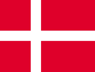
46
id
Country
Country
Denmark
Country in French
Danemark
countryucasefr
DANEMARK
Country in Chinese
Country in Spanish
Dinamarca
Country in Italian
La Danimarca
Country in Portuguese
Dinamarca
Country in Germain
Dänemark
countrypy
dan1 mai4
countrylocal
Danmark
countryfull
Denmark
countrynm
Denmark
ISO2
DK
ISO3
DNK
countrycodeisono
208
countrycodevehicle
DK
countrycodeolympic
DEN
countrycodeirs
DA
countrycodeirsfr
DA
countrycodeirsmixt
DA
countrycode
45
♂Male
1
12
6
38
languagesfr
Danois
33
currency
krone (pl. kroner)
currencyfr
krone
currencyisocode
DKK
currencyisocodefull
DKK 208
currencypxcode
DKK
currencysymbol
Dkr
currencysubdivision
100 øre
currencyregime
EMS-II
currencyvalue
0.164
nationalityfr
Danoise
Capital
Copenhagen
capitalfr
Copenhague
Phone Prefix
45
Area km2
43 070
arealand
42 394
areawater
700
landarablerate
0.5574
landforestrate
0.107
coastline
7314
summit
Yding Skovhøj 173 m.Yding Skovhøj 173 m.
boundarycountries
Allemagne, Suède.
timezonedeltabegin
1
flaglink
maplink
dkcolor.gif
outlinemaplink
dk.gif
visapassenger
-1
maincities
Århus, Odense, Ålborg, Esbjerg, Randers, Elseneur, Kolding, Herning, Horsens, Vejle.
largestcity
Copenhagen
largestcitypopulation
1 326 000
rankpopulation
105
Population
5 387 000
rankgdp
24
gdp
211888000000
rankgdpppp
42
gdpppp
169508000000
rankgni
25
gni
180859000000
rankincomeorigin
8
rankincome
6
income
33570
rankincomeppp
8
incomeppp
31050
lifeexpectation
77.44
alphabetizationrate
1
natalityrate
0.01159
mortalityrate
0.01053
mortalityrateinfantile
0.00463
hdi
0.93
urbanization
0.851
nationalevent
none designated; Constitution Day
nationaleventfr
Jour de la Constitution
nationalholiday
5 June
Birthday yyyy-mm-dd
2000-06-05 00:00:00
7
5
location
Northern Europe, bordering the Baltic Sea and the North Sea, on a peninsula north of Germany (Jutland); also includes two major islands (Sjaelland and Fyn)
terrain
low and flat to gently rolling plains
naturalresources
petroleum, natural gas, fish, salt, limestone, sto
6
Web
rgbback
16777215
todate
1
47
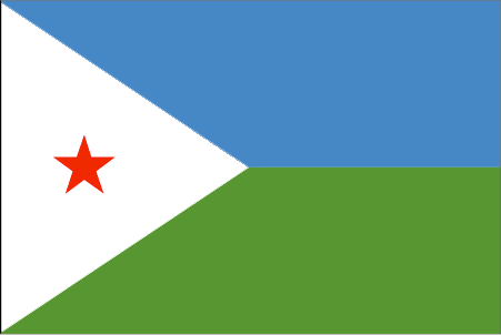
id
Country
Country
Djibouti
Country in French
Djibouti
countryucasefr
DJIBOUTI
Country in Chinese
Country in Spanish
Djibouti
Country in Italian
Djibouti
Country in Portuguese
Djibouti
Country in Germain
Djibouti
countrypy
ji2 bu4 ti2
countrylocal
Djibouti
countryfull
Djibouti
countrynm
Djibouti
ISO2
DJ
ISO3
DJI
countrycodeisono
262
countrycodeolympic
DJI
countrycodeirs
DJ
countrycodeirsfr
DJ
countrycodeirsmixt
DJ
15
4
3
languagesfr
Arabe
133
currency
franc
currencyfr
franc de Djibouti
currencyisocode
DJF
currencyisocodefull
DJF 262
currencypxcode
DJF
currencysymbol
DF
currencysubdivision
100 centimes
currencyregime
US-$ (177.72)
currencyvalue
0.00603
Capital
Jibuti
capitalfr
Djibouti
Phone Prefix
253
Area km2
23 200
arealand
22 980
areawater
20
landforestrate
0.003
coastline
314
summit
Moussa Ali 2 063 m.
boundarycountries
Ethiopie, Somaliland, Erythrée.
timezonedeltabegin
3
flaglink
maplink
djcolor.gif
outlinemaplink
djout.gif
visapassenger
-1
maincities
Tadjourah, Dikhil, Obock, Ali-Sabieh.
largestcity
Djibouti
largestcitypopulation
493 000
rankpopulation
158
Population
705 000
rankgdp
166
gdp
625000000
rankgdpppp
154
gdpppp
1471000000
rankgni
185
gni
643000000
rankincomeorigin
141
rankincome
154
income
910
rankincomeppp
157
incomeppp
2140
lifeexpectation
43.12
alphabetizationrate
0.669
natalityrate
0.04039
fecondity
5.7
mortalityrate
0.01942
mortalityrateinfantile
0.10554
hdi
0.462
urbanization
0.842
precipitation
163
nationalevent
Independence Day
nationaleventfr
Jour de l'Indépendance
nationalholiday
27 June (1977)
Birthday yyyy-mm-dd
1977-06-27 00:00:00
4
6
location
Eastern Africa, bordering the Gulf of Aden and the Red Sea, between Eritrea and Somalia
terrain
coastal plain and plateau separated by central mountains
naturalresources
geothermal areas
9
rgbback
16777215
todate
1
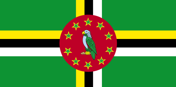
48
id
Country
Country
Dominica
Country in French
Dominique
countryucasefr
DOMINIQUE
Country in Chinese
Country in Spanish
Dominica
Country in Italian
Dominica
Country in Portuguese
Dominica
Country in Germain
Dominica
countrypy
duo1 ming2 ni2 jia1
countrylocal
Dominica
countryfull
Dominica
countrynm
Dominica
ISO2
DM
ISO3
DMA
countrycodeisono
212
countrycodevehicle
WD
countrycodeolympic
DMA
countrycodeirs
DO
countrycodeirsfr
DO
countrycodeirsmixt
DO
♀Female
18
6
51
languagesfr
Anglais, Français.
35
currency
dollar
currencyfr
dollar des Caraïbes orientales
currencyisocode
XCD
currencyisocodefull
XCD 951
currencypxcode
XCD
currencysymbol
EC$
currencysubdivision
100 cents
currencyregime
US-$ (2.7)
currencyvalue
0.3745
nationalityfr
Dominicaine
Capital
Roseau
capitalfr
Roseau
Phone Prefix
1-767
Area km2
753
arealand
754
landarablerate
0.04
landforestrate
0.613
coastline
148
summit
Morne Diablotin 1 447 m.
timezonedeltabegin
-4
flaglink
maplink
dmcolor.gif
outlinemaplink
dm.gif
visapassenger
-1
maincities
Portsmouth, Marigot, Berekua, Saint Joseph.
largestcity
Roseau
largestcitypopulation
21 000
rankpopulation
195
Population
71 000
rankgdp
177
gdp
259000000
rankgdpppp
166
gdpppp
388000000
rankgni
202
gni
237000000
rankincomeorigin
90
rankincome
100
income
3330
rankincomeppp
118
incomeppp
5020
lifeexpectation
74.38
alphabetizationrate
0.94
natalityrate
0.01625
fecondity
2.01
mortalityrate
0.0069
mortalityrateinfantile
0.01475
growthrate
-0.00452
hdi
0.776
urbanization
0.7169
precipitation
654
nationalevent
Independence Day
nationaleventfr
Jour de l'Indépendance
nationalholiday
3 November (1978)
Birthday yyyy-mm-dd
1978-11-03 00:00:00
5
7
location
Caribbean, island between the Caribbean Sea and the North Atlantic Ocean, about one-half of the way from Puerto Rico to Trinidad and Tobago
terrain
rugged mountains of volcanic origin
naturalresources
timber, hydropower, arable land
9
Web
rgbback
16777215
todate
1
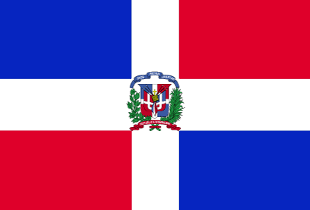
49
id
Country
Country
Dominican Republic
Country in French
République Dominicaine
countryucasefr
DOMINICAINE (REPUBLIQUE)
Country in Chinese
Country in Spanish
República Dominicana
Country in Italian
Repubblica Domenicana
Country in Portuguese
República Dominican
Country in Germain
Dominikanische Republik
countrypy
duo1 mi3 ni2 jia1 gong4 he2 guo2
countrylocal
Dominicana, Republica
countryfull
Dominican Republic
countrynm
Dominican Republic
ISO2
DO
ISO3
DOM
countrycodeisono
214
countrycodevehicle
DOM
countrycodeolympic
DOM
countrycodeirs
DR
countrycodeirsfr
DR
countrycodeirsmixt
DR
countrycode
1809
♀Female
18
6
131
languagesfr
Espagnol
34
currency
peso
currencyfr
peso dominicain
currencyisocode
DOP
currencyisocodefull
DOP 214
currencypxcode
DOP
currencysymbol
RD$
currencysubdivision
100 centavos
currencyregime
m.float
currencyvalue
0.03472
nationalityfr
Dominicaine
Capital
Santo Domingo
capitalfr
Saint-Domingue
Phone Prefix
1-809
Area km2
48 734
arealand
48 380
areawater
350
landarablerate
0.2108
landforestrate
0.284
coastline
1288
summit
Pico Duarte 3 175 m.
boundarycountries
Haïti.
timezonedeltabegin
-4
flaglink
maplink
docolor.gif
outlinemaplink
do.gif
visapassenger
-1
maincities
Santiago, La Vega, Puerto Plata, Barahona, La Romana, San Pedro de Macoris, San Francisco de Macoris, San Juan.
largestcity
Santo Domingo
largestcitypopulation
3 166 000
rankpopulation
82
Population
8 739 000
rankgdp
80
gdp
16541000000
rankgdpppp
65
gdpppp
59622000000
rankgni
72
gni
18601000000
rankincomeorigin
107
rankincome
117
income
2130
rankincomeppp
99
incomeppp
6310
lifeexpectation
67.63
alphabetizationrate
0.8435
natalityrate
0.0236
mortalityrate
0.0071
mortalityrateinfantile
0.03328
hdi
0.737
urbanization
0.66
precipitation
1448
nationalevent
Independence Day
nationaleventfr
Jour de l'Indépendance
nationalholiday
27 February (1844)
Birthday yyyy-mm-dd
1844-02-27 00:00:00
1
5
location
Caribbean, eastern two-thirds of the island of Hispaniola, between the Caribbean Sea and the North Atlantic Ocean, east of Haiti
terrain
rugged highlands and mountains with fertile valleys interspersed
naturalresources
nickel, bauxite, gold, silver
cooking
Fruits de Mer
9
Web
rgbback
16777215
todate
1
Notes
Fruits de Mer
50
id
Country
Country
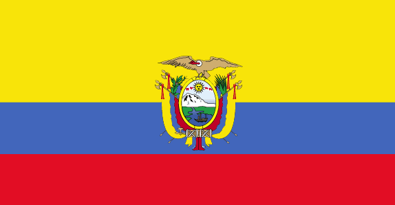
Ecuador
Country in French
Equateur
countryucasefr
EQUATEUR
Country in Chinese
Country in Spanish
Ecuador
Country in Italian
L'Ecuador
Country in Portuguese
Equador
Country in Germain
Ecuador
countrypy
e4 gua1 duo1 er3
countrylocal
Ecuador
countryfull
Ecuador
countrynm
Ecuador
ISO2
EC
ISO3
ECU
countrycodeisono
218
countrycodevehicle
EC
countrycodeolympic
ECU
countrycodeirs
EC
countrycodeirsfr
EC
countrycodeirsmixt
EC
countrycode
593
♂Male
15
6
131
languagesfr
Espagnol
6
currency
dollar
currencyfr
dollar
currencyisocode
USD
currencyisocodefull
USD 840
currencypxcode
USD
currencysymbol
$
currencysubdivision
100 cents
currencyregime
float
currencyvalue
1
nationalityfr
Equatorienne
Capital
Quito
capitalfr
Quito
Phone Prefix
593
Area km2
283 561
arealand
276 840
areawater
6 720
landarablerate
0.0569
landforestrate
0.381
coastline
2237
summit
Chimborazo 6 267 m.
boundarycountries
Colombie, Pérou.
timezonedeltabegin
-5
flaglink
maplink
eccolor.gif
outlinemaplink
ec.gif
visapassenger
-1
maincities
Guayaquil, Cuenca, Machala, Portoviejo, Riobamba, Ambato, Manta, Esmeraldas.
largestcity
Guayaquil
largestcitypopulation
1 831 000
rankpopulation
63
Population
13 008 000
rankgdp
63
gdp
27201000000
rankgdpppp
69
gdpppp
47362000000
rankgni
66
gni
23772000000
rankincomeorigin
117
rankincome
128
income
1830
rankincomeppp
137
incomeppp
3440
lifeexpectation
71.89
alphabetizationrate
0.8975
natalityrate
0.02494
mortalityrate
0.00529
mortalityrateinfantile
0.03197
hdi
0.732
precipitation
1026
nationalevent
Independence Day (independence of Quito)
nationaleventfr
Jour de l'Indépendance (indépendance de Quito)
nationalholiday
10 August (1809)
Birthday yyyy-mm-dd
1809-08-10 00:00:00
6
6
location
Western South America, bordering the Pacific Ocean at the Equator, between Colombia and Peru
terrain
coastal plain (costa), inter-Andean central highlands (sierra), and flat to rolling eastern jungle (oriente)
naturalresources
petroleum, fish, timber, hydropower
cooking
Fruits de Mer
9
Web
rgbback
16777215
todate
1
Notes
Fruits de Mer
| Countries/Territories | Regions of China | Provinces of China | Regions in France | French Departments | States/Provinces | Cities/Towns | Locations | World Continents | French AOP Wines
