Pays/Territoires
Mise à jour 2021-01-12 18:58:07
Les noms des pays/territoires du monde sont donnés en Français et Chinois. Cette collection des précieuses terres fermes du monde que toute l'humanité partage inclut non seulement les pays indépendants, mais aussi des régions spécifiques qui ne sont pas membre de l'ONUOrganisation des Nations Unies: Nous, peuples des Nations Unies ... Une ONU plus forte pour un monde meilleur. Veuillez aussi consulter les noms des pays en masculin et féminin en Français.
GéoPays Fermer
31
id
Pays
Pays en Anglais
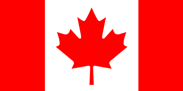
Canada
Pays
Canada
countryucasefr
CANADA
Pays en Chinois
Pays en Espagnol
Canadá
Pays en Italien
Il Canada
Pays en Portugais
Canadá
Pays en Allemand
Kanada
countrypy
jia1 na2 da4
countrylocal
Canada
countryfull
Canada
countrynm
Canada
ISO2
CA
ISO3
CAN
countrycodeisono
124
countrycodevehicle
CDN
countrycodeolympic
CAN
countrycodeirs
CA
countrycodeirsfr
CA
countrycodeirsmixt
CA
countrycode
1
♂Masulin
17
7
51
languagesfr
Anglais, Français.
25
currency
dollar
currencyfr
dollar canadien
currencyisocode
CAD
currencyisocodefull
CAD 124
currencypxcode
CAD
currencysymbol
Can$
currencysubdivision
100 cents
currencyregime
float
currencyvalue
0.8013
nationalityfr
Canadienne
Capitale
Ottawa
capitalfr
Ottawa
Préfixe Tél.
1
Superficie km2
9 976 139
arealand
9 093 507
areawater
891 163
landarablerate
0.0494
landforestrate
0.265
coastline
202080
summit
Mount Logan 6 050 m.
boundarycountries
Etats-Unis.
timezonedeltabegin
-3.5
timezonedeltaend
-8
zipcodelength
6
flaglink
maplink
ciaca.gif
outlinemaplink
caoutl.gif
maincities
Toronto, Montréal, Vancouver, Calgary, Winnipeg, Edmonton, Hamilton, Regina, Québec, Halifax, Thunder Bay.
largestcity
Toronto
largestcitypopulation
4 319 000
rankpopulation
36
Population
31 630 000
rankgdp
8
gdp
856523000000
rankgdpppp
11
gdpppp
970326000000
rankgni
8
gni
773943000000
rankincomeorigin
24
rankincome
20
income
24470
rankincomeppp
11
incomeppp
30040
lifeexpectation
79.83
alphabetizationrate
0.99
natalityrate
0.01099
mortalityrate
0.00761
mortalityrateinfantile
0.00488
nationalevent
Canada Day
nationaleventfr
Jour du Canada
nationalholiday
1 July (1867)
Date de naissance aaaa-mm-jj
1867-07-01 00:00:00
4
4
location
Northern North America, bordering the North Atlantic Ocean on the east, North Pacific Ocean on the west, and the Arctic Ocean on the north, north of the conterminous US
terrain
mostly plains with mountains in west and lowlands in southeast
naturalresources
iron ore, nickel, zinc, copper, gold, lead, molybd
cooking
Fruits de Mer.
8
Web
rgbback
16777215
todate
1
Notes
Fruits de Mer.
32
id
Pays
Pays en Anglais
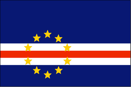
Cape Verde
Pays
Cap-Vert
countryucasefr
CAP-VERT
Pays en Chinois
Pays en Espagnol
Cabo Verde
Pays en Italien
Cape Verde
Pays en Portugais
Cape Verde
Pays en Allemand
Cape Verde
countrypy
fo2 de2 jiao3
countrylocal
Cabo Verde
countryfull
Cape Verde
countrynm
Cape Verde
ISO2
CV
ISO3
CPV
countrycodeisono
132
countrycodeolympic
CPV
countrycodeirs
CV
countrycodeirsfr
CV
countrycodeirsmixt
CV
♂Masulin
15
6
114
languagesfr
Portugais
2
currency
escudo
currencyfr
escudo du Cap Vert
currencyisocode
CVE
currencyisocodefull
CVE 132
currencypxcode
CVE
currencysymbol
C.V.Esc.
currencysubdivision
100 centavos
currencyregime
composite
currencyvalue
0.01107
Capitale
Praia
capitalfr
Praia
Préfixe Tél.
238
Superficie km2
4 033
arealand
4 033
landarablerate
0.0968
landforestrate
0.211
coastline
965
summit
Pico 2 829 m.
timezonedeltabegin
-1
flaglink
maplink
cvcolor
outlinemaplink
cvout.gif
visapassenger
-1
maincities
Mindelo, Ribeira Grande, Sal, Santa Maria.
largestcity
Praia
largestcitypopulation
68 000
rankpopulation
162
Population
470 000
rankgdp
157
gdp
797000000
rankgdpppp
152
gdpppp
2449000000
rankgni
183
gni
675000000
rankincomeorigin
124
rankincome
136
income
1440
rankincomeppp
115
incomeppp
5130
lifeexpectation
70.14
alphabetizationrate
0.768
natalityrate
0.02613
fecondity
3.3
mortalityrate
0.00672
mortalityrateinfantile
0.04914
hdi
0.727
urbanization
0.635
nationalevent
Independence Day
nationaleventfr
Jour de l'Indépendance
nationalholiday
5 July (1975)
Date de naissance aaaa-mm-jj
1975-07-05 00:00:00
2
4
location
Western Africa, group of islands in the North Atlantic Ocean, west of Senegal
terrain
steep, rugged, rocky, volcanic
naturalresources
salt, basalt rock, limestone, kaolin, fish
9
Web
rgbback
16777215
todate
1
33
id
Pays
Pays en Anglais
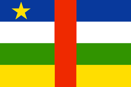
Central Africa
Pays
République Centrafricaine
countryucasefr
CENTRAFRICAINE
Pays en Chinois
Pays en Espagnol
República Africana De centro
Pays en Italien
Repubblica Africana Concenta
Pays en Portugais
República Africana Center
Pays en Allemand
Afrikanische Mittelrepublik
countrypy
zhong1 fei1 gong4 he2 guo2
countrylocal
Republique Centrafricaine
countryfull
Central African Republic
countrynm
Central African Republic
ISO2
CF
ISO3
CAF
countrycodeisono
140
countrycodevehicle
RCA
countrycodeolympic
CAF
countrycodeirs
CT
countrycodeirsfr
CT
countrycodeirsmixt
CT
♀Féminin
15
1
57
languagesfr
Français
119
currency
franc
currencyfr
franc C.F.A.
currencyisocode
XAF
currencyisocodefull
XAF 950
currencypxcode
XAF
currencysymbol
CFAF
currencysubdivision
100 centimes
currencyregime
Euro (655.957)
currencyvalue
0.00186
nationalityfr
Centre-Africaine
Capitale
Bangui
capitalfr
Bangui
Préfixe Tél.
236
Superficie km2
622 984
arealand
622 984
landarablerate
0.031
landforestrate
0.368
summit
Mont Gaou 1 420 m.
boundarycountries
Cameroun, Tchad, Soudan, Congo démocratique, Congo.
timezonedeltabegin
1
flaglink
maplink
cfcolor.gif
outlinemaplink
cfout.gif
visapassenger
-1
maincities
Berbérati, Bouar, Bambari, Bangassou, Mbaïki.
largestcity
Bangui
largestcitypopulation
553 000
rankpopulation
125
Population
3 881 000
rankgdp
151
gdp
1198000000
rankgdpppp
146
gdpppp
4225000000
rankgni
172
gni
1019000000
rankincomeorigin
190
rankincome
204
income
260
rankincomeppp
185
incomeppp
1080
lifeexpectation
41.71
alphabetizationrate
0.377
natalityrate
0.03593
mortalityrate
0.01973
mortalityrateinfantile
0.0933
nationalevent
Republic Day
nationaleventfr
Jour de la République
nationalholiday
1 December (1958)
Date de naissance aaaa-mm-jj
1958-12-01 00:00:00
5
11
location
Central Africa, north of Democratic Republic of the Congo
terrain
vast, flat to rolling, monotonous plateau; scattered hills in northeast and southwest
naturalresources
diamonds, uranium, timber, gold, oil, hydropower
9
Web
rgbback
16777215
todate
1
34
id
Pays
Pays en Anglais
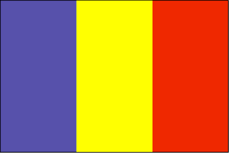
Chad
Pays
Tchad
countryucasefr
TCHAD
Pays en Chinois
Pays en Espagnol
Sábalo
Pays en Italien
Il Ritaglio
Pays en Portugais
República do Tchad
Pays en Allemand
Tschad
countrypy
zha4 de2
countrylocal
Tchad
countryfull
Chad
countrynm
Chad
ISO2
TD
ISO3
TCD
countrycodeisono
148
countrycodevehicle
TCH
countrycodeolympic
CHA
countrycodeirs
CD
countrycodeirsfr
CD
countrycodeirsmixt
CD
♂Masulin
15
4
57
languagesfr
Arabe, Français
119
currency
franc
currencyfr
franc C.F.A.
currencyisocode
XAF
currencyisocodefull
XAF 950
currencypxcode
XAF
currencysymbol
CFAF
currencysubdivision
100 centimes
currencyregime
Euro (655.957)
currencyvalue
0.00186
nationalityfr
Chadienne
Capitale
N'Djamena
capitalfr
N'Djamena
Préfixe Tél.
235
Superficie km2
1 284 000
arealand
1 259 200
areawater
24 800
landarablerate
0.0278
landforestrate
0.101
summit
Emi Koussi 3 415 m.
boundarycountries
Niger, Libye, Soudan, Centrafrique, Cameroun, Nigeria.
timezonedeltabegin
1
flaglink
maplink
tdcolor.gif
outlinemaplink
tdout.gif
visapassenger
-1
maincities
Sarh, Moundou, Abéché, Bongor, Doba, Lai, Koumra, Kélo.
largestcity
Ndjamena
largestcitypopulation
826 000
rankpopulation
83
Population
8 582 000
rankgdp
139
gdp
2608000000
rankgdpppp
123
gdpppp
10386000000
rankgni
151
gni
2073000000
rankincomeorigin
192
rankincome
206
income
240
rankincomeppp
185
incomeppp
1080
lifeexpectation
48.24
alphabetizationrate
0.46
natalityrate
0.0465
mortalityrate
0.01638
mortalityrateinfantile
0.09478
hdi
0.376
urbanization
0.241
nationalevent
Independence Day
nationaleventfr
Jour de l'Indépendance
nationalholiday
11 August (1960)
Date de naissance aaaa-mm-jj
1960-08-11 00:00:00
7
1
location
Central Africa, south of Libya
terrain
broad, arid plains in center, desert in north, mountains in northwest, lowlands in south
naturalresources
petroleum (unexploited but exploration under way),
9
Web
rgbback
16777215
todate
1
35
id
Pays
Pays en Anglais
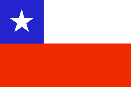
Chile
Pays
Chili
countryucasefr
CHILI
Pays en Chinois
Pays en Espagnol
Chile
Pays en Italien
Il Cile
Pays en Portugais
O Chile
Pays en Allemand
Chile
countrypy
zhi4 li4
countrylocal
Chile
countryfull
Chile
countrynm
Chile
ISO2
CL
ISO3
CHL
countrycodeisono
152
countrycodevehicle
RCH
countrycodeolympic
CHI
countrycodeirs
CI
countrycodeirsfr
CI
countrycodeirsmixt
CL
countrycode
56
♂Masulin
15
6
131
languagesfr
Espagnol
27
currency
peso
currencyfr
peso
currencyisocode
CLP
currencyisocodefull
CLP 152
currencypxcode
CLP
currencysymbol
Ch$
currencysubdivision
100 centavos
currencyregime
indicators
currencyvalue
0.0017
nationalityfr
Chillienne
Capitale
Santiago
capitalfr
Santiago
Préfixe Tél.
56
Superficie km2
756 945
arealand
748 800
areawater
8 150
landarablerate
0.0265
landforestrate
0.207
coastline
6435
summit
Cerro Ojos del Salado 6 863 m.
boundarycountries
Pérou, Bolivie, Argentine.
timezonedeltabegin
-4
flaglink
maplink
clcolor.gif
outlinemaplink
cl.gif
visapassenger
-1
maincities
Viña del Mar, Valparaíso, Concepcíon, Talcahuano, Temuco, Antofagasta, Rancagua, Arica, Talca, Puerto Montt, Punta Arenas
largestcity
Santiago
largestcitypopulation
4 891 000
rankpopulation
58
Population
15 774 000
rankgdp
47
gdp
72415000000
rankgdpppp
44
gdpppp
162067000000
rankgni
46
gni
68733000000
rankincomeorigin
76
rankincome
83
income
4360
rankincomeppp
77
incomeppp
9810
lifeexpectation
76.35
alphabetizationrate
0.946
natalityrate
0.0161
mortalityrate
0.00563
mortalityrateinfantile
0.00888
hdi
0.826
nationalevent
Independence Day
nationaleventfr
Jour de l'Indépendance
nationalholiday
18 September (1810)
Date de naissance aaaa-mm-jj
1810-09-18 00:00:00
7
7
location
Southern South America, bordering the South Pacific Ocean, between Argentina and Peru
terrain
low coastal mountains; fertile central valley; rugged Andes in east
naturalresources
copper, timber, iron ore, nitrates, precious metal
cooking
Fruits de Mer
9
Web
rgbback
16777215
todate
1
Notes
Fruits de Mer
36
id
Pays
Pays en Anglais
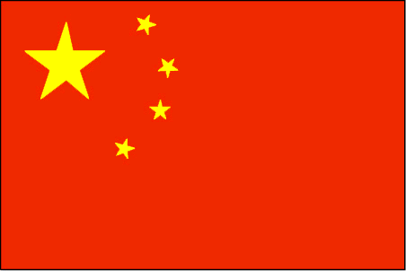
China
Pays
Chine
countryucasefr
CHINE
Pays en Chinois
Pays en Espagnol
China
Pays en Italien
La Cina
Pays en Portugais
China
Pays en Allemand
China
countrypy
zhong1 guo2, zhong1 hua2
countrylocal
Zhongguo
countryfull
China
countrynm
China
ISO2
CN
ISO3
CHN
countrycodeisono
156
countrycodeolympic
CHN
countrycodeirs
CH
countrycodeirsfr
CN
countrycodeirsmixt
CN
countrycode
86
countrycodefr
86
♀Féminin
5
1
126
languagesfr
Chinois
3
currency
yuan renminbi
currencyfr
Yuan
currencyisocode
CNY
currencyisocodefull
CNY 156
currencypxcode
CNY
currencysymbol
Y
currencysubdivision
10 jiao = 100 fen
currencyregime
m.float
currencyvalue
0.121
nationality
Chinese
nationalityfr
Chinoise
Capitale
Beijing
capitalfr
Pékin
Préfixe Tél.
86
Superficie km2
9 574 479
arealand
9 326 410
areawater
270 550
landarablerate
0.1331
landforestrate
0.175
coastline
14500
summit
Mont Everest 8 850m
boundarycountries
Inde, Pakistan, Afghanistan, Tadjikistan, Kirghizstan, Kazakhstan, Russie, Mongolie, Corée du Nord, Vietnam, Laos, Birmanie, Bhoutan, Népal
timezonedeltabegin
8
zipcodelength
6
flaglink
maplink
cncolor.gif
outlinemaplink
cnout.gif
visapassenger
-1
maincities
Shanghaï, Tianjin, Shenyang, Wuhan, Canton, Harbin, Chongqing, Nanjing, Xi'an, Dalian, Chengdu, Changchun, Taiyuan, Jinan.
largestcity
Shanghai
largestcitypopulation
13 584 000
rankpopulation
1
Population
1 339 724 852
rankgdp
7
gdp
1417000000000
rankgdpppp
2
gdpppp
6446033000000
rankgni
6
gni
1416751000000
rankincomeorigin
134
rankincome
146
income
1100
rankincomeppp
119
incomeppp
4980
lifeexpectation
71.9
alphabetizationrate
0.835
mortalityrateinfantile
0.0272
precipitation
1331.7
nationalevent
Anniversary of the Founding of the People's Republic of China
nationaleventfr
Déclaration de la République Populaire de Chine
nationalholiday
1 October (1949)
Date de naissance aaaa-mm-jj
1949-10-01 00:00:00
6
2
president
HU Jintao
location
Eastern Asia, bordering the East China Sea, Korea Bay, Yellow Sea, and South China Sea, between North Korea and Vietnam
terrain
mostly mountains, high plateaus, deserts in west; plains, deltas, and hills in east
naturalresources
coal, iron ore, petroleum, natural gas, mercury, t
cooking
Riz, Cuisine à la Vapeur, Canard laqué de Pékin - Révolutionnaire !
phoneinputmask
CC CC CCC CCCCCCCCCCCCCCCCCCCCCCCCCCCCCCCCCCCCCCC;;_
8
Web
rgbback
12303359
todate
1
Notes
Riz, Cuisine à la Vapeur, Canard laqué de Pékin - Révolutionnaire !
Ce Buffle de la Terre laboure depuis la nuit des temps dans les rizières. Et fouirnit aux peuples du monde entier de produits peu onéreux depuis 1979 du petit timonier DENG Xiaoping.
37
id
Pays
Pays en Anglais
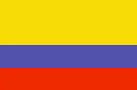
Colombia
Pays
Colombie
countryucasefr
COLOMBIE
Pays en Chinois
Pays en Espagnol
Colombia
Pays en Italien
La Colombia
Pays en Portugais
Colômbia
Pays en Allemand
Kolumbien
countrypy
ge1 lun2 bi3 ya4
countrylocal
Colombia
countryfull
Colombia
countrynm
Colombia
ISO2
CO
ISO3
COL
countrycodeisono
170
countrycodevehicle
CO
countrycodeolympic
COL
countrycodeirs
CO
countrycodeirsfr
CO
countrycodeirsmixt
CO
countrycode
57
♀Féminin
15
6
131
languagesfr
Espagnol
28
currency
peso
currencyfr
peso
currencyisocode
COP
currencyisocodefull
COP 170
currencypxcode
COP
currencysymbol
Col$
currencysubdivision
100 centavos
currencyregime
m.float
currencyvalue
0.00043
nationalityfr
Colombienne
Capitale
Bogota
capitalfr
Bogota
Préfixe Tél.
57
Superficie km2
1 138 914
arealand
1 038 700
areawater
100 210
landarablerate
0.019
landforestrate
0.478
coastline
3208
summit
Pico Cristóbal Colón 5 775 m.
boundarycountries
Panama, Vénézuéla, Brésil, Pérou, Equateur.
timezonedeltabegin
-5
flaglink
maplink
cocolor.gif
outlinemaplink
co.gif
visapassenger
-1
maincities
Medellín, Cali, Barranquilla, Cartagena, Pereira, Cúcuta, Bucaramanga, Manizales
largestcity
Bogota
largestcitypopulation
6 079 000
rankpopulation
28
Population
44 584 000
rankgdp
46
gdp
78651000000
rankgdpppp
26
gdpppp
298799000000
rankgni
42
gni
80540000000
rankincomeorigin
118
rankincome
130
income
1810
rankincomeppp
97
incomeppp
6410
lifeexpectation
70.9
alphabetizationrate
0.867
natalityrate
0.0232
nationalevent
Independence Day
nationaleventfr
Jour de l'Indépendance
nationalholiday
20 July (1810)
Date de naissance aaaa-mm-jj
1810-07-20 00:00:00
7
7
location
Northern South America, bordering the Caribbean Sea, between Panama and Venezuela, and bordering the North Pacific Ocean, between Ecuador and Panama
terrain
flat coastal lowlands, central highlands, high Andes Mountains, eastern lowland plains
naturalresources
petroleum, natural gas, coal, iron ore, nickel, go
cooking
Fruits de Mer, Epices.
9
Web
rgbback
16777215
todate
1
Notes
Fruits de Mer, Epices.
38
id
Pays
Pays en Anglais
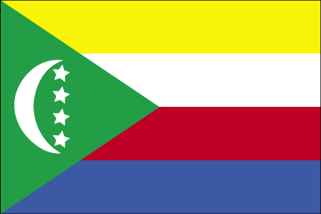
Comoros
Pays
Comores
countryucasefr
COMORES
Pays en Chinois
Pays en Espagnol
El Comoro
Pays en Italien
Le Comore
Pays en Portugais
Cômoros
Pays en Allemand
Comoren
countryfull
Comoros
countrynm
Comoros
ISO2
KM
ISO3
COM
countrycodeisono
174
countrycodeolympic
COM
countrycodeirs
CN
countrycodeirsfr
CN
countrycodeirsmixt
CMR
♀Féminin
15
2
57
languagesfr
Français
119
currency
franc
currencyfr
franc C.F.A.
currencyisocode
KMF
currencyisocodefull
KMF 174
currencypxcode
KMF
currencysymbol
CF
currencysubdivision
-
currencyregime
Euro (491.96775)
currencyvalue
0.00257
Capitale
Moroni
capitalfr
Moroni
Préfixe Tél.
269
Superficie km2
2 171
arealand
2 170
landarablerate
0.3498
landforestrate
0.043
coastline
340
summit
Kartala 2 361 m.
timezonedeltabegin
3
flaglink
maplink
kmcolor.gif
outlinemaplink
kmout.gif
visapassenger
-1
maincities
Mutsamudu, Fomboni, Mitsamiouli.
largestcity
Moroni
largestcitypopulation
36 000
rankpopulation
160
Population
600 000
rankgdp
174
gdp
323000000
rankgdpppp
157
gdpppp
1029000000
rankgni
197
gni
269000000
rankincomeorigin
169
rankincome
183
income
450
rankincomeppp
172
incomeppp
1720
lifeexpectation
61.57
alphabetizationrate
0.563
natalityrate
0.038
fecondity
4.9
mortalityrate
0.00863
mortalityrateinfantile
0.07722
hdi
0.528
urbanization
0.338
nationalevent
Independence Day
nationaleventfr
Jour de l'Indépendance
nationalholiday
6 July (1975)
Date de naissance aaaa-mm-jj
1975-07-06 00:00:00
2
4
location
Southern Africa, group of islands at the northern mouth of the Mozambique Channel, about two-thirds of the way between northern Madagascar and northern Mozambique
terrain
volcanic islands, interiors vary from steep mountains to low hills
naturalresources
NEGL
9
Web
rgbback
16777215
todate
1
39
id
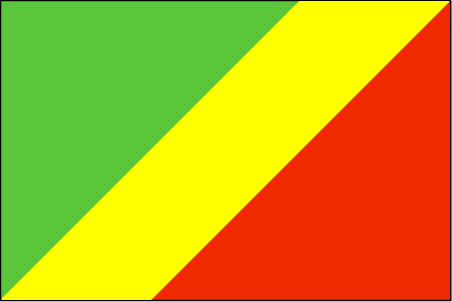
Pays
Pays en Anglais
Congo
Pays
Congo
countryucasefr
CONGO
Pays en Chinois
Pays en Espagnol
Congo
Pays en Italien
Il Congo
Pays en Portugais
Congo
Pays en Allemand
Der Kongo
countrypy
gang1 guo3 gong4 he2 guo2
countrylocal
République du Congo
countryfull
Congo, Republic of the
countrynm
Congo, Republic of the
ISO2
CG
ISO3
COG
countrycodeisono
178
countrycodevehicle
RCB
countrycodeolympic
CGO
countrycodeirs
CF
countrycodeirsfr
CF
countrycodeirsmixt
CF
♂Masulin
15
57
languagesfr
Français
119
currency
franc
currencyfr
franc C.F.A.
currencyisocode
XAF
currencyisocodefull
XAF 950
currencypxcode
XAF
currencysymbol
CFAF
currencysubdivision
100 centimes [*]
currencyregime
Euro (655.957)
currencyvalue
0.00186
nationalityfr
Congolaise
Capitale
Brazzaville
capitalfr
Brazzaville
Préfixe Tél.
242
Superficie km2
342 000
arealand
341 500
areawater
500
landarablerate
0.005
coastline
169
summit
Monts de la Lékéti 1 040 m.
boundarycountries
Gabon, Cameroun, Centrafrique, Congo démocratique, Angola.
timezonedeltabegin
1
flaglink
maplink
cgcolor.gif
outlinemaplink
cgout.gif
visapassenger
-1
maincities
Pointe Noire, N'Kayi, Loubomo, Ngamaba-Mfilou, Loandjili, Massendjo.
largestcity
Brazzaville
rankpopulation
126
Population
3 757 000
rankgdp
130
gdp
3564000000
rankgdpppp
148
gdpppp
3625000000
rankgni
147
gni
2443000000
rankincomeorigin
153
rankincome
167
income
650
rankincomeppp
200
incomeppp
730
lifeexpectation
50.02
alphabetizationrate
0.566
natalityrate
0.02946
mortalityrate
0.0142
mortalityrateinfantile
0.09534
nationalevent
Independence Day
nationaleventfr
Jour de l'Indépendance
nationalholiday
15 August (1960)
Date de naissance aaaa-mm-jj
1960-08-15 00:00:00
7
1
location
Western Africa, bordering the South Atlantic Ocean, between Angola and Gabon
terrain
coastal plain, southern basin, central plateau, northern basin
naturalresources
petroleum, timber, potash, lead, zinc, uranium, co
9
Web
rgbback
16777215
todate
1
40
id
Pays
Pays en Anglais
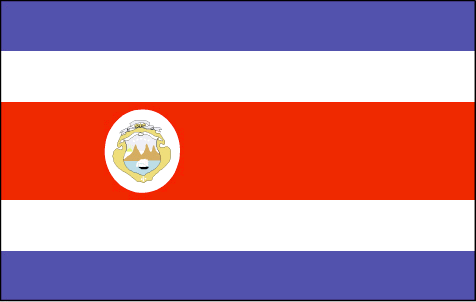
Costa Rica
Pays
Costa Rica
countryucasefr
COSTA RICA
Pays en Chinois
Pays en Espagnol
Costa Rica
Pays en Italien
Costa Rica
Pays en Portugais
Costa Rica
Pays en Allemand
Costa Rica
countrypy
ge1 si1 da4 li2 jia1
countrylocal
Costa Rica
countryfull
Costa Rica
countrynm
Costa Rica
ISO2
CR
ISO3
CRI
countrycodeisono
188
countrycodevehicle
CR
countrycodeolympic
CRC
countrycodeirs
CS
countrycodeirsfr
CS
countrycodeirsmixt
CS
countrycode
506
♀Féminin
15
6
131
languagesfr
Espagnol
29
currency
colon
currencyfr
Colon
currencyisocode
CRC
currencyisocodefull
CRC 188
currencypxcode
CRC
currencysymbol
slashed C
currencysubdivision
100 centimos
currencyregime
float
currencyvalue
0.00211
nationalityfr
Costa Ricaine
Capitale
San Jose
capitalfr
San Jose
Préfixe Tél.
506
Superficie km2
51 100
arealand
50 660
areawater
440
landarablerate
0.0441
landforestrate
0.385
coastline
1290
summit
Cerro Chirripó 3 819 m.
boundarycountries
Nicaragua, Panama.
timezonedeltabegin
-6
flaglink
maplink
crcolor.gif
outlinemaplink
croutl.gif
visapassenger
-1
maincities
Alajuela, Cartago, Limón, Puntarenas, Herdia, Liberia.
largestcity
San Jose
largestcitypopulation
920 000
rankpopulation
122
Population
4 005 000
rankgdp
79
gdp
17427000000
rankgdpppp
74
gdpppp
38469000000
rankgni
75
gni
17203000000
rankincomeorigin
77
rankincome
84
income
4300
rankincomeppp
79
incomeppp
9140
lifeexpectation
77.7
alphabetizationrate
0.928
natalityrate
0.0194
mortalityrate
0.00431
mortalityrateinfantile
0.01082
nationalevent
Independence Day
nationaleventfr
Jour de l'Indépendance
nationalholiday
15 September (1821)
Date de naissance aaaa-mm-jj
1821-09-15 00:00:00
8
6
location
Middle America, bordering both the Caribbean Sea and the North Pacific Ocean, between Nicaragua and Panama
terrain
coastal plains separated by rugged mountains including over 100 volcanic cones, of which several are major volcanoes
naturalresources
hydropower
cooking
Fruits de Mer
9
Web
rgbback
16777215
todate
1
Notes
Fruits de Mer
| Pays/Territoires | Régions en Chine | Provinces de Chine | Régions en France | Départements de France | Provinces du Monde | Villes/Villages | Localités | Continents du Monde | Vins AOP
