Countries/Territories

Updated 2021-01-12 18:58:07

The names of countries/territories of the world are taught in English and Chinese. This collection of precious dry lands that shares the whole mankind includes not only the world's independent countries, but also specific areas that are not a UNUnited Nations: We the peoples...A stronger UN for a better world. member. Please visit the table of male and female genders of country names in French.

In French, country names have their male and female gender. The majority of young countries have their name in male form just as Ouganda, Congo. But historical countries have their gender according to the termination of the word. La Chine is female as the majority of European Coutries except for Andorre, Chypre, Malte, Monaco, Saint-Marin, le Danemark, le Luxembourg, le Liechtenstein, le Monténégro. les Pays-Bas, le Portugal et le Vatican (cf. Noms Pays masculins féminins).

So the gender column will be presented as follows: ♂Male, ♀Female, Neutral.

Countries/locations    Close
World | Countries/Territories | Regions of China | Provinces of China | Regions in France | French Departments | States/Provinces | Cities/Towns | Locations | World Continents | French AOP Wines

31

id
Country
Country
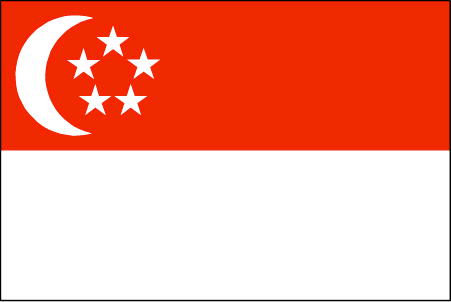
Singapore
Country in French
Singapour
countryucasefr
SINGAPOUR
Country in Chinese
Country in Spanish
Singapur
Country in Italian
Singapore
Country in Portuguese
Singapore
Country in Germain
Singapur
countrypy
xin1 jia1 po1
countrylocal
Singapore
countryfull
Singapore
countrynm
Singapore
ISO2
SG
ISO3
SGP
countrycodeisono
702
countrycodevehicle
SGP
countrycodeolympic
SIN
countrycodeirs
SN
countrycodeirsfr
SP
countrycodeirsmixt
SP
countrycode
65
16
4
126
languagesfr
Chinois, Malais, Anglais, Tamoul
93
currency
dollar
currencyfr
dollar de Singapour
currencyisocode
SGD
currencyisocodefull
SGD 702
currencypxcode
SGD
currencysymbol
S$
currencysubdivision
100 cents
currencyregime
m.float
currencyvalue
0.5968
nationalityfr
Singaporienne
Capital
Singapore
capitalfr
Singapour
Phone Prefix
65
Area km2
632.60
arealand
682.70
areawater
10
landarablerate
0.0164
landforestrate
0.033
coastline
193
summit
Bukit Timah 177 m.
timezonedeltabegin
8
zipcodelength
4
flaglink
maplink
sg.jpg
outlinemaplink
sgout.gif
maincities
Serangoon, Jurong, Nee Soon.
largestcity
Singapore
largestcitypopulation
3 327 000
rankpopulation
117
Population
4 250 000
rankgdp
38
gdp
91342000000
rankgdpppp
54
gdpppp
104046000000
rankgni
39
gni
90228000000
rankincomeorigin
29
rankincome
25
income
21230
rankincomeppp
30
incomeppp
24180
lifeexpectation
78.7
alphabetizationrate
0.937
natalityrate
0.0114
mortalityrate
0.0044
mortalityrateinfantile
0.0025
hdi
0.9
urbanization
1
precipitation
2150
nationalevent
Independence Day
nationaleventfr
Jour de l'Indépendance
nationalholiday
9 August (1965)
Birthday yyyy-mm-dd
1965-08-09 00:00:00
2
6
location
Southeastern Asia, islands between Malaysia and Indonesia
terrain
lowland; gently undulating central plateau contains water catchment area and nature preserve
naturalresources
fish, deepwater ports
cooking
Nouilles de Riz.
8
Web
rgbback
16777215
todate
1
Notes
Nouilles de Riz.

32

id
Country
Country
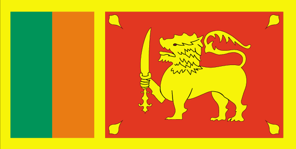
Sri Lanka
Country in French
Sri Lanka
countryucasefr
SRI LANKA
Country in Chinese
Country in Spanish
Sri Lanka
Country in Italian
Sri Lanka
Country in Portuguese
Sri Lanka
Country in Germain
Sri Lanka
countrypy
si1 li3 lan2 ka3
countrylocal
Sri Lanka
countryfull
Sri Lanka
countrynm
Sri Lanka
ISO2
LK
ISO3
LKA
countrycodeisono
144
countrycodevehicle
CL
countrycodeolympic
SRI
countrycodeirs
CE
countrycodeirsfr
CE
countrycodeirsmixt
CE
♂Male
15
6
188
languagesfr
Cinghalais
97
currency
rupee
currencyfr
roupie de Sri Lanka
currencyisocode
LKR
currencyisocodefull
LKR 144
currencypxcode
LKR
currencysymbol
SLRs
currencysubdivision
100 cents
currencyregime
m.float
currencyvalue
0.01001
nationalityfr
Sri Lankaise
Capital
Colombo
capitalfr
Colombo
Phone Prefix
94
Area km2
65 610
arealand
64 740
areawater
870
landarablerate
0.1343
landforestrate
0.3
coastline
1340
summit
Pidurutalagala 2 524 m.
timezonedeltabegin
5.5
flaglink
maplink
lkcolor.gif
outlinemaplink
lkout.gif
visapassenger
-1
maincities
Dehiwala, Jaffna, Moratuwa, Kandym Galle, Negombo, Trincomalee, Kotte.
largestcity
Colombo
largestcitypopulation
645 000
rankpopulation
50
Population
19 232 000
rankgdp
73
gdp
18237000000
rankgdpppp
59
gdpppp
72654000000
rankgni
74
gni
17825000000
rankincomeorigin
140
rankincome
152
income
930
rankincomeppp
136
incomeppp
3740
lifeexpectation
72.62
alphabetizationrate
0.884
natalityrate
0.01612
mortalityrate
0.00646
mortalityrateinfantile
0.01522
hdi
0.733
nationalevent
Independence Day
nationaleventfr
Jour de l'Indépendance
nationalholiday
4 February (1948)
Birthday yyyy-mm-dd
1948-02-04 00:00:00
4
12
location
Southern Asia, island in the Indian Ocean, south of India
terrain
mostly low, flat to rolling plain; mountains in south-central interior
naturalresources
limestone, graphite, mineral sands, gems, phosphat
cooking
Fruits de Mer
9
Web
rgbback
16777215
todate
1
Notes
Fruits de Mer

33

id
Country
Country
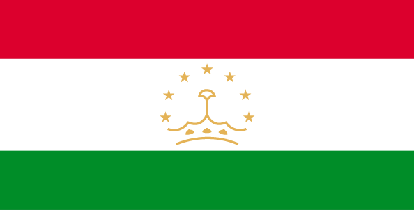
Tajikistan
Country in French
Tadjikistan
countryucasefr
TADJIKISTAN
Country in Chinese
Country in Spanish
Tajikistan
Country in Italian
Tajikistan
Country in Portuguese
Tajikistan
Country in Germain
Tajikistan
countrypy
ta3 ji2 ke4 si1 tan3
countrylocal
Jumhurii Tojikiston
countryfull
Tajikistan
countrynm
Tajikistan
ISO2
TJ
ISO3
TJK
countrycodeisono
762
countrycodevehicle
TJ
countrycodeolympic
TJK
countrycodeirs
TI
countrycodeirsfr
TI
countrycodeirsmixt
TI
♂Male
15
4
199
languagesfr
Tadjik
158
currency
somoni
currencyfr
rouble
currencyisocode
TJS
currencyisocodefull
TJS 762
currencypxcode
TJS
currencysymbol
100 dirams
nationalityfr
Tajik
Capital
Dushanbe
capitalfr
Douchanbe
Phone Prefix
992
Area km2
143 100
arealand
142 700
areawater
400
landarablerate
0.0541
landforestrate
0.028
summit
Qullai Kommunizm 7 495 m.
boundarycountries
Ouzbekistan, Kirghizstan, Chine, Afghanistan.
timezonedeltabegin
5
flaglink
maplink
tjcolor.gif
outlinemaplink
tjout.gif
visapassenger
-1
maincities
Khodzent, Kulyab, Kurgan-Tyube, Kanibadam, Tursunzade, Khorogl.
largestcity
Dushanbe
largestcitypopulation
664 000
rankpopulation
98
Population
6 305 000
rankgdp
149
gdp
1553000000
rankgdpppp
135
gdpppp
6976000000
rankgni
162
gni
1343000000
rankincomeorigin
195
rankincome
209
income
210
rankincomeppp
188
incomeppp
1040
lifeexpectation
64.47
alphabetizationrate
0.994
natalityrate
0.03263
mortalityrate
0.00842
mortalityrateinfantile
0.1121
hdi
0.677
urbanization
0.277
precipitation
569
nationalevent
Independence Day (or National Day)
nationaleventfr
Jour de l'Indépendance (ou Jour National)
nationalholiday
9 September (1991)
Birthday yyyy-mm-dd
1991-09-09 00:00:00
8
8
location
Central Asia, west of China
terrain
Pamir and Alay Mountains dominate landscape; western Fergana Valley in north, Kofarnihon and Vakhsh Valleys in southwest
naturalresources
hydropower, some petroleum, uranium, mercury, brow
9
Web
rgbback
16777215
todate
1

34

id
Country
Country
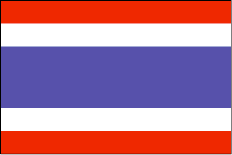
Thailand
Country in French
Thaïlande
countryucasefr
THAILANDE
Country in Chinese
Country in Spanish
Tailandia
Country in Italian
La Tailandia
Country in Portuguese
Tailândia
Country in Germain
Thailand
countrypy
tai4 guo2
countrylocal
Prathet Thai
countryfull
Thailand
countrynm
Thailand
ISO2
TH
ISO3
THA
countrycodeisono
764
countrycodevehicle
T
countrycodeolympic
THA
countrycodeirs
TH
countrycodeirsfr
TH
countrycodeirsmixt
TH
countrycode
66
♀Female
12
6
161
languagesfr
Thaï
103
currency
baht
currencyfr
baht
currencyisocode
THB
currencyisocodefull
THB 764
currencypxcode
THB
currencysymbol
Bht or Bt
currencysubdivision
100 stang
currencyregime
float
currencyvalue
0.02457
nationalityfr
Taïlandaise
Capital
Bangkok
capitalfr
Bankok
Phone Prefix
66
Area km2
514 820
arealand
511 770
areawater
2 230
landarablerate
0.3288
landforestrate
0.289
coastline
3219
summit
Doi Inthanon 2 595 m.
boundarycountries
Birmanie, Laos, Cambodge, Malaisie.
timezonedeltabegin
7
flaglink
maplink
thcolor.gif
outlinemaplink
thout.gif
visapassenger
-1
maincities
Nakhon Ratchasima, Phuket, Chiang Mai, Songkhla, Khon Kaen, Chon Buri, Nakhon Si Thammarat, Ban Hat Yai, Phitsanulok.
largestcity
Bangkok
largestcitypopulation
6 547 000
rankpopulation
19
Population
62 014 000
rankgdp
33
gdp
142953000000
rankgdpppp
20
gdpppp
470992000000
rankgni
31
gni
135877000000
rankincomeorigin
105
rankincome
115
income
2190
rankincomeppp
87
incomeppp
7450
lifeexpectation
71.24
alphabetizationrate
0.93
natalityrate
0.01637
mortalityrate
0.00686
mortalityrateinfantile
0.02183
precipitation
1498
nationalevent
Birthday of King PHUMIPHON
nationaleventfr
Anniversaire du Roi PHUMIPHON
nationalholiday
5 December (1927)
Birthday yyyy-mm-dd
1927-12-05 00:00:00
4
4
location
Southeastern Asia, bordering the Andaman Sea and the Gulf of Thailand, southeast of Burma
terrain
central plain; Khorat Plateau in the east; mountains elsewhere
naturalresources
tin, rubber, natural gas, tungsten, tantalum, timb
cooking
Meilleurs Riz Parfumés du Monde.
8
Web
rgbback
16777215
todate
1
Notes
Meilleurs Riz Parfumés du Monde. Grâce à son intelligence suprême, Ce Lapin de Feu gère bien la cohabitation de la modernité et le boudhisme traditionnel. Avec un tempérament chaud, il est aimé de tous.

35

id
Country
Country
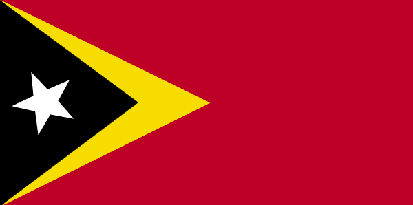
East Timor
Country in French
Timor Oriental
countryucasefr
TIMOR ORIENTAL
Country in Chinese
Country in Spanish
Timor (Del este)
Country in Italian
Timor (Orientale)
Country in Portuguese
Timor (Oriental)
Country in Germain
Timor (Östlich)
countrypy
dong1 di4 wen4
countrylocal
Timor
countryfull
East Timor
countrynm
East Timor
ISO2
TL
ISO3
TLS
countrycodeisono
626
countrycodeolympic
TLS
countrycodeirs
TL
countrycodeirsfr
TL
countrycodeirsmixt
TOL
♂Male
15
6
114
languagesfr
Portugais
51
currency
rupiah
currencyfr
Escudo de Timor
currencyisocode
IDR
currencyisocodefull
IDR 360
currencypxcode
IDR
currencysymbol
Rp
currencysubdivision
100 sen (no longer used)
currencyregime
m.float
currencyvalue
0.0001
Capital
Dili
capitalfr
Dili
Phone Prefix
670
Area km2
18 997
coastline
706
summit
Tata Mailau 2 960 m.
boundarycountries
Indonésie.
timezonedeltabegin
7
timezonedeltaend
9
flaglink
maplink
etimorcl.gif
visapassenger
-1
maincities
Ocussi, Manatuto, Ermera, Viqueque, Same, Ainaro, Maliana, Suai, Baucau.
largestcity
Dili
rankpopulation
152
Population
877 000
rankgdp
173
gdp
341000000
rankgni
194
gni
372000000
rankincomeorigin
167
rankincome
181
income
460
lifeexpectation
65.2
alphabetizationrate
0.48
natalityrate
0.02775
mortalityrate
0.00641
mortalityrateinfantile
0.05047
nationalevent
Independence Day
nationaleventfr
Jour de l'Indépendance
nationalholiday
28 November (1975)
Birthday yyyy-mm-dd
1975-11-28 00:00:00
2
4
location
Southeastern Asia, northwest of Australia in the Lesser Sunda Islands at the eastern end of the Indonesian archipelago; note - East Timor includes the eastern half of the island of Timor, the Oecussi (Ambeno) region on the northwest portion of the island
terrain
mountainous
naturalresources
gold, petroleum, natural gas, manganese, marble
9
rgbback
16777215
todate
1

36

id
Country
Country
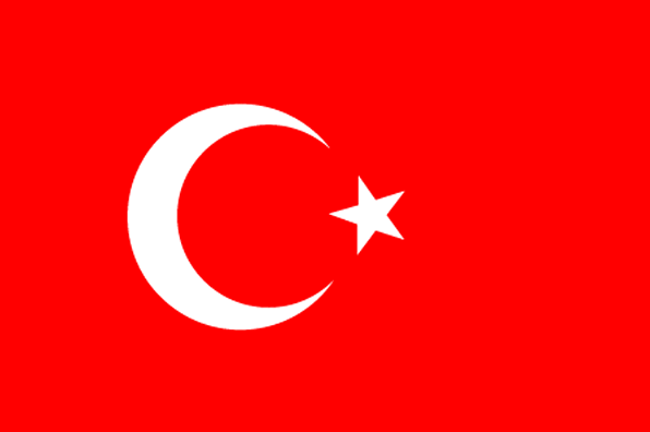
Turkey
Country in French
Turquie
countryucasefr
TURQUIE
Country in Chinese
Country in Spanish
Turquía
Country in Italian
La Turchia
Country in Portuguese
Turquia
Country in Germain
Die Türkei
countrypy
tu3 er3 qi2
countrylocal
Turkiye
countryfull
Turkey
countrynm
Turkey
ISO2
TR
ISO3
TUR
countrycodeisono
792
countrycodevehicle
TR
countrycodeolympic
TUR
countrycodeirs
TU
countrycodeirsfr
TU
countrycodeirsmixt
TU
countrycode
90
♀Female
18
6
166
languagesfr
Turc
105
currency
new lira
currencyfr
livre turque
currencyisocode
TRY
currencyisocodefull
TRY 949
currencypxcode
TRY
currencysymbol
YTL
currencysubdivision
100 new kurus
currencyregime
float
currencyvalue
0.74129
nationalityfr
Turque
Capital
Ankara
capitalfr
Ankara
Phone Prefix
90
Area km2
780 576
arealand
770 760
areawater
9 820
landarablerate
0.3453
landforestrate
0.133
coastline
7200
summit
Büyük Agri Dagi 5 185 m.
boundarycountries
Grèce, Bulgarie, Géorgie, Arménie, Azerbaïdjan, Iran, Irak, Syrie.
timezonedeltabegin
2
flaglink
maplink
treunewl.gif
outlinemaplink
tr.gif
visapassenger
-1
maincities
Istanbul, Izmir, Adana, Bursa, Gaziantep, Konya, Kayseri, Eskisehir, Mersin, Diyarbakir.
largestcity
Istanbul
largestcitypopulation
7 911 000
rankpopulation
15
Population
70 712 000
rankgdp
21
gdp
240376000000
rankgdpppp
17
gdpppp
478891000000
rankgni
24
gni
197788000000
rankincomeorigin
93
rankincome
103
income
2800
rankincomeppp
94
incomeppp
6710
lifeexpectation
71.8
alphabetizationrate
0.8144
natalityrate
0.01759
mortalityrate
0.00595
mortalityrateinfantile
0.0442
precipitation
697
nationalevent
Independence Day
nationaleventfr
Jour de l'Indépendance
nationalholiday
29 October (1923)
Birthday yyyy-mm-dd
1923-10-29 00:00:00
10
12
location
southeastern Europe and southwestern Asia (that portion of Turkey west of the Bosporus is geographically part of Europe), bordering the Black Sea, between Bulgaria and Georgia, and bordering the Aegean Sea and the Mediterranean Sea, between Greece and Syr
terrain
high central plateau (Anatolia); narrow coastal plain; several mountain ranges
naturalresources
antimony, coal, chromium, mercury, copper, borate,
7
Web
rgbback
16777215
todate
1

37

id
Country
Country
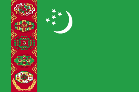
Turkmenistan
Country in French
Turkménistan
countryucasefr
TURKMENISTAN
Country in Chinese
Country in Spanish
Turkmenistan
Country in Italian
Turkmenistan
Country in Portuguese
Turkmenistan
Country in Germain
Turkmenistan
countrypy
tu3 ku4 man4
countrylocal
Turkmenistan
countryfull
Turkmenistan
countrynm
Turkmenistan
ISO2
TM
ISO3
TKM
countrycodeisono
795
countrycodevehicle
TM
countrycodeolympic
TKM
countrycodeirs
TX
countrycodeirsfr
TX
countrycodeirsmixt
TX
♂Male
15
1
201
languagesfr
Turkmen
162
currency
manat
currencyfr
rouble
currencyisocode
TMM
currencyisocodefull
TMM 795
currencypxcode
TMM
currencysubdivision
100 tenga
currencyregime
US-$ (10.0;230.0)
nationalityfr
Turkmen
Capital
Ashgabat
capitalfr
Achkhabad
Phone Prefix
993
Area km2
488 100
arealand
488 100
landarablerate
0.0347
landforestrate
0.08
summit
Ayrybaba 3 189 m.
boundarycountries
Iran, Kazakhstan, Ouzbekistan, Afghanistan.
timezonedeltabegin
5
flaglink
maplink
tmcolor.gif
outlinemaplink
tmout.gif
visapassenger
-1
maincities
Chardzhou, Tashauz, Krasnovodsk
largestcity
Ashkhabad
largestcitypopulation
462 000
rankpopulation
111
Population
4 864 000
rankgdp
109
gdp
6201000000
rankgdpppp
86
gdpppp
28881000000
rankgni
116
gni
5442000000
rankincomeorigin
131
rankincome
143
income
1120
rankincomeppp
106
incomeppp
5860
lifeexpectation
61.29
alphabetizationrate
0.98
natalityrate
0.02782
mortalityrate
0.00882
mortalityrateinfantile
0.07313
hdi
0.748
urbanization
0.449
precipitation
227
nationalevent
Independence Day
nationaleventfr
Jour de l'Indépendance
nationalholiday
27 October (1991)
Birthday yyyy-mm-dd
1991-10-27 00:00:00
8
8
location
Central Asia, bordering the Caspian Sea, between Iran and Kazakhstan
terrain
flat-to-rolling sandy desert with dunes rising to mountains in the south; low mountains along border with Iran; borders Caspian Sea in west
naturalresources
petroleum, natural gas, coal, sulfur, salt
9
Web
rgbback
16777215
todate
1

38

id
Country
Country
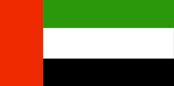
United Arab Emirates
Country in French
Emirats Arabes Unis
countryucasefr
EMIRATS ARABES UNIS
Country in Chinese
Country in Spanish
Emiratos Árabes Unidos
Country in Italian
Gli Emirati Arabi Uniti
Country in Portuguese
Emirates Árabes Unidos
Country in Germain
Vereinigte Arabische Emirates
countrypy
a1 la1 bo2 lian2 he2 qiu2 chang2 guo2
countrylocal
Al Imarat al Arabiyah al Muttahidah
countryfull
United Arab Emirates
countrynm
United Arab Emirates
ISO2
AE
ISO3
ARE
countrycodeisono
784
countrycodeolympic
UAE
countrycodeirs
TC
countrycodeirsfr
TC
countrycodeirsmixt
TC
countrycode
971
♂Male
12
3
3
languagesfr
Arabe
164
currency
dirham
currencyfr
dirham
currencyisocode
AED
currencyisocodefull
AED 784
currencypxcode
AED
currencysymbol
Dh
currencysubdivision
100 fils
currencyregime
US-$ (lim.flex.)
currencyvalue
0.2723
Capital
Abu Dhabi
capitalfr
Abu Zabi
Phone Prefix
971
Area km2
75 581
arealand
82 880
landarablerate
0.0048
landforestrate
0.038
coastline
1318
summit
Jabal Yibir 1 527 m.
boundarycountries
Arabie Saoudite, Qatar, Oman.
timezonedeltabegin
4
flaglink
maplink
aecolor.gif
outlinemaplink
aeout.gif
visapassenger
-1
maincities
Dubai, Sharjah, Ras al Khaimah, Fujairah.Dubai, Sharjah, Ras al Khaimah, Fujairah.
largestcity
Abu Dhabi
largestcitypopulation
799 000
rankpopulation
120
Population
4 041 000
rankgdp
48
gdp
70960000000
rankgni
44
gni
66300000000
rankincomeorigin
24
rankincome
26
income
20097
rankincomeppp
38
incomeppp
20920
lifeexpectation
74.99
alphabetizationrate
0.7825
natalityrate
0.01865
mortalityrate
0.00414
mortalityrateinfantile
0.01506
hdi
0.816
urbanization
0.872
precipitation
89
nationalevent
Independence Day
nationaleventfr
Jour de l'Indépendance
nationalholiday
2 December (1971)
Birthday yyyy-mm-dd
1971-12-02 00:00:00
8
12
location
Middle East, bordering the Gulf of Oman and the Persian Gulf, between Oman and Saudi Arabia
terrain
flat, barren coastal plain merging into rolling sand dunes of vast desert wasteland; mountains in east
naturalresources
petroleum, natural gas
9
Web
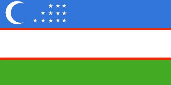
rgbback
16777215
todate
1

39

id
Country
Country
Uzbekistan
Country in French
Ouzbékistan
countryucasefr
OUZBEKISTAN
Country in Chinese
Country in Spanish
Uzbekistan
Country in Italian
Uzbekistan
Country in Portuguese
Uzbekistan
Country in Germain
Uzbekistan
countrypy
wu1 zi1 bie2 ke4 si1 tan3
countrylocal
Uzbekiston Respublikasi
countryfull
Uzbekistan
countrynm
Uzbekistan
ISO2
UZ
ISO3
UZB
countrycodeisono
860
countrycodevehicle
UZ
countrycodeolympic
UZB
countrycodeirs
UZ
countrycodeirsfr
UZ
countrycodeirsmixt
UZ
♂Male
15
4
203
languagesfr
Ouzbek
110
currency
som
currencyfr
rouble
currencyisocode
UZS
currencyisocodefull
UZS 860
currencypxcode
UZS
currencysubdivision
100 tiyin
nationalityfr
Uzbek
Capital
Tashkent
capitalfr
Tachkent
Phone Prefix
998
Area km2
447 400
arealand
425 400
areawater
22 000
landarablerate
0.108
landforestrate
0.048
summit
Gora Manas 4 488 m.
boundarycountries
Kazakhstan, Kirghizstan, Tadjikistan, Turkmenistan, Afghanistan.
timezonedeltabegin
5
flaglink
maplink
uzcolor.gif
outlinemaplink
uzout.gif
visapassenger
-1
maincities
Samarkand, Namangan, Andizhan, Boukhara, Fergana, Kokand, Nukus, Chirchik, Karshi, Angren, Ourgentch, Margilan, Almalyk.
largestcity
Tashkent
largestcitypopulation
2 282 000
rankpopulation
40
Population
25 590 000
rankgdp
94
gdp
9949000000
rankgdpppp
71
gdpppp
44638000000
rankgni
88
gni
10778000000
rankincomeorigin
172
rankincome
186
income
420
rankincomeppp
172
incomeppp
1720
lifeexpectation
64.19
natalityrate
0.02622
mortalityrate
0.00795
mortalityrateinfantile
0.0711
hdi
0.709
precipitation
420
nationalevent
Independence Day
nationaleventfr
Jour de l'Indépendance
nationalholiday
1 September (1991)
Birthday yyyy-mm-dd
1991-09-01 00:00:00
8
8
location
Central Asia, north of Afghanistan
terrain
mostly flat-to-rolling sandy desert with dunes; broad, flat intensely irrigated river valleys along course of Amu Darya, Syr Darya (Sirdaryo), and Zarafshon; Fergana Valley in east surrounded by mountainous Tajikistan and Kyrgyzstan; shrinking Aral Sea in west
naturalresources
natural gas, petroleum, coal, gold, uranium, silve
9
Web
rgbback
16777215
todate
1

40

id
Country
Country
Vietnam
Country in French
Vietnam
countryucasefr
VIETNAM
Country in Chinese
Country in Spanish
Vietnam
Country in Italian
Il Vietnam
Country in Portuguese
Vietnam
Country in Germain
Vietnam
countrypy
yue4 nan2
countrylocal
Viet Nam
countryfull
Vietnam
countrynm
Vietnam
ISO2
VN
ISO3
VNM
countrycodeisono
704
countrycodevehicle
VN
countrycodeolympic
VIE
countrycodeirs
VM
countrycodeirsfr
VN
countrycodeirsmixt
VN
♂Male
5
1
173
languagesfr
Vietnamien
112
currency
dong
currencyfr
dong
currencyisocode
VND
currencyisocodefull
VND 704
currencypxcode
VND
currencysymbol
dashed d,
currencysubdivision
(not used)
currencyregime
m.float
currencyvalue
0.00006
nationalityfr
Vietnamienne
Capital
Hanoi
capitalfr
Hanoï
Phone Prefix
84
Area km2
329 560
arealand
325 360
areawater
4 200
landarablerate
0.1741
landforestrate
0.302
coastline
3444
summit
Ngoc Linh 3 143 m.
boundarycountries
Cambodge, Laos, Chine.
timezonedeltabegin
7
flaglink
maplink
vncolor.gif
outlinemaplink
vnout.gif
visapassenger
-1
maincities
Saïgon, Haiphong, Da Nang, Nha Trang, Qui Nhon, Hué, Can Tho, Nam Dinh, Vinh, My Tho, Cam Ranhr.
largestcity
Hanoi
rankpopulation
14
Population
81 314 000
rankgdp
58
gdp
39164000000
rankgdpppp
37
gdpppp
202502000000
rankgni
58
gni
38772000000
rankincomeorigin
165
rankincome
178
income
480
rankincomeppp
151
incomeppp
2490
lifeexpectation
77.06
alphabetizationrate
0.9385
natalityrate
0.01508
mortalityrate
0.00502
mortalityrateinfantile
0.02231
hdi
0.688
nationalevent
Independence Day
nationaleventfr
Jour de l'Indépendance
nationalholiday
2 September (1945)
Birthday yyyy-mm-dd
1945-09-02 00:00:00
2
10
location
Southeastern Asia, bordering the Gulf of Thailand, Gulf of Tonkin, and South China Sea, alongside China, Laos, and Cambodia
terrain
low, flat delta in south and north; central highlands; hilly, mountainous in far north and northwest
naturalresources
phosphates, coal, manganese, bauxite, chromate, of
cooking
Nems.
8
Web
rgbback
16777215
todate
1
Notes
Nems.

More+
A | B | C | D | E | F | G | H | I | J | K | L | M | N | O | P | Q | R | S | T | U | V | W | X | Y | Z
 

Vietnam | Countries/Territories | Regions of China | Provinces of China | Regions in France | French Departments | States/Provinces | Cities/Towns | Locations | World Continents | French AOP Wines

Give us feedback (0)

No any user feedback.
Email Web

Please copy the string:
String to copy.

Chinese Shoes > Singapore 新加坡 => Countries/Territories
  
Popup Window    Close
Patience please...