Countries/Territories
Updated 2021-01-12 18:58:56
The names of countries/territories of the world are taught in English and Chinese. This collection of precious dry lands that shares the whole mankind includes not only the world's independent countries, but also specific areas that are not a UNUnited Nations: We the peoples...A stronger UN for a better world. member. Please visit the table of male and female genders of country names in French.
Countries/locations Close
11
id
Country
Country
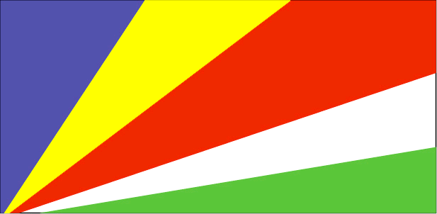
Seychelles
Country in French
Seychelles
countryucasefr
SEYCHELLES
Country in Chinese
Country in Spanish
Seychelles
Country in Italian
Le Seychelles
Country in Portuguese
Seychelles
Country in Germain
Seychellen
countrypy
sai1 she2 er3
countrylocal
Seychelles
countryfull
Seychelles
countrynm
Seychelles
ISO2
SC
ISO3
SYC
countrycodeisono
690
countrycodevehicle
SY
countrycodeolympic
SEY
countrycodeirs
SE
countrycodeirsfr
SE
countrycodeirsmixt
SEY
♀Female
15
6
57
languagesfr
Français, Anglais
92
currency
rupee
currencyfr
roupie des Seychelles
currencyisocode
SCR
currencyisocodefull
SCR 690
currencypxcode
SCR
currencysymbol
SR
currencysubdivision
100 cents
currencyregime
SDR (7.2345)
currencyvalue
0.1924
nationalityfr
Seychelloises
Capital
Victoria
capitalfr
Victoria
Phone Prefix
248
Area km2
455
arealand
455
landarablerate
0.0222
landforestrate
0.667
coastline
491
summit
Morne Seychellois 905 m.
timezonedeltabegin
4
flaglink
maplink
sccolor.gif
outlinemaplink
scout.gif
visapassenger
-1
maincities
Anse Boileau, Cascade, Anse Royal.
largestcity
Victoria
largestcitypopulation
40 000
rankpopulation
191
Population
84 000
rankgdp
162
gdp
720000000
rankgni
187
gni
626000000
rankincomeorigin
62
rankincome
67
income
7490
lifeexpectation
72.95
alphabetizationrate
0.58
natalityrate
0.01655
fecondity
2.09
mortalityrate
0.00641
mortalityrateinfantile
0.01597
growthrate
0.01445
hdi
0.84
urbanization
0.6528
precipitation
2172
nationalevent
Constitution Day (National Day)
nationaleventfr
Jour de la Constitution (Jour National)
nationalholiday
18 June (1993)
Birthday yyyy-mm-dd
1993-06-18 00:00:00
10
10
location
Eastern Africa, group of islands in the Indian Ocean, northeast of Madagascar
terrain
Mahe Group is granitic, narrow coastal strip, rocky, hilly; others are coral, flat, elevated reefs
naturalresources
fish, copra, cinnamon trees
9
Web
rgbback
16777215
todate
1
12
id
Country
Country
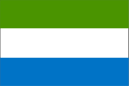
Sierra Leone
Country in French
Sierra Leone
countryucasefr
SIERRA LEONE
Country in Chinese
Country in Spanish
Sierra Leone
Country in Italian
Sierra Leone
Country in Portuguese
Sierra Leone
Country in Germain
Sierra Leone
countrypy
sai1 la1 li4 ang2
countrylocal
Sierra Leone
countryfull
Sierra Leone
countrynm
Sierra Leone
ISO2
SL
ISO3
SLE
countrycodeisono
694
countrycodevehicle
WAL
countrycodeolympic
SLE
countrycodeirs
SL
countrycodeirsfr
SL
countrycodeirsmixt
SL
♂Male
19
6
51
languagesfr
Anglais
22
currency
leone
currencyfr
leone
currencyisocode
SLL
currencyisocodefull
SLL 694
currencypxcode
SLL
currencysymbol
Le
currencysubdivision
100 cents
currencyregime
float
currencyvalue
0.00043
Capital
Freetown
capitalfr
Freetown
Phone Prefix
232
Area km2
71 740
arealand
71 620
areawater
120
landarablerate
0.0676
landforestrate
0.147
coastline
402
summit
Loma Mansa 1 948 m.
boundarycountries
Guinée, Liberia.
flaglink
maplink
slcolor.gif
outlinemaplink
slout.gif
visapassenger
-1
maincities
Bo, Kenema, Makeni, Bonthe, Port Loko.
largestcity
Freetown
largestcitypopulation
699 000
rankpopulation
106
Population
5 337 000
rankgdp
158
gdp
793000000
rankgdpppp
150
gdpppp
2927000000
rankgni
177
gni
808000000
rankincomeorigin
201
rankincome
216
income
150
rankincomeppp
208
incomeppp
530
lifeexpectation
42.69
alphabetizationrate
0.3665
natalityrate
0.04334
mortalityrate
0.02062
mortalityrateinfantile
0.14524
hdi
0.275
urbanization
0.373
precipitation
2946
nationalevent
Independence Day
nationaleventfr
Jour de l'Indépendance
nationalholiday
27 April (1961)
Birthday yyyy-mm-dd
1961-04-27 00:00:00
8
2
location
Western Africa, bordering the North Atlantic Ocean, between Guinea and Liberia
terrain
coastal belt of mangrove swamps, wooded hill country, upland plateau, mountains in east
naturalresources
diamonds, titanium ore, bauxite, iron ore, gold, c
9
Web
Guinée, Liberia.
rgbback
16777215
todate
1
13
id
Country
Country
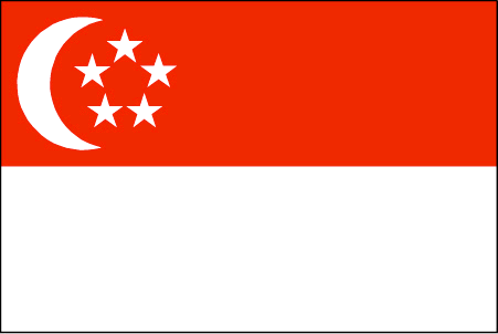
Singapore
Country in French
Singapour
countryucasefr
SINGAPOUR
Country in Chinese
Country in Spanish
Singapur
Country in Italian
Singapore
Country in Portuguese
Singapore
Country in Germain
Singapur
countrypy
xin1 jia1 po1
countrylocal
Singapore
countryfull
Singapore
countrynm
Singapore
ISO2
SG
ISO3
SGP
countrycodeisono
702
countrycodevehicle
SGP
countrycodeolympic
SIN
countrycodeirs
SN
countrycodeirsfr
SP
countrycodeirsmixt
SP
countrycode
65
16
4
126
languagesfr
Chinois, Malais, Anglais, Tamoul
93
currency
dollar
currencyfr
dollar de Singapour
currencyisocode
SGD
currencyisocodefull
SGD 702
currencypxcode
SGD
currencysymbol
S$
currencysubdivision
100 cents
currencyregime
m.float
currencyvalue
0.5968
nationalityfr
Singaporienne
Capital
Singapore
capitalfr
Singapour
Phone Prefix
65
Area km2
632.60
arealand
682.70
areawater
10
landarablerate
0.0164
landforestrate
0.033
coastline
193
summit
Bukit Timah 177 m.
timezonedeltabegin
8
zipcodelength
4
flaglink
maplink
sg.jpg
outlinemaplink
sgout.gif
maincities
Serangoon, Jurong, Nee Soon.
largestcity
Singapore
largestcitypopulation
3 327 000
rankpopulation
117
Population
4 250 000
rankgdp
38
gdp
91342000000
rankgdpppp
54
gdpppp
104046000000
rankgni
39
gni
90228000000
rankincomeorigin
29
rankincome
25
income
21230
rankincomeppp
30
incomeppp
24180
lifeexpectation
78.7
alphabetizationrate
0.937
natalityrate
0.0114
mortalityrate
0.0044
mortalityrateinfantile
0.0025
hdi
0.9
urbanization
1
precipitation
2150
nationalevent
Independence Day
nationaleventfr
Jour de l'Indépendance
nationalholiday
9 August (1965)
Birthday yyyy-mm-dd
1965-08-09 00:00:00
2
6
location
Southeastern Asia, islands between Malaysia and Indonesia
terrain
lowland; gently undulating central plateau contains water catchment area and nature preserve
naturalresources
fish, deepwater ports
cooking
Nouilles de Riz.
8
Web
rgbback
16777215
todate
1
Notes
Nouilles de Riz.
14
id
Country
Country
Sint Eustatius
Country in French
Sint Eustatius
countryucasefr
Sint Eustatius
Country in Chinese
Country in Spanish
Sint Eustatius
Country in Italian
Sint Eustatius
Country in Portuguese
Sint Eustatius
Country in Germain
Sint Eustatius
ISO2
XB
ISO3
NL-BQ2
todate
1
15
id
Country
Country
Sint Maarten (Dutch part)
Country in French
Sint Maarten (Dutch part)
countryucasefr
Sint Maarten (Dutch part)
Country in Chinese
Country in Spanish
Sint Maarten (Dutch part)
Country in Italian
Sint Maarten (Dutch part)
Country in Portuguese
Sint Maarten (Dutch part)
Country in Germain
Sint Maarten (Dutch part)
countrypy
He2 Lan2 Sheng4 Ma2 Ding1
countrylocal
Sint Maarten (Dutch part)
countryfull
Sint Maarten (Dutch part)
countrynm
Sint Maarten (Dutch part)
ISO2
SX
ISO3
SXM
rgbback
16777215
todate
1
16
id
Country
Country
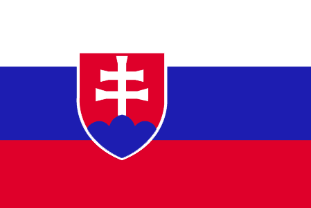
Slovakia
Country in French
Slovaquie
countryucasefr
SLOVAQUIE
Country in Chinese
Country in Spanish
Eslovaquia
Country in Italian
La Slovacchia
Country in Portuguese
Slovakia
Country in Germain
Slowakei
countrypy
si1 luo4 fa2 ke4
countrylocal
Slovensko
countryfull
Slovakia
countrynm
Slovakia
ISO2
SK
ISO3
SVK
countrycodeisono
703
countrycodevehicle
SK
countrycodeolympic
SVK
countrycodeirs
LO
countrycodeirsfr
LO
countrycodeirsmixt
LO
♀Female
18
6
128
languagesfr
Slovaque
154
currency
koruna
currencyfr
couronne tchécoslovaque
currencyisocode
SKK
currencyisocodefull
SKK 703
currencypxcode
SKK
currencysymbol
Sk
currencysubdivision
100 halierov
currencyregime
float
currencyvalue
0.03126
nationalityfr
Slovaque
Capital
Bratislava
capitalfr
Bratislava
Phone Prefix
421
Area km2
49 032
arealand
48 800
areawater
45
landarablerate
0.3074
landforestrate
0.453
summit
Gerlachovsky Stit 2 654 m.
boundarycountries
Tchéquie, Pologne, Ukraine, Hongrie, Autriche.
timezonedeltabegin
1
flaglink
maplink
lo-map.gif
outlinemaplink
sk.gif
visapassenger
-1
maincities
Kosice, Nitra, Trnava, Banska Bytrica, Presov, Zilina.
largestcity
Bratislava
largestcitypopulation
471 000
rankpopulation
104
Population
5 390 000
rankgdp
59
gdp
32519000000
rankgdpppp
58
gdpppp
72730000000
rankgni
61
gni
26631000000
rankincomeorigin
73
rankincome
80
income
4940
rankincomeppp
59
incomeppp
13440
lifeexpectation
74.19
alphabetizationrate
0.97
natalityrate
0.01057
mortalityrate
0.00948
mortalityrateinfantile
0.00762
hdi
0.836
urbanization
0.576
precipitation
523
nationalevent
Constitution Day
nationaleventfr
Jour de la Constitution
nationalholiday
1 September (1992)
Birthday yyyy-mm-dd
1992-09-01 00:00:00
9
9
location
Central Europe, south of Poland
terrain
rugged mountains in the central and northern part and lowlands in the south
naturalresources
brown coal and lignite; small amounts of iron ore,
6
Web
rgbback
16777215
todate
1
17
id
Country
Country
Slovenia
Country in French
Slovénie
countryucasefr
SLOVENIE
Country in Chinese
Country in Spanish
Eslovenia
Country in Italian
La Slovenia
Country in Portuguese
Slovenia
Country in Germain
Slowenien
countrypy
si1 luo4 wen2 ni2 ya4
countrylocal
Slovenija
countryfull
Slovenia
countrynm
Slovenia
ISO2
SI
ISO3
SVN
countrycodeisono
705
countrycodevehicle
SLO
countrycodeolympic
SLO
countrycodeirs
SI
countrycodeirsfr
SI
countrycodeirsmixt
SI
♀Female
18
6
129
languagesfr
Slovène
2
currency
tolar
currencyfr
tolar
currencyisocode
SIT
currencyisocodefull
SIT 705
currencypxcode
SIT
currencysymbol
SlT
currencysubdivision
100 stotinov (stotins)
currencyregime
m.float
currencyvalue
0.0051
nationalityfr
Slovénienne
Capital
Ljubljana
capitalfr
Ljubljana
Phone Prefix
386
Area km2
20 251
arealand
20 151
areawater
122
landarablerate
0.1148
landforestrate
0.55
coastline
46.6
summit
Triglav 2 863 m.
boundarycountries
Italie, Autriche, Hongrie, Croatie.
timezonedeltabegin
1
flaglink
maplink
si-map.gif
outlinemaplink
si.gif
visapassenger
-1
maincities
Maribor, Koper, Kranj, Celje, Trbovlje, Jesenice.
largestcity
Ljubljana
largestcitypopulation
278 000
rankpopulation
142
Population
1 995 000
rankgdp
62
gdp
27749000000
rankgdpppp
75
gdpppp
38204000000
rankgni
65
gni
23777000000
rankincomeorigin
50
rankincome
50
income
11920
rankincomeppp
45
incomeppp
19100
lifeexpectation
75.73
alphabetizationrate
1
natalityrate
0.00919
mortalityrate
0.01024
mortalityrateinfantile
0.00438
hdi
0.881
urbanization
0.491
precipitation
1393
nationalevent
Independence Day/Statehood Day
nationaleventfr
Jour de l'Indépendance
nationalholiday
25 June (1991)
Birthday yyyy-mm-dd
1991-06-25 00:00:00
8
8
location
Central Europe, eastern Alps bordering the Adriatic Sea, between Austria and Croatia
terrain
a short coastal strip on the Adriatic, an alpine mountain region adjacent to Italy and Austria, mixed mountains and valleys with numerous rivers to the east
naturalresources
lignite coal, lead, zinc, mercury, uranium, silver
5
Web
rgbback
16777215
todate
1
18
id
Country
Country
Small states
Country in French
Small states
countryucasefr
Small states
Country in Chinese
Country in Spanish
Small states
Country in Italian
Small states
Country in Portuguese
Small states
Country in Germain
Small states
ISO2
SST
ISO3
SST
todate
1
19
id
Country
Country
Solomon Islands
Country in French
Salomon
countryucasefr
SALOMON
Country in Chinese
Country in Spanish
Islas De Solomon
Country in Italian
Isole Di Solomon
Country in Portuguese
Consoles De Solomon
Country in Germain
Inseln Solomon
countryfull
Solomon Islands
countrynm
Solomon Islands
ISO2
SB
ISO3
SLB
countrycodeisono
090
countrycodeolympic
SOL
countrycodeirs
BP
countrycodeirsfr
BP
countrycodeirsmixt
BP
18
6
51
languagesfr
Anglais
94
currency
dollar
currencyfr
dollar des Salomon
currencyisocode
SBD
currencyisocodefull
SBD 090
currencypxcode
SBD
currencysymbol
SI$
currencysubdivision
100 cents
currencyregime
composite
currencyvalue
0.1358
Capital
Honiara
capitalfr
Honiara
Phone Prefix
677
Area km2
28 450
arealand
27 540
areawater
910
landarablerate
0.015
landforestrate
0.888
coastline
5313
summit
Mount Makarakomburu 2 447 m.
timezonedeltabegin
11
flaglink
maplink
sbcolor.gif
outlinemaplink
sb.gif
visapassenger
-1
maincities
Kirakira, Auki, Tangarare, Gizo, Gateri.
largestcity
Honiara
largestcitypopulation
53 000
rankpopulation
163
Population
457 000
rankgdp
178
gdp
253000000
rankgdpppp
161
gdpppp
800000000
rankgni
200
gni
255000000
rankincomeorigin
158
rankincome
172
income
560
rankincomeppp
174
incomeppp
1710
lifeexpectation
72.38
alphabetizationrate
0.77
natalityrate
0.0316
fecondity
4.42
mortalityrate
0.00404
mortalityrateinfantile
0.02209
growthrate
0.02756
hdi
0.632
urbanization
0.202
precipitation
3290
nationalevent
Independence Day
nationaleventfr
Jour de l'Indépendance
nationalholiday
7 July (1978)
Birthday yyyy-mm-dd
1978-07-07 00:00:00
5
7
location
Oceania, group of islands in the South Pacific Ocean, east of Papua New Guinea
terrain
mostly rugged mountains with some low coral atolls
naturalresources
fish, forests, gold, bauxite, phosphates, lead, zi
9
rgbback
16777215
todate
1
20
id
Country
Country
Somalia
Country in French
Somalie
countryucasefr
SOMALIE
Country in Chinese
Country in Spanish
Somalia
Country in Italian
La Somalia
Country in Portuguese
Somália
Country in Germain
Somalia
countrypy
suo3 ma3 li3
countrylocal
Somalia
countryfull
Somalia
countrynm
Somalia
ISO2
SO
ISO3
SOM
countrycodeisono
706
countrycodevehicle
SO
countrycodeolympic
SOM
countrycodeirs
SO
countrycodeirsfr
SO
countrycodeirsmixt
SO
♀Female
2
187
languagesfr
Somali, Arabe
95
currency
shilling
currencyfr
shilling
currencyisocode
SOS
currencyisocodefull
SOS 706
currencypxcode
SOS
currencysymbol
So. Sh.
currencysubdivision
100 centesimi
currencyregime
float
currencyvalue
0.00033
nationalityfr
Somalienne
Capital
Mogadishu
capitalfr
Mogadiscio
Phone Prefix
252
Area km2
528 657
arealand
627 337
areawater
10 320
landarablerate
0.0166
landforestrate
0.12
coastline
3025
summit
Shimbiris 2 450 m.
boundarycountries
Kenya, Ethiopie, Somaliland.
timezonedeltabegin
3
flaglink
maplink
socolor.gif
outlinemaplink
soout.gif
visapassenger
-1
maincities
Baioa, Kisimayu, Merca, Gioher, Boromo.
largestcity
Mogadishu
largestcitypopulation
997 000
rankpopulation
79
Population
9 626 000
rankgni
158
gni
1350000000
rankincomeorigin
208
rankincome
213
income
180
lifeexpectation
47.71
alphabetizationrate
0.3765
natalityrate
0.04604
mortalityrate
0.0173
mortalityrateinfantile
0.11852
urbanization
0.279
nationalevent
Foundation of the Somali Republic
nationaleventfr
Fondation de la République du Somali
nationalholiday
1 July (1960)
Birthday yyyy-mm-dd
1960-07-01 00:00:00
7
1
location
Eastern Africa, bordering the Gulf of Aden and the Indian Ocean, east of Ethiopia
terrain
mostly flat to undulating plateau rising to hills in north
naturalresources
uranium and largely unexploited reserves of iron o
9
rgbback
16777215
todate
1
| Countries/Territories | Regions of China | Provinces of China | Regions in France | French Departments | States/Provinces | Cities/Towns | Locations | World Continents | French AOP Wines
