Countries/Territories
Updated 2021-01-12 18:58:56
The names of countries/territories of the world are taught in English and Chinese. This collection of precious dry lands that shares the whole mankind includes not only the world's independent countries, but also specific areas that are not a UNUnited Nations: We the peoples...A stronger UN for a better world. member. Please visit the table of male and female genders of country names in French.
Countries/locations Close
11
id
Country
Country
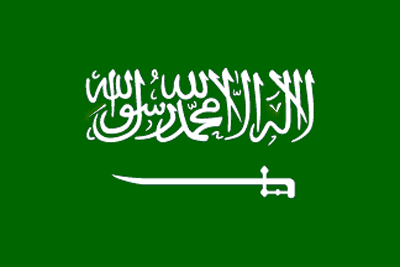
Saudi Arabia
Country in French
Arabie Saoudite
countryucasefr
ARABIE SAOUDITE
Country in Chinese
Country in Spanish
Arabia Saudi
Country in Italian
L'Arabia Saudi
Country in Portuguese
Arábia Saudi
Country in Germain
Saudi Arabien
countrypy
sha1 te4 a1 la1 bo2
countrylocal
Al Arabiyah as Suudiyah
countryfull
Saudi Arabia
countrynm
Saudi Arabia
ISO2
SA
ISO3
SAU
countrycodeisono
682
countrycodevehicle
SA
countrycodeolympic
KSA
countrycodeirs
SA
countrycodeirsfr
SA
countrycodeirsmixt
SA
countrycode
966
♀Female
1
3
3
languagesfr
Arabei
90
currency
riyal
currencyfr
riyal
currencyisocode
SAR
currencyisocodefull
SAR 682
currencypxcode
SAR
currencysymbol
SRls
currencysubdivision
100 halalat
currencyregime
US-$ (lim.flex.)
currencyvalue
0.2667
nationalityfr
Saoudienne
Capital
Riyadh
capitalfr
Riyad
Phone Prefix
966
Area km2
2 149 690
arealand
1 960 582
landarablerate
0.0172
landforestrate
0.007
coastline
2640
summit
Jabal al Hijaz 3 133 m.
boundarycountries
Jordanie, Irak, Koweït, Qatar, Oman, Yémen, Emirats Arabes Unis.
timezonedeltabegin
3
flaglink
maplink
sacolor.gif
outlinemaplink
saout.gif
visapassenger
-1
maincities
Jeddah, La Mecque, Medina, Dammam, At Ta'if, Al Hufuf, Haradh, Tabuk, Buraydah.
largestcity
Riyadh
largestcitypopulation
2 619 000
rankpopulation
46
Population
22 528 000
rankgdp
23
gdp
214748000000
rankgdpppp
27
gdpppp
297967000000
rankgni
21
gni
208089000000
rankincomeorigin
56
rankincome
60
income
9240
rankincomeppp
61
incomeppp
13230
lifeexpectation
68.73
alphabetizationrate
0.624
natalityrate
0.0372
mortalityrate
0.00579
mortalityrateinfantile
0.04794
nationalevent
Unification of the Kingdom
nationaleventfr
Unification du Royaume
nationalholiday
23 September (1932)
Birthday yyyy-mm-dd
1932-09-23 00:00:00
9
9
location
Middle East, bordering the Persian Gulf and the Red Sea, north of Yemen
terrain
mostly uninhabited, sandy desert
naturalresources
petroleum, natural gas, iron ore, gold, copper
9
Web
rgbback
16777215
todate
1
12
id
Country
Country
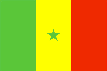
Senegal
Country in French
Sénégal
countryucasefr
SENEGAL
Country in Chinese
Country in Spanish
Senegal
Country in Italian
Il Senegal
Country in Portuguese
Senegal
Country in Germain
Senegal
countrypy
se4 nei4 jia1 er3
countrylocal
Senegal
countryfull
Senegal
countrynm
Senegal
ISO2
SN
ISO3
SEN
countrycodeisono
686
countrycodevehicle
SN
countrycodeolympic
SEN
countrycodeirs
SG
countrycodeirsfr
SG
countrycodeirsmixt
SE
countrycode
221
♂Male
15
6
57
languagesfr
Français
119
currency
franc
currencyfr
franc C.F.A.
currencyisocode
XOF
currencyisocodefull
XOF 952
currencypxcode
XOF
currencysymbol
CFAF
currencysubdivision
100 centimes
currencyregime
Euro (655.957)
currencyvalue
0.00186
nationalityfr
Sénégalaise
Capital
Dakar
capitalfr
Dakar
Phone Prefix
221
Area km2
196 192
arealand
192 000
areawater
4 190
landarablerate
0.1158
landforestrate
0.322
coastline
531
summit
Futa Jaldon Foothills 581 m.
boundarycountries
Mauritanie, Mali, Guinée Bissau, Guinée, Gambie.
flaglink
maplink
sncolor.gif
outlinemaplink
snout.gif
visapassenger
-1
maincities
Thiès, Kaolack, Ziguinchor, Saint Louis, Diourbel.
largestcity
Dakar
largestcitypopulation
1 708 000
rankpopulation
74
Population
10 240 000
rankgdp
107
gdp
6496000000
rankgdpppp
104
gdpppp
16875000000
rankgni
114
gni
5563000000
rankincomeorigin
159
rankincome
173
income
540
rankincomeppp
177
incomeppp
1620
lifeexpectation
56.37
alphabetizationrate
0.383
natalityrate
0.03623
mortalityrate
0.01088
mortalityrateinfantile
0.05757
hdi
0.423
nationalevent
Independence Day
nationaleventfr
Jour de l'Indépendance
nationalholiday
4 April (1960)
Birthday yyyy-mm-dd
1960-04-04 00:00:00
7
1
location
Western Africa, bordering the North Atlantic Ocean, between Guinea-Bissau and Mauritania
terrain
generally low, rolling, plains rising to foothills in southeast
naturalresources
fish, phosphates, iron ore
cooking
Farine de Bonfoufou.
9
Web
rgbback
16777215
todate
1
Notes
Farine de Bonfoufou.
13
id
Country
Country
Serbia
Country in French
Serbie
countryucasefr
SERBIE
Country in Chinese
Country in Spanish
Serbia
Country in Italian
La Serbia
Country in Portuguese
Serbia
Country in Germain
Serbien
countrypy
sai1 er3 wei2 ya4 ji2 meng2 te4 ni2 ge1 luo2
countrylocal
Srbija i Crna Gora
countryfull
Serbia and Montenegro
countrynm
Serbia
ISO2
RS
ISO3
SRB
countrycodeisono
688
countrycodeolympic
SRB
countrycodeirs
SR
countrycodeirsfr
SR
countrycodeirsmixt
SR
countrycode
381
♀Female
15
6
182
languagesfr
Serbe
91
currency
dinar
currencyfr
dinar
currencyisocode
YUM
currencyisocodefull
YUM 891
currencypxcode
CSD
currencysymbol
Din
currencysubdivision
100 paras
currencyvalue
0.01479
nationalityfr
Serbe
Capital
Belgrade
capitalfr
Belgrade
Phone Prefix
381
Area km2
102 200
arealand
102 136
areawater
214
landarablerate
0.3634
landforestrate
0.283
coastline
199
summit
Daravica 2 656 m.
boundarycountries
Albanie, Bosnie-Herzégovine, Bulgarie, Croatie, Hongrie, Macédoine, Roumanie.
timezonedeltabegin
1
flaglink
maplink
yi-map.gif
outlinemaplink
yu.gif
visapassenger
-1
maincities
Novi Sad, Niš, Subotica, Kragujevac, Zrenjanin, Pec, Podgorica, Pristina, Cacak, Kikinda, Sombor, Leskovac.
largestcity
Belgrade
largestcitypopulation
1 746 528
rankpopulation
87
Population
8 104 000
rankgdp
68
gdp
20729000000
rankgni
78
gni
15848000000
rankincomeorigin
114
rankincome
124
income
1910
lifeexpectation
74.22
alphabetizationrate
0.95
natalityrate
0.01268
mortalityrate
0.01069
mortalityrateinfantile
0.01637
nationalevent
National Day
nationaleventfr
Jour National
nationalholiday
27 April
Birthday yyyy-mm-dd
2000-04-17 00:00:00
7
5
location
Southeastern Europe, bordering the Adriatic Sea, between Albania and Bosnia and Herzegovina
terrain
extremely varied; to the north, rich fertile plains; to the east, limestone ranges and basins; to the southeast, ancient mountains and hills; to the southwest, extremely high shoreline with no islands off the coast
naturalresources
oil, gas, coal, antimony, copper, lead, zinc, nick
7
Web
rgbback
16777215
todate
1
14
id
Country
Country
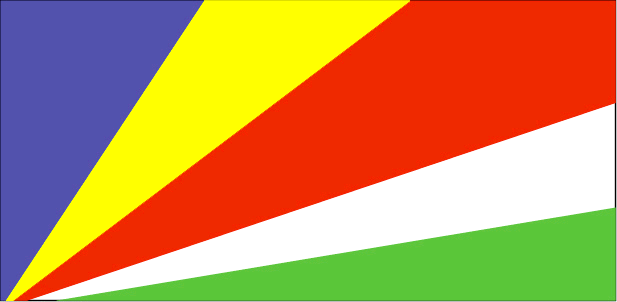
Seychelles
Country in French
Seychelles
countryucasefr
SEYCHELLES
Country in Chinese
Country in Spanish
Seychelles
Country in Italian
Le Seychelles
Country in Portuguese
Seychelles
Country in Germain
Seychellen
countrypy
sai1 she2 er3
countrylocal
Seychelles
countryfull
Seychelles
countrynm
Seychelles
ISO2
SC
ISO3
SYC
countrycodeisono
690
countrycodevehicle
SY
countrycodeolympic
SEY
countrycodeirs
SE
countrycodeirsfr
SE
countrycodeirsmixt
SEY
♀Female
15
6
57
languagesfr
Français, Anglais
92
currency
rupee
currencyfr
roupie des Seychelles
currencyisocode
SCR
currencyisocodefull
SCR 690
currencypxcode
SCR
currencysymbol
SR
currencysubdivision
100 cents
currencyregime
SDR (7.2345)
currencyvalue
0.1924
nationalityfr
Seychelloises
Capital
Victoria
capitalfr
Victoria
Phone Prefix
248
Area km2
455
arealand
455
landarablerate
0.0222
landforestrate
0.667
coastline
491
summit
Morne Seychellois 905 m.
timezonedeltabegin
4
flaglink
maplink
sccolor.gif
outlinemaplink
scout.gif
visapassenger
-1
maincities
Anse Boileau, Cascade, Anse Royal.
largestcity
Victoria
largestcitypopulation
40 000
rankpopulation
191
Population
84 000
rankgdp
162
gdp
720000000
rankgni
187
gni
626000000
rankincomeorigin
62
rankincome
67
income
7490
lifeexpectation
72.95
alphabetizationrate
0.58
natalityrate
0.01655
fecondity
2.09
mortalityrate
0.00641
mortalityrateinfantile
0.01597
growthrate
0.01445
hdi
0.84
urbanization
0.6528
precipitation
2172
nationalevent
Constitution Day (National Day)
nationaleventfr
Jour de la Constitution (Jour National)
nationalholiday
18 June (1993)
Birthday yyyy-mm-dd
1993-06-18 00:00:00
10
10
location
Eastern Africa, group of islands in the Indian Ocean, northeast of Madagascar
terrain
Mahe Group is granitic, narrow coastal strip, rocky, hilly; others are coral, flat, elevated reefs
naturalresources
fish, copra, cinnamon trees
9
Web
rgbback
16777215
todate
1
15
id
Country
Country
Sicily
Country in French
Sicile
countryucasefr
SICILE
Country in Chinese
Country in Spanish
Sicily
Country in Italian
Sicilia
Country in Portuguese
Sicily
Country in Germain
Sicily
countrylocal
Sicilia
countryfull
Sicily
countrynm
Sicily
ISO2
ITAS
ISO3
ITAS
countrycodeisono
380
countrycodevehicle
I
countrycodeolympic
ITA
countrycodeirs
IT
countrycodeirsfr
IT
countrycodeirsmixt
SCL
countrycode
39
countrycodefr
39
♀Female
1
4
6
84
languagesfr
Italien
religions
Catholic, others
2
currency
Euro
currencyfr
Euro
currencyisocode
EUR
currencyisocodefull
EUR 978
currencypxcode
EUR
currencysymbol
€
currencysubdivision
100 cents
currencyregime
float
currencyvalue
1.2203
nationality
Italian
nationalityfr
Italienne
Capital
Palermo
capitalfr
Palerme
Phone Prefix
39
longtitude
38
latitude
13.5
Area km2
25 426
arealand
25 706
summit
Mt. Etna (an active volcano), rises 3 323m
The central plateau slopes to coastal
timezonedeltabegin
1
flaglink
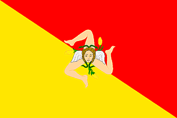
maplink
sicilymap.gif
outlinemaplink
sicilyout.gif
maincities
Palermo
largestcity
Palermo
largestcitypopulation
676 000
Population
5 200 000
location
Sicily is the largest island (25,426 sq. km.) in the Mediterranean; it is also the most important economically and has the richest heritage of history and art. Its geographical particularity lies in its compact but varied orographical structure, the uniformity of its rivers, the typically Mediterranean climate and the insularity which has helped Sicily to experience homogeneous historical development with originality of custom, art and culture.
Together with the minor Aeolian islands (the Lipari), Ustica, Egadi, Pantelleria and the distant Pelagie, Sicily is the most extensive region in Italy, though it has only the fourth highest population. The population density is slightly higher than the national average.
The island is bounded by the Tyrrhenian Sea to the north, the Ionian to the east and the Sicilian Sea to the south-west; the Strait of Messina separates it from Calabria.
terrain
Most of the island is a mountainous plateau. The highest point, Mt. Etna (an active volcano), rises to 10,902 ft. (3,323m). The central plateau slopes to coastal lowlands, fertile areas drained by many small rivers amd streams.
Significant rivers include the Salso and Simeta.
7
rgbback
16777215
todate
1
16
id
Country
Country
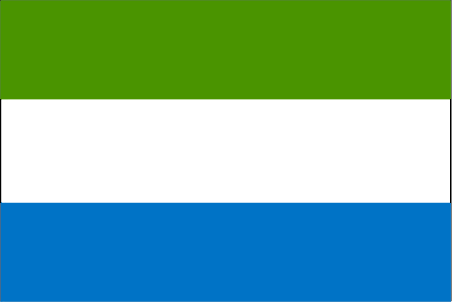
Sierra Leone
Country in French
Sierra Leone
countryucasefr
SIERRA LEONE
Country in Chinese
Country in Spanish
Sierra Leone
Country in Italian
Sierra Leone
Country in Portuguese
Sierra Leone
Country in Germain
Sierra Leone
countrypy
sai1 la1 li4 ang2
countrylocal
Sierra Leone
countryfull
Sierra Leone
countrynm
Sierra Leone
ISO2
SL
ISO3
SLE
countrycodeisono
694
countrycodevehicle
WAL
countrycodeolympic
SLE
countrycodeirs
SL
countrycodeirsfr
SL
countrycodeirsmixt
SL
♂Male
19
6
51
languagesfr
Anglais
22
currency
leone
currencyfr
leone
currencyisocode
SLL
currencyisocodefull
SLL 694
currencypxcode
SLL
currencysymbol
Le
currencysubdivision
100 cents
currencyregime
float
currencyvalue
0.00043
Capital
Freetown
capitalfr
Freetown
Phone Prefix
232
Area km2
71 740
arealand
71 620
areawater
120
landarablerate
0.0676
landforestrate
0.147
coastline
402
summit
Loma Mansa 1 948 m.
boundarycountries
Guinée, Liberia.
flaglink
maplink
slcolor.gif
outlinemaplink
slout.gif
visapassenger
-1
maincities
Bo, Kenema, Makeni, Bonthe, Port Loko.
largestcity
Freetown
largestcitypopulation
699 000
rankpopulation
106
Population
5 337 000
rankgdp
158
gdp
793000000
rankgdpppp
150
gdpppp
2927000000
rankgni
177
gni
808000000
rankincomeorigin
201
rankincome
216
income
150
rankincomeppp
208
incomeppp
530
lifeexpectation
42.69
alphabetizationrate
0.3665
natalityrate
0.04334
mortalityrate
0.02062
mortalityrateinfantile
0.14524
hdi
0.275
urbanization
0.373
precipitation
2946
nationalevent
Independence Day
nationaleventfr
Jour de l'Indépendance
nationalholiday
27 April (1961)
Birthday yyyy-mm-dd
1961-04-27 00:00:00
8
2
location
Western Africa, bordering the North Atlantic Ocean, between Guinea and Liberia
terrain
coastal belt of mangrove swamps, wooded hill country, upland plateau, mountains in east
naturalresources
diamonds, titanium ore, bauxite, iron ore, gold, c
9
Web
Guinée, Liberia.
rgbback
16777215
todate
1
17
id
Country
Country
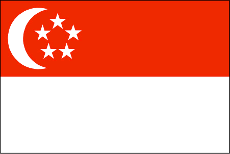
Singapore
Country in French
Singapour
countryucasefr
SINGAPOUR
Country in Chinese
Country in Spanish
Singapur
Country in Italian
Singapore
Country in Portuguese
Singapore
Country in Germain
Singapur
countrypy
xin1 jia1 po1
countrylocal
Singapore
countryfull
Singapore
countrynm
Singapore
ISO2
SG
ISO3
SGP
countrycodeisono
702
countrycodevehicle
SGP
countrycodeolympic
SIN
countrycodeirs
SN
countrycodeirsfr
SP
countrycodeirsmixt
SP
countrycode
65
16
4
126
languagesfr
Chinois, Malais, Anglais, Tamoul
93
currency
dollar
currencyfr
dollar de Singapour
currencyisocode
SGD
currencyisocodefull
SGD 702
currencypxcode
SGD
currencysymbol
S$
currencysubdivision
100 cents
currencyregime
m.float
currencyvalue
0.5968
nationalityfr
Singaporienne
Capital
Singapore
capitalfr
Singapour
Phone Prefix
65
Area km2
632.60
arealand
682.70
areawater
10
landarablerate
0.0164
landforestrate
0.033
coastline
193
summit
Bukit Timah 177 m.
timezonedeltabegin
8
zipcodelength
4
flaglink
maplink
sg.jpg
outlinemaplink
sgout.gif
maincities
Serangoon, Jurong, Nee Soon.
largestcity
Singapore
largestcitypopulation
3 327 000
rankpopulation
117
Population
4 250 000
rankgdp
38
gdp
91342000000
rankgdpppp
54
gdpppp
104046000000
rankgni
39
gni
90228000000
rankincomeorigin
29
rankincome
25
income
21230
rankincomeppp
30
incomeppp
24180
lifeexpectation
78.7
alphabetizationrate
0.937
natalityrate
0.0114
mortalityrate
0.0044
mortalityrateinfantile
0.0025
hdi
0.9
urbanization
1
precipitation
2150
nationalevent
Independence Day
nationaleventfr
Jour de l'Indépendance
nationalholiday
9 August (1965)
Birthday yyyy-mm-dd
1965-08-09 00:00:00
2
6
location
Southeastern Asia, islands between Malaysia and Indonesia
terrain
lowland; gently undulating central plateau contains water catchment area and nature preserve
naturalresources
fish, deepwater ports
cooking
Nouilles de Riz.
8
Web
rgbback
16777215
todate
1
Notes
Nouilles de Riz.
18
id
Country
Country
Sint Eustatius
Country in French
Sint Eustatius
countryucasefr
Sint Eustatius
Country in Chinese
Country in Spanish
Sint Eustatius
Country in Italian
Sint Eustatius
Country in Portuguese
Sint Eustatius
Country in Germain
Sint Eustatius
ISO2
XB
ISO3
NL-BQ2
todate
1
19
id
Country
Country
Sint Maarten (Dutch part)
Country in French
Sint Maarten (Dutch part)
countryucasefr
Sint Maarten (Dutch part)
Country in Chinese
Country in Spanish
Sint Maarten (Dutch part)
Country in Italian
Sint Maarten (Dutch part)
Country in Portuguese
Sint Maarten (Dutch part)
Country in Germain
Sint Maarten (Dutch part)
countrypy
He2 Lan2 Sheng4 Ma2 Ding1
countrylocal
Sint Maarten (Dutch part)
countryfull
Sint Maarten (Dutch part)
countrynm
Sint Maarten (Dutch part)
ISO2
SX
ISO3
SXM
rgbback
16777215
todate
1
20
id
Country
Country
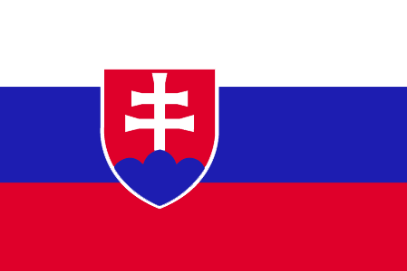
Slovakia
Country in French
Slovaquie
countryucasefr
SLOVAQUIE
Country in Chinese
Country in Spanish
Eslovaquia
Country in Italian
La Slovacchia
Country in Portuguese
Slovakia
Country in Germain
Slowakei
countrypy
si1 luo4 fa2 ke4
countrylocal
Slovensko
countryfull
Slovakia
countrynm
Slovakia
ISO2
SK
ISO3
SVK
countrycodeisono
703
countrycodevehicle
SK
countrycodeolympic
SVK
countrycodeirs
LO
countrycodeirsfr
LO
countrycodeirsmixt
LO
♀Female
18
6
128
languagesfr
Slovaque
154
currency
koruna
currencyfr
couronne tchécoslovaque
currencyisocode
SKK
currencyisocodefull
SKK 703
currencypxcode
SKK
currencysymbol
Sk
currencysubdivision
100 halierov
currencyregime
float
currencyvalue
0.03126
nationalityfr
Slovaque
Capital
Bratislava
capitalfr
Bratislava
Phone Prefix
421
Area km2
49 032
arealand
48 800
areawater
45
landarablerate
0.3074
landforestrate
0.453
summit
Gerlachovsky Stit 2 654 m.
boundarycountries
Tchéquie, Pologne, Ukraine, Hongrie, Autriche.
timezonedeltabegin
1
flaglink
maplink
lo-map.gif
outlinemaplink
sk.gif
visapassenger
-1
maincities
Kosice, Nitra, Trnava, Banska Bytrica, Presov, Zilina.
largestcity
Bratislava
largestcitypopulation
471 000
rankpopulation
104
Population
5 390 000
rankgdp
59
gdp
32519000000
rankgdpppp
58
gdpppp
72730000000
rankgni
61
gni
26631000000
rankincomeorigin
73
rankincome
80
income
4940
rankincomeppp
59
incomeppp
13440
lifeexpectation
74.19
alphabetizationrate
0.97
natalityrate
0.01057
mortalityrate
0.00948
mortalityrateinfantile
0.00762
hdi
0.836
urbanization
0.576
precipitation
523
nationalevent
Constitution Day
nationaleventfr
Jour de la Constitution
nationalholiday
1 September (1992)
Birthday yyyy-mm-dd
1992-09-01 00:00:00
9
9
location
Central Europe, south of Poland
terrain
rugged mountains in the central and northern part and lowlands in the south
naturalresources
brown coal and lignite; small amounts of iron ore,
6
Web
rgbback
16777215
todate
1
| Countries/Territories | Regions of China | Provinces of China | Regions in France | French Departments | States/Provinces | Cities/Towns | Locations | World Continents | French AOP Wines
