Countries/Territories
Updated 2021-01-12 18:58:56
The names of countries/territories of the world are taught in English and Chinese. This collection of precious dry lands that shares the whole mankind includes not only the world's independent countries, but also specific areas that are not a UNUnited Nations: We the peoples...A stronger UN for a better world. member. Please visit the table of male and female genders of country names in French.
Countries/locations Close
51
id
Country
Country
Somalia
Country in French
Somalie
countryucasefr
SOMALIE
Country in Chinese
Country in Spanish
Somalia
Country in Italian
La Somalia
Country in Portuguese
Somália
Country in Germain
Somalia
countrypy
suo3 ma3 li3
countrylocal
Somalia
countryfull
Somalia
countrynm
Somalia
ISO2
SO
ISO3
SOM
countrycodeisono
706
countrycodevehicle
SO
countrycodeolympic
SOM
countrycodeirs
SO
countrycodeirsfr
SO
countrycodeirsmixt
SO
♀Female
2
187
languagesfr
Somali, Arabe
95
currency
shilling
currencyfr
shilling
currencyisocode
SOS
currencyisocodefull
SOS 706
currencypxcode
SOS
currencysymbol
So. Sh.
currencysubdivision
100 centesimi
currencyregime
float
currencyvalue
0.00033
nationalityfr
Somalienne
Capital
Mogadishu
capitalfr
Mogadiscio
Phone Prefix
252
Area km2
528 657
arealand
627 337
areawater
10 320
landarablerate
0.0166
landforestrate
0.12
coastline
3025
summit
Shimbiris 2 450 m.
boundarycountries
Kenya, Ethiopie, Somaliland.
timezonedeltabegin
3
flaglink
maplink
socolor.gif
outlinemaplink
soout.gif
visapassenger
-1
maincities
Baioa, Kisimayu, Merca, Gioher, Boromo.
largestcity
Mogadishu
largestcitypopulation
997 000
rankpopulation
79
Population
9 626 000
rankgni
158
gni
1350000000
rankincomeorigin
208
rankincome
213
income
180
lifeexpectation
47.71
alphabetizationrate
0.3765
natalityrate
0.04604
mortalityrate
0.0173
mortalityrateinfantile
0.11852
urbanization
0.279
nationalevent
Foundation of the Somali Republic
nationaleventfr
Fondation de la République du Somali
nationalholiday
1 July (1960)
Birthday yyyy-mm-dd
1960-07-01 00:00:00
7
1
location
Eastern Africa, bordering the Gulf of Aden and the Indian Ocean, east of Ethiopia
terrain
mostly flat to undulating plateau rising to hills in north
naturalresources
uranium and largely unexploited reserves of iron o
9
rgbback
16777215
todate
1
52
id
Country
Country
South Africa
Country in French
Afrique du Sud
countryucasefr
AFRIQUE DU SUD
Country in Chinese
Country in Spanish
África Del sur
Country in Italian
L'Africa Del sud
Country in Portuguese
África Sul
Country in Germain
SüdcAfrika
countrypy
nan2 fei1
countrylocal
South Africa
countryfull
South Africa
countrynm
South Africa
ISO2
ZA
ISO3
ZAF
countrycodeisono
710
countrycodevehicle
ZA
countrycodeolympic
RSA
countrycodeirs
SF
countrycodeirsfr
SF
countrycodeirsmixt
SF
countrycode
27
♀Female
15
7
1
languagesfr
Afrikaans
96
currency
rand
currencyfr
rand
currencyisocode
ZAR
currencyisocodefull
ZAR 710
currencypxcode
ZAR
currencysymbol
R
currencysubdivision
100 cents
currencyregime
float
currencyvalue
0.1453
nationalityfr
Africaine du Sud
Capital
Pretoria
capitalfr
Pretoria
Phone Prefix
27
Area km2
1 219 912
arealand
1 219 912
landarablerate
0.1213
landforestrate
0.073
coastline
2798
summit
Injasuti 3 408 m.
boundarycountries
Namibie, Botswana, Zimbabwe, Mozambique, Swaziland, Lesotho.
timezonedeltabegin
2
flaglink
maplink
zacolor.gif
outlinemaplink
zaout.gif
visapassenger
-1
maincities
Cape Town (Le Cap), Johannesburg, Durban, Port Elizabeth, Umhlali, East London.
largestcity
Pretoria (administrative) Cape Town (legislative)
largestcitypopulation
2 727 000
rankpopulation
27
Population
45 829 000
rankgdp
29
gdp
159886000000
rankgdpppp
19
gdpppp
474137000000
rankgni
33
gni
125960000000
rankincomeorigin
94
rankincome
104
income
2750
rankincomeppp
76
incomeppp
10130
lifeexpectation
44.1
alphabetizationrate
0.8605
natalityrate
0.01909
fecondity
2.61
mortalityrate
0.0204
mortalityrateinfantile
0.06284
hdi
0.684
precipitation
520
nationalevent
Freedom Day
nationaleventfr
Jour de la Liberté
nationalholiday
27 April (1994)
Birthday yyyy-mm-dd
1994-04-27 00:00:00
1
11
location
Southern Africa, at the southern tip of the continent of Africa
terrain
vast interior plateau rimmed by rugged hills and narrow coastal plain
naturalresources
gold, chromium, antimony, coal, iron ore, manganes
cooking
Fruits Exotiques.
9
Web
rgbback
16777215
todate
1
Notes
Fruits Exotiques.
53
id
Country
Country
Sudan
Country in French
Soudan
countryucasefr
SOUDAN
Country in Chinese
Country in Spanish
Sudán
Country in Italian
Il Sudan
Country in Portuguese
Sudão
Country in Germain
Sudan
countrypy
su1 dan1
countrylocal
As-Sudan
countryfull
Sudan
countrynm
Sudan
ISO2
SD
ISO3
SDN
countrycodeisono
736
countrycodevehicle
SUD
countrycodeolympic
SUD
countrycodeirs
SU
countrycodeirsfr
SU
countrycodeirsmixt
SU
♂Male
3
4
3
languagesfr
Arabe
156
currency
dinar
currencyfr
livre soudanaise
currencyisocode
SDP
currencyisocodefull
SDP 736
currencypxcode
SDP
currencysubdivision
100 piastres
currencyregime
m.float
currencyvalue
0.0004
nationalityfr
Soudanaise
Capital
Khartoum
capitalfr
Khartoum
Phone Prefix
249
Area km2
2 505 813
arealand
2 376 000
areawater
129 810
landarablerate
0.0703
landforestrate
0.259
coastline
853
summit
Kinyeti 3 187 m.
boundarycountries
Tchad, Libye, Egypte, Ethiopie, Erythrée, Ouganda, Kenya, Congo démocratique, Centrafrique.
timezonedeltabegin
2
flaglink
maplink
sdcolor.gif
outlinemaplink
sdout.gif
visapassenger
-1
maincities
Omdurman, Port Soudan, Wad Medani, El Obeid, Atbara, Kassala, Kosti.
largestcity
Khartoum
largestcitypopulation
2 249 000
rankpopulation
33
Population
33 546 000
rankgdp
75
gdp
17793000000
rankgdpppp
61
gdpppp
64088000000
rankgni
81
gni
15350000000
rankincomeorigin
167
rankincome
181
income
460
rankincomeppp
167
incomeppp
1760
lifeexpectation
57.73
alphabetizationrate
0.271
natalityrate
0.03648
mortalityrate
0.00959
mortalityrateinfantile
0.06559
nationalevent
Independence Day
nationaleventfr
Jour de l'Indépendance
nationalholiday
1 January (1956)
Birthday yyyy-mm-dd
1956-01-01 00:00:00
2
8
location
Northern Africa, bordering the Red Sea, between Egypt and Eritrea
terrain
generally flat, featureless plain; mountains in far south, northeast and west; desert dominates the north
naturalresources
petroleum; small reserves of iron ore, copper, chr
9
Web
rgbback
16777215
todate
1
54
id
Country
Country
Swaziland
Country in French
Swaziland
countryucasefr
SWAZILAND
Country in Chinese
Country in Spanish
Swazilandia
Country in Italian
Lo Swaziland
Country in Portuguese
Suazilândia
Country in Germain
Swasiland
countrypy
shi3 wa3 ji4 lan2
countrylocal
Swaziland
countryfull
Swaziland
countrynm
Swaziland
ISO2
SZ
ISO3
SWZ
countrycodeisono
748
countrycodevehicle
SD
countrycodeolympic
SWZ
countrycodeirs
WZ
countrycodeirsfr
WZ
countrycodeirsmixt
WZ
♂Male
1
3
189
languagesfr
Siswati, Anglais
157
currency
lilangeni, pl., emalangeni
currencyfr
lilangeni
currencyisocode
SZL
currencyisocodefull
SZL 748
currencypxcode
SZL
currencysymbol
L, pl., E
currencysubdivision
100 cents
currencyregime
South African rand (1.0)
currencyvalue
0.1452
Capital
Mbabana
capitalfr
Mbabane
Phone Prefix
268
Area km2
17 363
arealand
17 203
areawater
160
landarablerate
0.0977
landforestrate
0.303
summit
Emlemle 1 862 m.
boundarycountries
Afrique du Sud, Mozambique.
timezonedeltabegin
2
flaglink
maplink
szcolor.gif
outlinemaplink
szout.gif
visapassenger
-1
maincities
Manzini, Big Bend, Mhlume, Nhlangano, Pigg's Peak, Stegi.
largestcity
Mbabane
largestcitypopulation
61 000
rankpopulation
151
Population
1 106 000
rankgdp
145
gdp
1845000000
rankgdpppp
139
gdpppp
5225000000
rankgni
160
gni
1496000000
rankincomeorigin
127
rankincome
139
income
1350
rankincomeppp
123
incomeppp
4850
lifeexpectation
37.54
alphabetizationrate
0.81
natalityrate
0.02855
mortalityrate
0.02306
mortalityrateinfantile
0.06835
hdi
0.547
urbanization
0.267
nationalevent
Independence Day
nationaleventfr
Jour de l'Indépendance
nationalholiday
6 September (1968)
Birthday yyyy-mm-dd
1968-09-06 00:00:00
5
9
location
Southern Africa, between Mozambique and South Africa
terrain
mostly mountains and hills; some moderately sloping plains
naturalresources
asbestos, coal, clay, cassiterite, hydropower, for
9
Web
rgbback
16777215
todate
1
55
id
Country
Country
Syria
Country in French
Syrie
countryucasefr
SYRIE
Country in Chinese
Country in Spanish
Siria
Country in Italian
La Siria
Country in Portuguese
Syria
Country in Germain
Syrien
countrypy
xu4 li4 ya4
countrylocal
Suriyah
countryfull
Syria
countrynm
Syria
ISO2
SY
ISO3
SYR
countrycodeisono
760
countrycodevehicle
SYR
countrycodeolympic
SYR
countrycodeirs
SY
countrycodeirsfr
SY
countrycodeirsmixt
SY
♀Female
15
1
3
languagesfr
Arabe
101
currency
pound
currencyfr
livre syrienne
currencyisocode
SYP
currencyisocodefull
SYP 760
currencypxcode
SYP
currencysymbol
£S
currencysubdivision
100 piasters
currencyregime
US-$ (11.225)
currencyvalue
0.01926
nationalityfr
Syrienne
Capital
Damascus
capitalfr
Damas
Phone Prefix
963
Area km2
185 180
arealand
184 050
areawater
1 130
landarablerate
0.2596
landforestrate
0.025
coastline
193
summit
Jabal ash-Shaykh 2 814 m.
boundarycountries
Israël, Liban, Turquie, Irak, Jordanie.
timezonedeltabegin
2
flaglink
maplink
sycolor.gif
outlinemaplink
syout.gif
visapassenger
-1
maincities
Alep, Homs, Lattaquié, Hama, Deir es Zor, Raqqa, El Haseke, Tartoûs, Idlib, Deraa, Abu Kemal.
largestcity
Damascus
largestcitypopulation
2 036 000
rankpopulation
53
Population
17 384 000
rankgdp
67
gdp
21499000000
rankgdpppp
62
gdpppp
62165000000
rankgni
71
gni
20209000000
rankincomeorigin
130
rankincome
142
income
1160
rankincomeppp
138
incomeppp
3430
lifeexpectation
69.39
alphabetizationrate
0.645
natalityrate
0.02954
mortalityrate
0.00504
mortalityrateinfantile
0.03167
precipitation
143
nationalevent
Independence Day
nationaleventfr
Jour de l'Indépendance
nationalholiday
17 April (1946)
Birthday yyyy-mm-dd
1946-04-17 00:00:00
3
11
location
Middle East, bordering the Mediterranean Sea, between Lebanon and Turkey
terrain
primarily semiarid and desert plateau; narrow coastal plain; mountains in west
naturalresources
petroleum, phosphates, chrome and manganese ores,
9
rgbback
16777215
todate
1
56
id
Country
Country
Tanzania
Country in French
Tanzanie
countryucasefr
TANZANIE
Country in Chinese
Country in Spanish
Tanzania, república unida de
Country in Italian
La Tanzania, Repubblica unita di
Country in Portuguese
Tanzânia, república unida de
Country in Germain
Tanzania, vereinigte Republik von
countrypy
tan3 sang1 ni2 ya4
countrylocal
Tanzania
countryfull
Tanzania
countrynm
Tanzania
ISO2
TZ
ISO3
TZA
countrycodeisono
834
countrycodeolympic
TAN
countrycodeirs
TZ
countrycodeirsfr
TZ
countrycodeirsmixt
TZ
♀Female
15
5
151
languagesfr
Swahili, Anglais
159
currency
shilling
currencyfr
shilling
currencyisocode
TZS
currencyisocodefull
TZS 834
currencypxcode
TZS
currencysymbol
TSh
currencysubdivision
100 cents
currencyregime
float
currencyvalue
0.00092
nationalityfr
Tanzanienne
Capital
Dar es Salaam
capitalfr
Dar-Es-Salam
Phone Prefix
255
Area km2
945 090
arealand
886 037
areawater
59 050
landarablerate
0.0424
landforestrate
0.439
coastline
1424
summit
Kilimanjaro 5 895 m.
boundarycountries
Congo démocratique, Burundi, Rwanda, Ouganda, Kenya, Zambie, Mozambique, Malawi.
timezonedeltabegin
3
flaglink
maplink
tzcolor.gif
outlinemaplink
tzout.gif
visapassenger
-1
maincities
Dar es Salaam, Zanzibar, Mwanza, Tanga, Mbeya, Tabora, Arusha.
largestcity
Dar Es Salaam
largestcitypopulation
1 747 000
rankpopulation
32
Population
35 889 000
rankgdp
93
gdp
10297000000
rankgdpppp
97
gdpppp
22300000000
rankgni
89
gni
10665000000
rankincomeorigin
183
rankincome
197
income
300
rankincomeppp
206
incomeppp
620
lifeexpectation
44.56
alphabetizationrate
0.5157
natalityrate
0.0395
mortalityrate
0.01738
mortalityrateinfantile
0.10368
precipitation
1148
nationalevent
Union Day (Tanganyika and Zanzibar)
nationaleventfr
Jour de l'Union (Tanganyika et Zanzibar)
nationalholiday
26 April (1964)
Birthday yyyy-mm-dd
1964-04-26 00:00:00
1
5
location
Eastern Africa, bordering the Indian Ocean, between Kenya and Mozambique
terrain
plains along coast; central plateau; highlands in north, south
naturalresources
hydropower, tin, phosphates, iron ore, coal, diamo
9
Web
rgbback
16777215
todate
1
57
id
Country
Country
Togo
Country in French
Togo
countryucasefr
TOGO
Country in Chinese
Country in Spanish
Toga
Country in Italian
Toga
Country in Portuguese
Toga
Country in Germain
Toga
countrypy
duo1 ge1
countrylocal
Republique Togolaise
countryfull
Togo
countrynm
Togo
ISO2
TG
ISO3
TGO
countrycodeisono
768
countrycodevehicle
TG
countrycodeolympic
TOG
countrycodeirs
TO
countrycodeirsfr
TO
countrycodeirsmixt
TO
♂Male
15
4
57
languagesfr
Français
119
currency
franc
currencyfr
franc C.F.A.
currencyisocode
XOF
currencyisocodefull
XOF 952
currencypxcode
XOF
currencysymbol
CFAF
currencysubdivision
100 centimes
currencyregime
Euro (655.957)
currencyvalue
0.00186
nationalityfr
Togalaise
Capital
Lome
capitalfr
Lomé
Phone Prefix
228
Area km2
56 790
arealand
54 385
areawater
2 400
landarablerate
0.4137
landforestrate
0.094
coastline
56
summit
Pic Baumann 986 m.
boundarycountries
Ghana, Burkina Faso, Bénin.
flaglink
maplink
tgcolor.gif
outlinemaplink
tgout.gif
visapassenger
-1
maincities
Sokodé, Palimé, Atakpamé, Bassari, Tsévié, Anécho, Mango, Bafilo, Tabligbo.
largestcity
Lome
largestcitypopulation
662 000
rankpopulation
112
Population
4 861 000
rankgdp
146
gdp
1759000000
rankgdpppp
132
gdpppp
8247000000
rankgni
159
gni
1528000000
rankincomeorigin
182
rankincome
196
income
310
rankincomeppp
176
incomeppp
1640
lifeexpectation
53.43
alphabetizationrate
0.433
natalityrate
0.03523
mortalityrate
0.01151
mortalityrateinfantile
0.06873
hdi
0.489
precipitation
878
nationalevent
Independence Day
nationaleventfr
Jour de l'Indépendance
nationalholiday
27 April (1960)
Birthday yyyy-mm-dd
1960-04-27 00:00:00
7
1
location
Western Africa, bordering the Bight of Benin, between Benin and Ghana
terrain
gently rolling savanna in north; central hills; southern plateau; low coastal plain with extensive lagoons and marshes
naturalresources
phosphates, limestone, marble, arable land
9
Web
rgbback
16777215
todate
1
58
id
Country
Country
Tromelin Island
Country in French
Ile de Tromelin
countryucasefr
ILE DE TROMELIN
Country in Chinese
Country in Spanish
Isla De Tromelin
Country in Italian
Isola Di Tromelin
Country in Portuguese
Console De Tromelin
Country in Germain
Insel Tromelin
countryfull
Tromelin Island
countrynm
Tromelin Island
ISO2
REUT
ISO3
REUT
countrycodeisono
638
countrycodeirs
TE
countrycodeirsfr
TE
countrycodeirsmixt
TE
♀Female
15
6
57
2
currencypxcode
EUR
Capital
Saint Denis
capitalfr
Saint Denis
Phone Prefix
262
Area km2
1
arealand
1
coastline
3.7
timezonedeltabegin
4
flaglink
maplink
te-map.gif
visapassenger
-1
largestcity
Saint Denis
rankincome
222
location
Southern Africa, island in the Indian Ocean, east of Madagascar
terrain
low, flat, and sandy; likely volcanic
naturalresources
fish
cooking
Southern Africa, island in the Indian Ocean, east of Madagascar
9
rgbback
16777215
todate
1
59
id
Country
Country
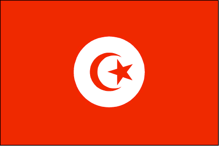
Tunisia
Country in French
Tunisie
countryucasefr
TUNISIE
Country in Chinese
Country in Spanish
Túnez
Country in Italian
La Tunisia
Country in Portuguese
Tunísia
Country in Germain
Tunesien
countrypy
tu1 ni2 xi1 ya4
countrylocal
Tunis
countryfull
Tunisia
countrynm
Tunisia
ISO2
TN
ISO3
TUN
countrycodeisono
788
countrycodevehicle
TN
countrycodeolympic
TUN
countrycodeirs
TS
countrycodeirsfr
TS
countrycodeirsmixt
TS
countrycode
216
♀Female
15
4
3
languagesfr
Arabe
161
currency
dinar
currencyfr
dinar tunisien
currencyisocode
TND
currencyisocodefull
TND 788
currencypxcode
TND
currencysymbol
TD
currencysubdivision
1,000 millimes
currencyregime
m.float (1.0)
currencyvalue
0.7685
nationalityfr
Tunisienne
Capital
Tunis
capitalfr
Tunis
Phone Prefix
216
Area km2
163 610
arealand
155 360
areawater
8 250
landarablerate
0.1867
landforestrate
0.031
coastline
1148
summit
Jabal ash Sha'ambi 1 544 m.
boundarycountries
Algérie, Libye.
timezonedeltabegin
1
flaglink
maplink
tncolor.gif
outlinemaplink
tnout.gif
visapassenger
-1
maincities
Sfax, Bizerte, Djerba, Gabès, Sousse, Kairouan, Gafsa.
largestcity
Tunis
largestcitypopulation
1 722 000
rankpopulation
77
Population
9 895 000
rankgdp
65
gdp
25037000000
rankgdpppp
60
gdpppp
70863000000
rankgni
68
gni
22204000000
rankincomeorigin
103
rankincome
113
income
2240
rankincomeppp
92
incomeppp
6850
lifeexpectation
72.9
alphabetizationrate
0.753
natalityrate
0.0169
mortalityrate
0.0055
mortalityrateinfantile
0.0228
precipitation
466
nationalevent
Independence Day
nationaleventfr
Jour de l'Indépendance
nationalholiday
20 March (1956)
Birthday yyyy-mm-dd
1956-03-20 00:00:00
3
9
location
Northern Africa, bordering the Mediterranean Sea, between Algeria and Libya
terrain
mountains in north; hot, dry central plain; semiarid south merges into the Sahara
naturalresources
petroleum, phosphates, iron ore, lead, zinc, salt
cooking
Couscous.
7
Web
rgbback
16777215
todate
1
Notes
Couscous.
60
id
Country
Country
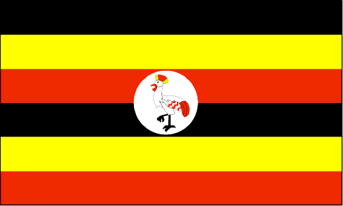
Uganda
Country in French
Ouganda
countryucasefr
OUGANDA
Country in Chinese
Country in Spanish
Uganda
Country in Italian
L'Uganda
Country in Portuguese
Uganda
Country in Germain
Uganda
countrypy
wu1 gan1 da2
countrylocal
Uganda
countryfull
Uganda
countrynm
Uganda
ISO2
UG
ISO3
UGA
countrycodeisono
800
countrycodevehicle
EAU
countrycodeolympic
UGA
countrycodeirs
UG
countrycodeirsfr
UG
countrycodeirsmixt
UG
♂Male
15
4
51
languagesfr
Anglais
163
currency
shilling
currencyfr
shilling ougandais
currencyisocode
UGX
currencyisocodefull
UGX 800
currencypxcode
UGS
currencysymbol
USh
currencysubdivision
100 cents
currencyregime
float
currencyvalue
0.00057
nationalityfr
Ugandaise
Capital
Kampala
capitalfr
Kampala
Phone Prefix
256
Area km2
236 040
arealand
199 710
areawater
36 330
landarablerate
0.2534
landforestrate
0.21
summit
Margherita Peak 5 109 m.
boundarycountries
Congo démocratique, Soudan, Kenya, Tanzanie, Rwanda.
timezonedeltabegin
3
flaglink
maplink
ugcolor.gif
outlinemaplink
ugout.gif
visapassenger
-1
maincities
Jinja, Masaka, Mbale, Mbarara, Entebbe, Tororo, Gulu, Fort Portal.
largestcity
Kampala
largestcitypopulation
954 000
rankpopulation
41
Population
25 280 000
rankgdp
108
gdp
6297000000
rankgdpppp
77
gdpppp
36827000000
rankgni
111
gni
6244000000
rankincomeorigin
191
rankincome
205
income
250
rankincomeppp
178
incomeppp
1430
lifeexpectation
44.88
alphabetizationrate
0.5397
natalityrate
0.04657
mortalityrate
0.01695
mortalityrateinfantile
0.0879
hdi
0.444
nationalevent
Independence Day
nationaleventfr
Jour de l'Indépendance
nationalholiday
9 October (1962)
Birthday yyyy-mm-dd
1962-10-09 00:00:00
9
3
location
Eastern Africa, west of Kenya
terrain
mostly plateau with rim of mountains
naturalresources
copper, cobalt, hydropower, limestone, salt, arabl
9
Web
rgbback
16777215
todate
1
| Countries/Territories | Regions of China | Provinces of China | Regions in France | French Departments | States/Provinces | Cities/Towns | Locations | World Continents | French AOP Wines
