Countries/Territories
Updated 2021-01-12 18:58:56
The names of countries/territories of the world are taught in English and Chinese. This collection of precious dry lands that shares the whole mankind includes not only the world's independent countries, but also specific areas that are not a UNUnited Nations: We the peoples...A stronger UN for a better world. member. Please visit the table of male and female genders of country names in French.
Countries/locations Close
21
id
Country
Country
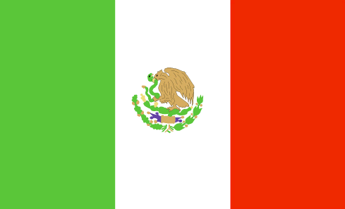
Mexico
Country in French
Mexique
countryucasefr
MEXIQUE
Country in Chinese
Country in Spanish
México
Country in Italian
Il Messico
Country in Portuguese
México
Country in Germain
Mexiko
countrypy
mo4 xi1 ge1
countrylocal
Estados Unidos Mexicanos
countryfull
Mexico
countrynm
Mexico
ISO2
MX
ISO3
MEX
countrycodeisono
484
countrycodevehicle
MEX
countrycodeolympic
MEX
countrycodeirs
MX
countrycodeirsfr
MX
countrycodeirsmixt
MX
countrycode
52
♂Male
7
131
languagesfr
Espagnol
69
currency
peso
currencyfr
peso mexicain
currencyisocode
MXN
currencyisocodefull
MXN 484
currencypxcode
MXN
currencysymbol
Mex$
currencysubdivision
100 centavos
currencyregime
float
currencyvalue
0.09239
nationalityfr
Mexicaine
Capital
Mexico City
capitalfr
Mexico
Phone Prefix
52
Area km2
1 972 547
arealand
1 923 040
areawater
49 510
landarablerate
0.132
landforestrate
0.289
coastline
9330
summit
Citlaltépelt 5 700 m.
boundarycountries
Etats-Unis, Guatémala, Bélize.
timezonedeltabegin
-6
flaglink
maplink
mxcolor.gif
outlinemaplink
mxout.gif
visapassenger
-1
maincities
Guadalajara, Monterrey, Zaragoza, León, Ciudad Juárez, Culiacán, Mexicali, Tijuana, Mérida, Acapulco, Chihuahua, San Luis Potosî, Hermosillo
largestcity
Mexico City
largestcitypopulation
16 562 000
rankpopulation
11
Population
102 291 000
rankgdp
10
gdp
626080000000
rankgdpppp
12
gdpppp
937836000000
rankgni
10
gni
637159000000
rankincomeorigin
68
rankincome
75
income
6230
rankincomeppp
80
incomeppp
8980
lifeexpectation
74.94
alphabetizationrate
0.917
natalityrate
0.02144
mortalityrate
0.00473
mortalityrateinfantile
0.02169
hdi
0.8
precipitation
848
nationalevent
Independence Day
nationaleventfr
Jour de l'Indépendance
nationalholiday
16 September (1810)
Birthday yyyy-mm-dd
1810-09-16 00:00:00
7
7
location
Middle America, bordering the Caribbean Sea and the Gulf of Mexico, between Belize and the US and bordering the North Pacific Ocean, between Guatemala and the US
terrain
high, rugged mountains; low coastal plains; high plateaus; desert
naturalresources
petroleum, silver, copper, gold, lead, zinc, natur
cooking
Spécialités très Epicées.
9
Web
rgbback
16777215
todate
1
Notes
Spécialités très Epicées.
22
id
Country
Country
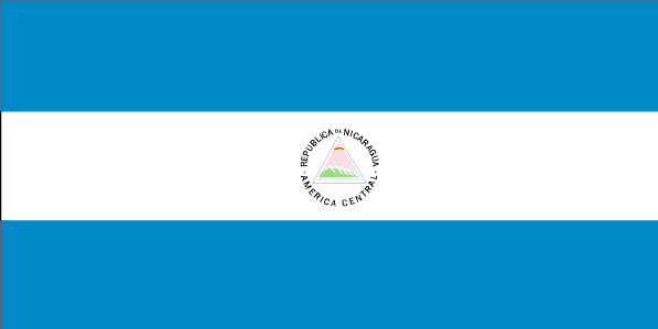
Nicaragua
Country in French
Nicaragua
countryucasefr
NICARAGUA
Country in Chinese
Country in Spanish
Nicaragua
Country in Italian
La Nicaragua
Country in Portuguese
Nicarágua
Country in Germain
Nicaragua
countrypy
ni2 jia1 la1 gua1
countrylocal
Nicaragua
countryfull
Nicaragua
countrynm
Nicaragua
ISO2
NI
ISO3
NIC
countrycodeisono
558
countrycodevehicle
NIC
countrycodeolympic
NCA
countrycodeirs
NU
countrycodeirsfr
NU
countrycodeirsmixt
NU
countrycode
505
♂Male
15
6
131
languagesfr
Espagnol
76
currency
gold cordoba
currencyfr
cordoba
currencyisocode
NIO
currencyisocodefull
NIO 558
currencypxcode
NIO
currencysymbol
C$
currencysubdivision
100 centavos
currencyregime
indicators
currencyvalue
0.06146
nationalityfr
Nicaraquaïenne
Capital
Managua
capitalfr
Managua
Phone Prefix
505
Area km2
129 494
arealand
120 254
areawater
9 240
landarablerate
0.2024
landforestrate
0.27
coastline
910
summit
Cerro Mogotón 2 438 m
boundarycountries
Honduras, Costa Rica.
timezonedeltabegin
-5
flaglink
maplink
nicolor.gif
outlinemaplink
nioutl.gif
visapassenger
-1
maincities
Rosita, León, Granada, Masaya, Chinandega, Matagalpa, San Carlos, Estelí, Jinotepe .
largestcity
Managua
largestcitypopulation
1 124 000
rankpopulation
103
Population
5 480 000
rankgdp
127
gdp
4083000000
rankgdpppp
102
gdpppp
17877000000
rankgni
127
gni
4082000000
rankincomeorigin
148
rankincome
162
income
740
rankincomeppp
143
incomeppp
3180
lifeexpectation
70
alphabetizationrate
0.672
natalityrate
0.02558
mortalityrate
0.00463
mortalityrateinfantile
0.03025
hdi
0.643
urbanization
0.565
precipitation
1147
nationalevent
Independence Day
nationaleventfr
Jour de l'Indépendance
nationalholiday
15 September (1821)
Birthday yyyy-mm-dd
1821-09-15 00:00:00
8
6
location
Middle America, bordering both the Caribbean Sea and the North Pacific Ocean, between Costa Rica and Honduras
terrain
extensive Atlantic coastal plains rising to central interior mountains; narrow Pacific coastal plain interrupted by volcanoes
naturalresources
gold, silver, copper, tungsten, lead, zinc, timber
9
Web
rgbback
16777215
todate
1
23
id
Country
Country
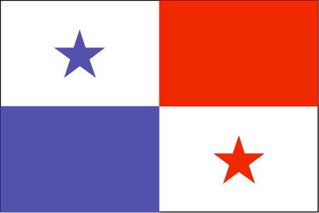
Panama
Country in French
Panama
countryucasefr
PANAMA
Country in Chinese
Country in Spanish
Panamá
Country in Italian
Il Panama
Country in Portuguese
Panamá
Country in Germain
Panama
countrypy
ba1 na2 ma3
countrylocal
Panama
countryfull
Panama
countrynm
Panama
ISO2
PA
ISO3
PAN
countrycodeisono
591
countrycodevehicle
PA
countrycodeolympic
PAN
countrycodeirs
PM
countrycodeirsfr
PM
countrycodeirsmixt
PM
countrycode
507
19
6
131
languagesfr
Espagnol
81
currency
balboa
currencyfr
balboa
currencyisocode
PAB
currencyisocodefull
PAB 590
currencypxcode
PAB
currencysymbol
B
currencysubdivision
100 centesimos
currencyregime
US-$ (1.0)
currencyvalue
1.005
nationalityfr
Panamienne
Capital
Panama City
capitalfr
Panama
Phone Prefix
507
Area km2
78 046
arealand
75 990
areawater
2 210
landarablerate
0.0672
landforestrate
0.386
coastline
2490
summit
Volcán de Chiriquí 3 475 m.
boundarycountries
Costa Rica, Colombie.
timezonedeltabegin
-5
flaglink
maplink
pacolor.gif
outlinemaplink
paoutl.gif
visapassenger
-1
maincities
David, La Chorrera, Santiago, Tocumen, Colón.
largestcity
Panama City
largestcitypopulation
967 000
rankpopulation
133
Population
2 984 000
rankgdp
85
gdp
12887000000
rankgdpppp
99
gdpppp
20452000000
rankgni
85
gni
12127000000
rankincomeorigin
79
rankincome
87
income
4060
rankincomeppp
96
incomeppp
6420
lifeexpectation
72.14
alphabetizationrate
0.9235
natalityrate
0.02036
mortalityrate
0.00639
mortalityrateinfantile
0.02095
hdi
0.788
urbanization
0.565
nationalevent
Independence Day
nationaleventfr
Jour de l'Indépendance
nationalholiday
3 November (1903)
Birthday yyyy-mm-dd
1903-11-03 00:00:00
10
4
location
Middle America, bordering both the Caribbean Sea and the North Pacific Ocean, between Colombia and Costa Rica
terrain
interior mostly steep, rugged mountains and dissected, upland plains; coastal areas largely plains and rolling hills
naturalresources
copper, mahogany forests, shrimp, hydropower
9
Web
rgbback
16777215
todate
1
24
id
Country
Country
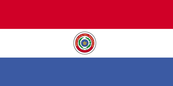
Paraguay
Country in French
Paraguay
countryucasefr
PARAGUAY
Country in Chinese
Country in Spanish
Paraguay
Country in Italian
Il Paraguay
Country in Portuguese
Paraguai
Country in Germain
Paraguay
countrypy
ba1 la1 gui1
countrylocal
Paraguay
countryfull
Paraguay
countrynm
Paraguay
ISO2
PY
ISO3
PRY
countrycodeisono
600
countrycodevehicle
PY
countrycodeolympic
PAR
countrycodeirs
PA
countrycodeirsfr
PA
countrycodeirsmixt
PA
countrycode
595
♂Male
15
6
131
languagesfr
Guarani, Espagnol
82
currency
guarani
currencyfr
guarani
currencyisocode
PYG
currencyisocodefull
PYG 600
currencypxcode
PYG
currencysymbol
slashed G
currencysubdivision
100 centimos [*]
currencyregime
float
currencyvalue
0.00016
nationalityfr
Paraguayenne
Capital
Asuncion
capitalfr
Asuncion
Phone Prefix
595
Area km2
406 750
arealand
397 300
areawater
9 450
landarablerate
0.0554
landforestrate
0.588
summit
Cerro San Rafael 850 m.
boundarycountries
Bolivie, Brésil, Argentine.
timezonedeltabegin
-4
flaglink
maplink
pycolor.gif
outlinemaplink
py.gif
visapassenger
-1
maincities
Puerto Strossner, Encarnación, Ciudad del Este, San Lorenzo, Pedro Juan Caballero, Concepción, Fernando de la Mora, Pilar, Villarrica, Coronel Oviedo.
largestcity
Asuncion
largestcitypopulation
1 081 000
rankpopulation
100
Population
5 643 000
rankgdp
112
gdp
6030000000
rankgdpppp
90
gdpppp
26430000000
rankgni
110
gni
6273000000
rankincomeorigin
132
rankincome
144
income
1110
rankincomeppp
127
incomeppp
4690
lifeexpectation
74.64
alphabetizationrate
0.937
natalityrate
0.02978
mortalityrate
0.00458
mortalityrateinfantile
0.02667
hdi
0.751
urbanization
0.567
precipitation
1333
nationalevent
Independence Day
nationaleventfr
Jour de l'Indépendance
nationalholiday
14 May (1811)
Birthday yyyy-mm-dd
1811-05-14 00:00:00
8
8
location
Central South America, northeast of Argentina
terrain
grassy plains and wooded hills east of Rio Paraguay; Gran Chaco region west of Rio Paraguay mostly low, marshy plain near the river, and dry forest and thorny scrub elsewhere
naturalresources
hydropower, timber, iron ore, manganese, limestone
9
Web
rgbback
16777215
todate
1
25
id
Country
Country
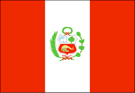
Peru
Country in French
Pérou
countryucasefr
PEROU
Country in Chinese
Country in Spanish
Perú
Country in Italian
Il Perù
Country in Portuguese
Peru
Country in Germain
Peru
countrypy
bi4 lu3
countrylocal
Peru
countryfull
Peru
countrynm
Peru
ISO2
PE
ISO3
PER
countrycodeisono
604
countrycodevehicle
PE
countrycodeolympic
PER
countrycodeirs
PE
countrycodeirsfr
PE
countrycodeirsmixt
PE
countrycode
51
♂Male
15
6
131
languagesfr
Espagnol, Quechua
83
currency
new sol
currencyfr
sol
currencyisocode
PEN
currencyisocodefull
PEN 604
currencypxcode
PEN
currencysymbol
S/.
currencysubdivision
100 centimos
currencyregime
float
currencyvalue
0.3073
nationalityfr
Péruvienne
Capital
Lima
capitalfr
Lima
Phone Prefix
51
Area km2
1 285 216
arealand
1 280 000
areawater
5 220
landarablerate
0.0285
landforestrate
0.509
coastline
2414
summit
Nevado Huascarán 6 768 m.
boundarycountries
Equateur, Colombie, Brésil, Bolivie, Chili.
timezonedeltabegin
-5
flaglink
maplink
pecolor.gif
outlinemaplink
pe.gif
visapassenger
-1
maincities
Arequipa, Lambayeque, Trujillo, Chiclayo, Callao, Chimbote, Piura, Cuzco, Huancayo, Iquitos, Sullana, Pucallpa
largestcity
Lima
largestcitypopulation
6 667 000
rankpopulation
38
Population
27 148 000
rankgdp
51
gdp
60577000000
rankgdpppp
50
gdpppp
142791000000
rankgni
50
gni
58179000000
rankincomeorigin
106
rankincome
116
income
2140
rankincomeppp
117
incomeppp
5080
lifeexpectation
70.88
alphabetizationrate
0.851
natalityrate
0.02281
mortalityrate
0.00569
mortalityrateinfantile
0.03697
hdi
0.743
precipitation
6
nationalevent
Independence Day
nationaleventfr
Jour de l'Indépendance
nationalholiday
28 July (1821)
Birthday yyyy-mm-dd
1821-07-28 00:00:00
8
6
location
Western South America, bordering the South Pacific Ocean, between Chile and Ecuador
terrain
western coastal plain (costa), high and rugged Andes in center (sierra), eastern lowland jungle of Amazon Basin (selva)
naturalresources
copper, silver, gold, petroleum, timber, fish, iro
cooking
Fruits exotiques.
9
Web
rgbback
16777215
todate
1
Notes
Fruits exotiques.
26
id
Country
Country
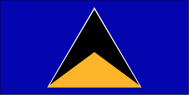
Saint Lucia
Country in French
Sainte-Lucie
countryucasefr
SAINTE-LUCIE
Country in Chinese
Country in Spanish
St. Lucia
Country in Italian
St Lucia
Country in Portuguese
St. Lucia
Country in Germain
Str. Lucia
countrypy
sheng4 lu2 xi1 ya4
countrylocal
Saint Lucia
countryfull
Saint Lucia
countrynm
Saint Lucia
ISO2
LC
ISO3
LCA
countrycodeisono
662
countrycodevehicle
WL
countrycodeolympic
LCA
countrycodeirs
ST
countrycodeirsfr
ST
countrycodeirsmixt
ST
♀Female
18
6
51
languagesfr
Anglais
35
currency
dollar
currencyfr
dollar des Caraïbes orientales
currencyisocode
XCD
currencyisocodefull
XCD 951
currencypxcode
XCD
currencysymbol
EC$
currencysubdivision
100 cents
currencyregime
US-$ (2.7)
currencyvalue
0.3745
Capital
Castries
capitalfr
Castries
Phone Prefix
1-758
Area km2
620
arealand
606
areawater
10
landarablerate
0.0492
landforestrate
0.148
coastline
158
summit
Mont Gimie 950 m.
timezonedeltabegin
-4
flaglink
maplink
lccolor.gif
outlinemaplink
lc.gif
visapassenger
-1
maincities
Vieux Fort, Dennery, Micoud, Soufrière.
largestcity
Castries
largestcitypopulation
53 000
rankpopulation
181
Population
161 000
rankgdp
165
gdp
693000000
rankgdpppp
158
gdpppp
917000000
rankgni
184
gni
650000000
rankincomeorigin
80
rankincome
88
income
4050
rankincomeppp
114
incomeppp
5310
lifeexpectation
73.34
alphabetizationrate
0.67
natalityrate
0.0205
fecondity
2.27
mortalityrate
0.00518
mortalityrateinfantile
0.01395
hdi
0.775
urbanization
0.38
nationalevent
Independence Day
nationaleventfr
Jour de l'Indépendance
nationalholiday
22 February (1979)
Birthday yyyy-mm-dd
1979-02-22 00:00:00
6
8
president
Reine Elisabeth II
location
Caribbean, island between the Caribbean Sea and North Atlantic Ocean, north of Trinidad and Tobago
terrain
volcanic and mountainous with some broad, fertile valleys
naturalresources
forests, sandy beaches, minerals (pumice), mineral
9
Web
rgbback
16777215
todate
1
27
id
Country
Country
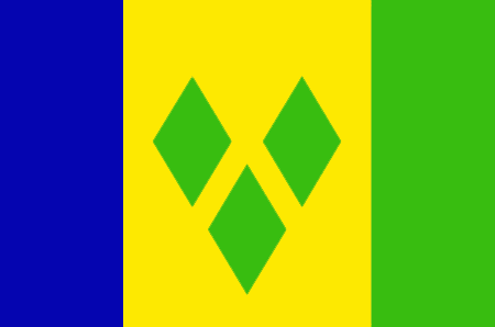
Saint Vincent and the Grenadines
Country in French
Saint-Vincent-et-les Grenadines
countryucasefr
SAINT-VINCENT-ET-LES GRENADINES
Country in Chinese
Country in Spanish
St. Vincent y el Grenadines
Country in Italian
St Vincent & il Grenadines
Country in Portuguese
St. Vincent & o Grenadines
Country in Germain
Str. Vincent u. das Grenadines
countrypy
sheng4 wen2 sen1 te4 he2 ge2 lin2 na4 ding1 si1
countrylocal
Saint Vincent and the Grenadines
countryfull
Saint Vincent and the Grenadines
countrynm
Saint Vincent and the Grenadines
ISO2
VC
ISO3
VCT
countrycodeisono
670
countrycodevehicle
WV
countrycodeolympic
VIN
countrycodeirs
VC
countrycodeirsfr
VC
countrycodeirsmixt
VC
18
6
51
languagesfr
Anglais
35
currency
dollar
currencyfr
dollar des Caraïbes orientales
currencyisocode
XCD
currencyisocodefull
XCD 951
currencypxcode
XCD
currencysymbol
EC$
currencysubdivision
100 cents
currencyregime
US-$ (2.7)
currencyvalue
0.3745
nationalityfr
Française
Capital
Kingstown
capitalfr
Kingstown
Phone Prefix
1-784
Area km2
389
arealand
389
landarablerate
0.1026
landforestrate
0.154
coastline
84
summit
Soufrière 1 234 m.
timezonedeltabegin
-4
flaglink
maplink
vccolor.gif
outlinemaplink
vc.gif
visapassenger
-1
maincities
Georgetown, Fancy, Chateaubelair, Layou.
largestcity
Kingstown
largestcitypopulation
27 000
rankpopulation
186
Population
109 000
rankgdp
171
gdp
371000000
rankgdpppp
163
gdpppp
668000000
rankgni
192
gni
361000000
rankincomeorigin
91
rankincome
101
income
3310
rankincomeppp
105
incomeppp
5870
lifeexpectation
73.35
alphabetizationrate
0.96
natalityrate
0.01677
fecondity
2.23
mortalityrate
0.00604
mortalityrateinfantile
0.01524
hdi
0.755
urbanization
0.56
nationalevent
Independence Day
nationaleventfr
Jour de l'Indépendance
nationalholiday
27 October (1979)
Birthday yyyy-mm-dd
1979-10-27 00:00:00
6
8
location
Caribbean, islands between the Caribbean Sea and North Atlantic Ocean, north of Trinidad and Tobago
terrain
volcanic, mountainous
naturalresources
hydropower, cropland
9
Web
rgbback
16777215
todate
1
28
id
Country
Country
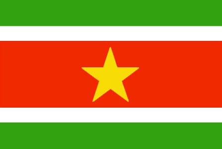
Suriname
Country in French
Suriname
countryucasefr
SURINAME
Country in Chinese
Country in Spanish
Suriname
Country in Italian
Il Surinam
Country in Portuguese
Surinam
Country in Germain
Surinam
countrypy
su1 li3 nan2
countrylocal
Suriname
countryfull
Suriname
countrynm
Suriname
ISO2
SR
ISO3
SUR
countrycodeisono
740
countrycodevehicle
SME
countrycodeolympic
SUR
countrycodeirs
NS
countrycodeirsfr
NS
countrycodeirsmixt
NS
♂Male
19
6
24
languagesfr
Néerlandais
100
currency
Dollar
currencyfr
Florin du Surinam
currencyisocode
SRD
currencyisocodefull
SRD 740
currencypxcode
SRD
currencysymbol
$Sur
currencysubdivision
100 cents
currencyregime
m.float
currencyvalue
0.39962
nationalityfr
Surinamienne
Capital
Paramaribo
capitalfr
Paramaribo
Phone Prefix
597
Area km2
163 265
arealand
161 470
areawater
1 800
landarablerate
0.0037
landforestrate
0.905
coastline
386
summit
Wilhelmina Gebergte 1 286 m.
boundarycountries
Guyana, Guyane, Brésil.
timezonedeltabegin
-3
flaglink
maplink
srcolor.gif
outlinemaplink
sr.gif
visapassenger
-1
maincities
Nieuw Nickerie, Marienburg, Moengo, Totness.
largestcity
Paramaribo
largestcitypopulation
112 000
rankpopulation
166
Population
438 000
rankgdp
152
gdp
1154000000
rankgni
173
gni
998000000
rankincomeorigin
101
rankincome
111
income
2280
lifeexpectation
69.1
alphabetizationrate
0.9425
natalityrate
0.01887
mortalityrate
0.00699
mortalityrateinfantile
0.02415
hdi
0.762
urbanization
0.748
nationalevent
Independence Day
nationaleventfr
Jour de l'Indépendance
nationalholiday
25 November (1975)
Birthday yyyy-mm-dd
1975-11-25 00:00:00
2
4
location
Northern South America, bordering the North Atlantic Ocean, between French Guiana and Guyana
terrain
mostly rolling hills; narrow coastal plain with swamps
naturalresources
timber, hydropower, fish, kaolin, shrimp, bauxite,
cooking
Fruits de Mer
9
Web
rgbback
16777215
todate
1
Notes
Fruits de Mer
29
id
Country
Country
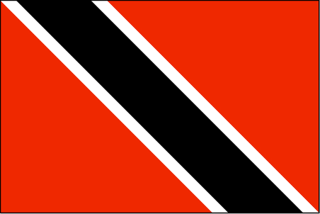
Trinidad and Tobago
Country in French
Trinité-et-Tobago
countryucasefr
TRINITE-ET-TOBAGO
Country in Chinese
Country in Spanish
Trinidad y Trinidad y Tobago
Country in Italian
La Trinidad ed il Tobago
Country in Portuguese
Trinidad e tobago
Country in Germain
Trinidad und Tobago
countrypy
te4 li4 ni2 da2 he2 duo1 ba1 ge1
countrylocal
Trinidad and Tobago
countryfull
Trinidad and Tobago
countrynm
Trinidad and Tobago
ISO2
TT
ISO3
TTO
countrycodeisono
780
countrycodevehicle
TT
countrycodeolympic
TRI
countrycodeirs
TD
countrycodeirsfr
TD
countrycodeirsmixt
TD
18
6
51
languagesfr
Anglais
104
currency
dollar
currencyfr
dollar de la Trinité
currencyisocode
TTD
currencyisocodefull
TTD 780
currencypxcode
TTD
currencysymbol
TT$
currencysubdivision
100 cents
currencyregime
float
currencyvalue
0.1613
Capital
Port-of-Spain
capitalfr
Port of Spain
Phone Prefix
1-868
Area km2
5 128
arealand
5 128
landarablerate
0.1462
landforestrate
0.505
coastline
362
summit
El Cerro del Aripo 940 m.
timezonedeltabegin
-4
flaglink
maplink
tt.jpg
outlinemaplink
trintbgo.gif
visapassenger
-1
maincities
San Fernando, Arima, Scarborough .
largestcity
Port of Spain
largestcitypopulation
52 000
rankpopulation
149
Population
1 313 000
rankgdp
92
gdp
10511000000
rankgdpppp
111
gdpppp
14132000000
rankgni
90
gni
10220000000
rankincomeorigin
60
rankincome
66
income
7790
rankincomeppp
74
incomeppp
10390
lifeexpectation
69.28
alphabetizationrate
0.985
natalityrate
0.01275
mortalityrate
0.00902
mortalityrateinfantile
0.02464
hdi
0.802
urbanization
0.745
precipitation
1870
nationalevent
Independence Day
nationaleventfr
Jour de l'Indépendance
nationalholiday
31 August (1962)
Birthday yyyy-mm-dd
1962-08-31 00:00:00
9
3
location
Caribbean, islands between the Caribbean Sea and the North Atlantic Ocean, northeast of Venezuela
terrain
mostly plains with some hills and low mountains
naturalresources
petroleum, natural gas, asphalt
9
Web
rgbback
16777215
todate
1
30
id
Country
Country
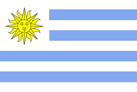
Uruguay
Country in French
Uruguay
countryucasefr
URUGUAY
Country in Chinese
Country in Spanish
Uruguay
Country in Italian
L'Uruguai
Country in Portuguese
Uruguai
Country in Germain
Uruguay
countrypy
wu1 la1 gui1
countrylocal
Republica Oriental del Uruguay
countryfull
Uruguay
countrynm
Uruguay
ISO2
UY
ISO3
URY
countrycodeisono
858
countrycodevehicle
ROU
countrycodeolympic
URU
countrycodeirs
UY
countrycodeirsfr
UY
countrycodeirsmixt
UY
countrycode
598
♂Male
15
6
131
languagesfr
Espagnol
109
currency
peso uruguayo
currencyfr
peso uruguayen
currencyisocode
UYU
currencyisocodefull
UYU 858
currencypxcode
UYP
currencysymbol
$U
currencysubdivision
100 centésimos
currencyregime
m.float
currencyvalue
0.04158
nationalityfr
Uruguayenne
Capital
Montevideo
capitalfr
Montévideo
Phone Prefix
598
Area km2
176 215
arealand
173 620
areawater
2 600
landarablerate
0.0721
landforestrate
0.074
coastline
660
summit
Cerro Catedral 514 m.
boundarycountries
Argentine, Brésil.
timezonedeltabegin
-3
flaglink
maplink
uycolor.gif
outlinemaplink
uy.gif
visapassenger
-1
maincities
Salto, Paysandú, Las Piedras, Rivera, Melo, Tacuarembó, Mercedes, Minas.
largestcity
Montevideo
largestcitypopulation
1 325 000
rankpopulation
128
Population
3 380 000
rankgdp
88
gdp
11182000000
rankgdpppp
87
gdpppp
27987000000
rankgni
83
gni
12904000000
rankincomeorigin
83
rankincome
92
income
3820
rankincomeppp
84
incomeppp
7980
lifeexpectation
75.38
alphabetizationrate
0.969
natalityrate
0.01572
mortalityrate
0.00935
mortalityrateinfantile
0.01231
hdi
0.834
urbanization
0.921
precipitation
1102
nationalevent
Independence Day
nationaleventfr
Jour de l'Indépendance
nationalholiday
25 August (1825)
Birthday yyyy-mm-dd
1825-08-25 00:00:00
2
10
location
Southern South America, bordering the South Atlantic Ocean, between Argentina and Brazil
terrain
mostly rolling plains and low hills; fertile coastal lowland
naturalresources
arable land, hydropower, minor minerals, fisheries
9
Web
rgbback
16777215
todate
1
| Countries/Territories | Regions of China | Provinces of China | Regions in France | French Departments | States/Provinces | Cities/Towns | Locations | World Continents | French AOP Wines
