Pays/Territoires
Mise à jour 2021-01-12 18:58:56
Les noms des pays/territoires du monde sont donnés en Français et Chinois. Cette collection des précieuses terres fermes du monde que toute l'humanité partage inclut non seulement les pays indépendants, mais aussi des régions spécifiques qui ne sont pas membre de l'ONUOrganisation des Nations Unies: Nous, peuples des Nations Unies ... Une ONU plus forte pour un monde meilleur. Veuillez aussi consulter les noms des pays en masculin et féminin en Français.
GéoPays Fermer
21
id
Pays
Pays en Anglais
Haiti
Pays
Haïti
countryucasefr
HAITI
Pays en Chinois
Pays en Espagnol
Haití
Pays en Italien
L'Haiti
Pays en Portugais
Haiti
Pays en Allemand
Haiti
countrypy
hai3 di4
countrylocal
Haiti
countryfull
Haiti
countrynm
Haiti
ISO2
HT
ISO3
HTI
countrycodeisono
332
countrycodevehicle
RH
countrycodeolympic
HAI
countrycodeirs
HA
countrycodeirsfr
HA
countrycodeirsmixt
HA
8
57
languagesfr
Français, créole.
140
currency
gourde
currencyfr
gourde
currencyisocode
HTG
currencyisocodefull
HTG 332
currencypxcode
HTG
currencysymbol
G
currencysubdivision
100 centimes
currencyregime
float
currencyvalue
0.0274
nationalityfr
Haïtienne
Capitale
Port-au-Prince
capitalfr
Port-au-Prince
Préfixe Tél.
509
Superficie km2
247,50
arealand
27 560
areawater
190
landarablerate
0.2032
landforestrate
0.032
coastline
1771
summit
Pic La Selle 2 674 m.
boundarycountries
République Dominicaine.
timezonedeltabegin
-5
flaglink
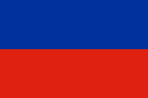
maplink
htcolor.gif
outlinemaplink
ht.gif
visapassenger
-1
maincities
Cap Haïtien, Pétionville, Gonaives, Les Cayes, Port-de-Paix.
largestcity
Port-au-Prince
largestcitypopulation
1 461 000
rankpopulation
84
Population
8 440 000
rankgdp
134
gdp
2921000000
rankgdpppp
107
gdpppp
14703000000
rankgni
139
gni
3342000000
rankincomeorigin
173
rankincome
187
income
400
rankincomeppp
170
incomeppp
1730
lifeexpectation
51.78
alphabetizationrate
0.5195
natalityrate
0.03376
mortalityrate
0.01321
mortalityrateinfantile
0.07438
hdi
0.467
urbanization
0.363
nationalevent
Independence Day
nationaleventfr
Jour de l'Indépendance
nationalholiday
1 January (1804)
Date de naissance aaaa-mm-jj
1804-01-01 00:00:00
10
12
location
Caribbean, western one-third of the island of Hispaniola, between the Caribbean Sea and the North Atlantic Ocean, west of the Dominican Republic
terrain
mostly rough and mountainous
naturalresources
bauxite, copper, calcium carbonate, gold, marble,
9
Web
rgbback
16777215
todate
1
22
id
Pays
Pays en Anglais
Honduras
Pays
Honduras
countryucasefr
HONDURAS
Pays en Chinois
Pays en Espagnol
Honduras
Pays en Italien
L'Honduras
Pays en Portugais
Honduras
Pays en Allemand
Honduras
countrypy
hong2 du1 la1 si1
countrylocal
Honduras
countryfull
Honduras
countrynm
Honduras
ISO2
HN
ISO3
HND
countrycodeisono
340
countrycodeolympic
HON
countrycodeirs
HO
countrycodeirsfr
HO
countrycodeirsmixt
HO
countrycode
504
♂Masulin
19
6
131
languagesfr
Espagnol
46
currency
lempira
currencyfr
lempira
currencyisocode
HNL
currencyisocodefull
HNL 340
currencypxcode
HNL
currencysymbol
L
currencysubdivision
100 centavos
currencyregime
m.float
currencyvalue
0.05549
Capitale
Tegucigalpa
capitalfr
Tegucigalpa
Préfixe Tél.
504
Superficie km2
112 088
arealand
111 890
areawater
200
landarablerate
0.1515
landforestrate
0.481
coastline
820
summit
Cerro Las Minas 2 865
boundarycountries
Guatémala, El Salvador, Nicaragua.
timezonedeltabegin
-6
flaglink
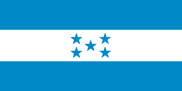
maplink
hncolor.gif
outlinemaplink
hnoutl.gif
visapassenger
-1
maincities
San Pedro Sula, La Ceiba, Choluteca, El Progeso, Puerto Cortés, Comayagua, Tela, Siguatepeque.
largestcity
Tegucigalpa
largestcitypopulation
995 000
rankpopulation
93
Population
6 969 000
rankgdp
103
gdp
6978000000
rankgdpppp
100
gdpppp
18572000000
rankgni
103
gni
6760000000
rankincomeorigin
137
rankincome
148
income
970
rankincomeppp
149
incomeppp
2590
lifeexpectation
66.15
alphabetizationrate
0.7565
natalityrate
0.03104
mortalityrate
0.00664
mortalityrateinfantile
0.02964
hdi
0.667
urbanization
0.537
precipitation
873
nationalevent
Independence Day
nationaleventfr
Jour de l'Indépendance
nationalholiday
15 September (1821)
Date de naissance aaaa-mm-jj
1821-09-15 00:00:00
8
6
location
Middle America, bordering the Caribbean Sea, between Guatemala and Nicaragua and bordering the Gulf of Fonseca (North Pacific Ocean), between El Salvador and Nicaragua
terrain
mostly mountains in interior, narrow coastal plains
naturalresources
timber, gold, silver, copper, lead, zinc, iron ore
cooking
Fruits de Mer
9
Web
rgbback
16777215
todate
1
Notes
Fruits de Mer
23
id
Pays
Pays en Anglais
Jamaica
Pays
Jamaïque
countryucasefr
JAMAIQUE
Pays en Chinois
Pays en Espagnol
Jamaica
Pays en Italien
La Giamaica
Pays en Portugais
Jamaica
Pays en Allemand
Jamaika
countrypy
ya2 mai3 jia1
countrylocal
Jamaica
countryfull
Jamaica
countrynm
Jamaica
ISO2
JM
ISO3
JAM
countrycodeisono
388
countrycodevehicle
JA
countrycodeolympic
JAM
countrycodeirs
JM
countrycodeirsfr
JM
countrycodeirsmixt
JM
♀Féminin
20
6
51
languagesfr
Anglais
55
currency
dollar
currencyfr
dollar de la Jamaïque
currencyisocode
JMD
currencyisocodefull
JMD 388
currencypxcode
JMD
currencysymbol
J$
currencysubdivision
100 cents
currencyregime
float
currencyvalue
0.02
nationalityfr
Jamaïcaine
Capitale
Kingston
capitalfr
Kingston
Préfixe Tél.
1-876
Superficie km2
10 991
arealand
10 831
areawater
160
landarablerate
0.1607
landforestrate
0.3
coastline
1022
summit
Blue Mountain Peak 2 256 m.
timezonedeltabegin
-5
flaglink
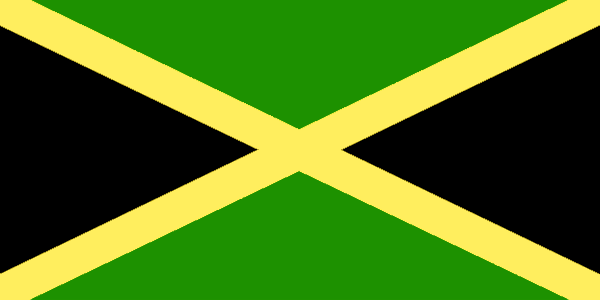
maplink
jmcolor.gif
outlinemaplink
jm.gif
visapassenger
-1
maincities
Spanish Town, Montego Bay, May Pen, Mandeville, Savanna la Mar
largestcity
Kingston
largestcitypopulation
621 000
rankpopulation
135
Population
2 643 000
rankgdp
97
gdp
8147000000
rankgdpppp
121
gdpppp
10846000000
rankgni
100
gni
7882000000
rankincomeorigin
92
rankincome
102
income
2980
rankincomeppp
134
incomeppp
3790
lifeexpectation
76.07
alphabetizationrate
0.875
natalityrate
0.01694
mortalityrate
0.0054
mortalityrateinfantile
0.01281
hdi
0.757
urbanization
0.566
nationalevent
Independence Day
nationaleventfr
Jour de l'Indépendance
nationalholiday
First Monday in August (1962)
Date de naissance aaaa-mm-jj
1962-08-01 00:00:00
9
3
location
Caribbean, island in the Caribbean Sea, south of Cuba
terrain
mostly mountains, with narrow, discontinuous coastal plain
naturalresources
bauxite, gypsum, limestone
9
Web
rgbback
16777215
todate
1
24
id
Pays
Pays en Anglais
Martinique
Pays
Martinique
countryucasefr
MARTINIQUE
Pays en Chinois
Pays en Espagnol
Martinica
Pays en Italien
La Martinica
Pays en Portugais
Martinica
Pays en Allemand
Martinique
countrypy
ma3 ding1 ni2 ke4 dao3
countrylocal
Martinique
countryfull
Martinique
countrynm
Martinique
ISO2
MQ
ISO3
MTQ
countrycodeisono
474
countrycodeirs
MB
countrycodeirsfr
MB
countrycodeirsmixt
MB
♀Féminin
15
6
57
languagesfr
Français
2
currency
euro
currencyfr
Euro
currencyisocode
EUR
currencyisocodefull
EUR 978
currencypxcode
EUR
currencysymbol
€
currencysubdivision
100 cents
currencyregime
float
currencyvalue
1.2203
nationalityfr
Martinicaise
Capitale
Fort-de-France
capitalfr
Fort-de-France
Préfixe Tél.
596
Superficie km2
1 079
arealand
1 060
areawater
40
landarablerate
0.0943
landforestrate
0.439
coastline
350
summit
Montagne Pelée 1 397 m.
timezonedeltabegin
-4
flaglink
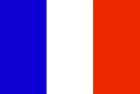
maplink
mqcolor.gif
outlinemaplink
mq.gif
visapassenger
-1
maincities
Le Lamentin, Sainte Marie, Schoelcher, Le François, La Trinité, Saint Pierre, Ducos
largestcity
Fort-de-France
rankpopulation
172
Population
422 277
rankgni
117
gni
5080000000
rankincomeorigin
45
rankincome
45
income
13026
lifeexpectation
78.88
alphabetizationrate
0.976
natalityrate
0.01456
mortalityrate
0.00643
mortalityrateinfantile
0.00727
urbanization
0.97
nationalevent
Bastille Day
nationaleventfr
Jour de la prise de la Bastille
nationalholiday
14 July (1789)
Date de naissance aaaa-mm-jj
1789-07-14 00:00:00
6
10
location
Caribbean, island between the Caribbean Sea and North Atlantic Ocean, north of Trinidad and Tobago
terrain
mountainous with indented coastline; dormant volcano
naturalresources
coastal scenery and beaches, cultivable land
cooking
Cuisine des Îles, Alcool fort.
2
Web
rgbback
16777215
todate
1
Notes
Cuisine des Îles, Alcool fort.
25
id
Pays
Pays en Anglais
Mexico
Pays
Mexique
countryucasefr
MEXIQUE
Pays en Chinois
Pays en Espagnol
México
Pays en Italien
Il Messico
Pays en Portugais
México
Pays en Allemand
Mexiko
countrypy
mo4 xi1 ge1
countrylocal
Estados Unidos Mexicanos
countryfull
Mexico
countrynm
Mexico
ISO2
MX
ISO3
MEX
countrycodeisono
484
countrycodevehicle
MEX
countrycodeolympic
MEX
countrycodeirs
MX
countrycodeirsfr
MX
countrycodeirsmixt
MX
countrycode
52
♂Masulin
7
131
languagesfr
Espagnol
69
currency
peso
currencyfr
peso mexicain
currencyisocode
MXN
currencyisocodefull
MXN 484
currencypxcode
MXN
currencysymbol
Mex$
currencysubdivision
100 centavos
currencyregime
float
currencyvalue
0.09239
nationalityfr
Mexicaine
Capitale
Mexico City
capitalfr
Mexico
Préfixe Tél.
52
Superficie km2
1 972 547
arealand
1 923 040
areawater
49 510
landarablerate
0.132
landforestrate
0.289
coastline
9330
summit
Citlaltépelt 5 700 m.
boundarycountries
Etats-Unis, Guatémala, Bélize.
timezonedeltabegin
-6
flaglink
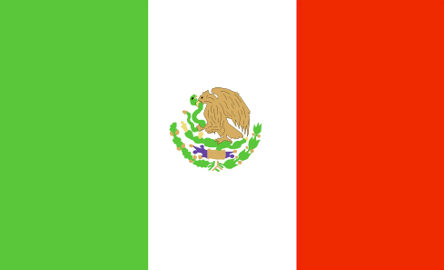
maplink
mxcolor.gif
outlinemaplink
mxout.gif
visapassenger
-1
maincities
Guadalajara, Monterrey, Zaragoza, León, Ciudad Juárez, Culiacán, Mexicali, Tijuana, Mérida, Acapulco, Chihuahua, San Luis Potosî, Hermosillo
largestcity
Mexico City
largestcitypopulation
16 562 000
rankpopulation
11
Population
102 291 000
rankgdp
10
gdp
626080000000
rankgdpppp
12
gdpppp
937836000000
rankgni
10
gni
637159000000
rankincomeorigin
68
rankincome
75
income
6230
rankincomeppp
80
incomeppp
8980
lifeexpectation
74.94
alphabetizationrate
0.917
natalityrate
0.02144
mortalityrate
0.00473
mortalityrateinfantile
0.02169
hdi
0.8
precipitation
848
nationalevent
Independence Day
nationaleventfr
Jour de l'Indépendance
nationalholiday
16 September (1810)
Date de naissance aaaa-mm-jj
1810-09-16 00:00:00
7
7
location
Middle America, bordering the Caribbean Sea and the Gulf of Mexico, between Belize and the US and bordering the North Pacific Ocean, between Guatemala and the US
terrain
high, rugged mountains; low coastal plains; high plateaus; desert
naturalresources
petroleum, silver, copper, gold, lead, zinc, natur
cooking
Spécialités très Epicées.
9
Web
rgbback
16777215
todate
1
Notes
Spécialités très Epicées.
26
id
Pays
Pays en Anglais
Navassa Island
Pays
Ile Navassa
countryucasefr
ILE NAVASSA
Pays en Chinois
Pays en Espagnol
Isla De Navassa
Pays en Italien
Isola Di Navassa
Pays en Portugais
Console De Navassa
Pays en Allemand
Insel Navassa
countryfull
Navassa Island
countrynm
Navassa Island
ISO2
UMI5
ISO3
UMI5
countrycodeisono
581
countrycodeirs
BQ
countrycodeirsfr
BQ
countrycodeirsmixt
BQ
♀Féminin
17
7
57
1
currencypxcode
USD
Superficie km2
5,20
arealand
5,20
coastline
8
timezonedeltabegin
-5
flaglink
maplink
bq-map.gif
visapassenger
-1
rankincome
222
location
Caribbean, island in the Caribbean Sea, about one-fourth of the way from Haiti to Jamaica
terrain
raised coral and limestone plateau, flat to undulating; ringed by vertical white cliffs (9 to 15 m high)
naturalresources
guano
cooking
Caribbean, island in the Caribbean Sea, about one-fourth of the way from Haiti to Jamaica
9
rgbback
16777215
todate
1
27
id
Pays
Pays en Anglais
Nicaragua
Pays
Nicaragua
countryucasefr
NICARAGUA
Pays en Chinois
Pays en Espagnol
Nicaragua
Pays en Italien
La Nicaragua
Pays en Portugais
Nicarágua
Pays en Allemand
Nicaragua
countrypy
ni2 jia1 la1 gua1
countrylocal
Nicaragua
countryfull
Nicaragua
countrynm
Nicaragua
ISO2
NI
ISO3
NIC
countrycodeisono
558
countrycodevehicle
NIC
countrycodeolympic
NCA
countrycodeirs
NU
countrycodeirsfr
NU
countrycodeirsmixt
NU
countrycode
505
♂Masulin
15
6
131
languagesfr
Espagnol
76
currency
gold cordoba
currencyfr
cordoba
currencyisocode
NIO
currencyisocodefull
NIO 558
currencypxcode
NIO
currencysymbol
C$
currencysubdivision
100 centavos
currencyregime
indicators
currencyvalue
0.06146
nationalityfr
Nicaraquaïenne
Capitale
Managua
capitalfr
Managua
Préfixe Tél.
505
Superficie km2
129 494
arealand
120 254
areawater
9 240
landarablerate
0.2024
landforestrate
0.27
coastline
910
summit
Cerro Mogotón 2 438 m
boundarycountries
Honduras, Costa Rica.
timezonedeltabegin
-5
flaglink
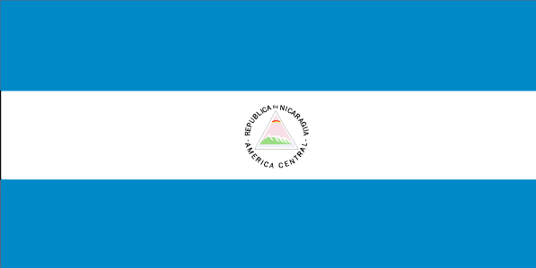
maplink
nicolor.gif
outlinemaplink
nioutl.gif
visapassenger
-1
maincities
Rosita, León, Granada, Masaya, Chinandega, Matagalpa, San Carlos, Estelí, Jinotepe .
largestcity
Managua
largestcitypopulation
1 124 000
rankpopulation
103
Population
5 480 000
rankgdp
127
gdp
4083000000
rankgdpppp
102
gdpppp
17877000000
rankgni
127
gni
4082000000
rankincomeorigin
148
rankincome
162
income
740
rankincomeppp
143
incomeppp
3180
lifeexpectation
70
alphabetizationrate
0.672
natalityrate
0.02558
mortalityrate
0.00463
mortalityrateinfantile
0.03025
hdi
0.643
urbanization
0.565
precipitation
1147
nationalevent
Independence Day
nationaleventfr
Jour de l'Indépendance
nationalholiday
15 September (1821)
Date de naissance aaaa-mm-jj
1821-09-15 00:00:00
8
6
location
Middle America, bordering both the Caribbean Sea and the North Pacific Ocean, between Costa Rica and Honduras
terrain
extensive Atlantic coastal plains rising to central interior mountains; narrow Pacific coastal plain interrupted by volcanoes
naturalresources
gold, silver, copper, tungsten, lead, zinc, timber
9
Web
rgbback
16777215
todate
1
28
id
Pays
Pays en Anglais
Panama
Pays
Panama
countryucasefr
PANAMA
Pays en Chinois
Pays en Espagnol
Panamá
Pays en Italien
Il Panama
Pays en Portugais
Panamá
Pays en Allemand
Panama
countrypy
ba1 na2 ma3
countrylocal
Panama
countryfull
Panama
countrynm
Panama
ISO2
PA
ISO3
PAN
countrycodeisono
591
countrycodevehicle
PA
countrycodeolympic
PAN
countrycodeirs
PM
countrycodeirsfr
PM
countrycodeirsmixt
PM
countrycode
507
19
6
131
languagesfr
Espagnol
81
currency
balboa
currencyfr
balboa
currencyisocode
PAB
currencyisocodefull
PAB 590
currencypxcode
PAB
currencysymbol
B
currencysubdivision
100 centesimos
currencyregime
US-$ (1.0)
currencyvalue
1.005
nationalityfr
Panamienne
Capitale
Panama City
capitalfr
Panama
Préfixe Tél.
507
Superficie km2
78 046
arealand
75 990
areawater
2 210
landarablerate
0.0672
landforestrate
0.386
coastline
2490
summit
Volcán de Chiriquí 3 475 m.
boundarycountries
Costa Rica, Colombie.
timezonedeltabegin
-5
flaglink
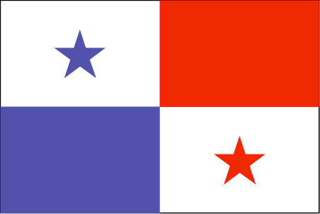
maplink
pacolor.gif
outlinemaplink
paoutl.gif
visapassenger
-1
maincities
David, La Chorrera, Santiago, Tocumen, Colón.
largestcity
Panama City
largestcitypopulation
967 000
rankpopulation
133
Population
2 984 000
rankgdp
85
gdp
12887000000
rankgdpppp
99
gdpppp
20452000000
rankgni
85
gni
12127000000
rankincomeorigin
79
rankincome
87
income
4060
rankincomeppp
96
incomeppp
6420
lifeexpectation
72.14
alphabetizationrate
0.9235
natalityrate
0.02036
mortalityrate
0.00639
mortalityrateinfantile
0.02095
hdi
0.788
urbanization
0.565
nationalevent
Independence Day
nationaleventfr
Jour de l'Indépendance
nationalholiday
3 November (1903)
Date de naissance aaaa-mm-jj
1903-11-03 00:00:00
10
4
location
Middle America, bordering both the Caribbean Sea and the North Pacific Ocean, between Colombia and Costa Rica
terrain
interior mostly steep, rugged mountains and dissected, upland plains; coastal areas largely plains and rolling hills
naturalresources
copper, mahogany forests, shrimp, hydropower
9
Web
rgbback
16777215
todate
1
29
id
Pays
Pays en Anglais
Paraguay
Pays
Paraguay
countryucasefr
PARAGUAY
Pays en Chinois
Pays en Espagnol
Paraguay
Pays en Italien
Il Paraguay
Pays en Portugais
Paraguai
Pays en Allemand
Paraguay
countrypy
ba1 la1 gui1
countrylocal
Paraguay
countryfull
Paraguay
countrynm
Paraguay
ISO2
PY
ISO3
PRY
countrycodeisono
600
countrycodevehicle
PY
countrycodeolympic
PAR
countrycodeirs
PA
countrycodeirsfr
PA
countrycodeirsmixt
PA
countrycode
595
♂Masulin
15
6
131
languagesfr
Guarani, Espagnol
82
currency
guarani
currencyfr
guarani
currencyisocode
PYG
currencyisocodefull
PYG 600
currencypxcode
PYG
currencysymbol
slashed G
currencysubdivision
100 centimos [*]
currencyregime
float
currencyvalue
0.00016
nationalityfr
Paraguayenne
Capitale
Asuncion
capitalfr
Asuncion
Préfixe Tél.
595
Superficie km2
406 750
arealand
397 300
areawater
9 450
landarablerate
0.0554
landforestrate
0.588
summit
Cerro San Rafael 850 m.
boundarycountries
Bolivie, Brésil, Argentine.
timezonedeltabegin
-4
flaglink
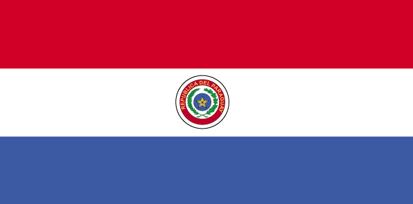
maplink
pycolor.gif
outlinemaplink
py.gif
visapassenger
-1
maincities
Puerto Strossner, Encarnación, Ciudad del Este, San Lorenzo, Pedro Juan Caballero, Concepción, Fernando de la Mora, Pilar, Villarrica, Coronel Oviedo.
largestcity
Asuncion
largestcitypopulation
1 081 000
rankpopulation
100
Population
5 643 000
rankgdp
112
gdp
6030000000
rankgdpppp
90
gdpppp
26430000000
rankgni
110
gni
6273000000
rankincomeorigin
132
rankincome
144
income
1110
rankincomeppp
127
incomeppp
4690
lifeexpectation
74.64
alphabetizationrate
0.937
natalityrate
0.02978
mortalityrate
0.00458
mortalityrateinfantile
0.02667
hdi
0.751
urbanization
0.567
precipitation
1333
nationalevent
Independence Day
nationaleventfr
Jour de l'Indépendance
nationalholiday
14 May (1811)
Date de naissance aaaa-mm-jj
1811-05-14 00:00:00
8
8
location
Central South America, northeast of Argentina
terrain
grassy plains and wooded hills east of Rio Paraguay; Gran Chaco region west of Rio Paraguay mostly low, marshy plain near the river, and dry forest and thorny scrub elsewhere
naturalresources
hydropower, timber, iron ore, manganese, limestone
9
Web
rgbback
16777215
todate
1
30
id
Pays
Pays en Anglais
Peru
Pays
Pérou
countryucasefr
PEROU
Pays en Chinois
Pays en Espagnol
Perú
Pays en Italien
Il Perù
Pays en Portugais
Peru
Pays en Allemand
Peru
countrypy
bi4 lu3
countrylocal
Peru
countryfull
Peru
countrynm
Peru
ISO2
PE
ISO3
PER
countrycodeisono
604
countrycodevehicle
PE
countrycodeolympic
PER
countrycodeirs
PE
countrycodeirsfr
PE
countrycodeirsmixt
PE
countrycode
51
♂Masulin
15
6
131
languagesfr
Espagnol, Quechua
83
currency
new sol
currencyfr
sol
currencyisocode
PEN
currencyisocodefull
PEN 604
currencypxcode
PEN
currencysymbol
S/.
currencysubdivision
100 centimos
currencyregime
float
currencyvalue
0.3073
nationalityfr
Péruvienne
Capitale
Lima
capitalfr
Lima
Préfixe Tél.
51
Superficie km2
1 285 216
arealand
1 280 000
areawater
5 220
landarablerate
0.0285
landforestrate
0.509
coastline
2414
summit
Nevado Huascarán 6 768 m.
boundarycountries
Equateur, Colombie, Brésil, Bolivie, Chili.
timezonedeltabegin
-5
flaglink
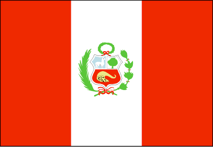
maplink
pecolor.gif
outlinemaplink
pe.gif
visapassenger
-1
maincities
Arequipa, Lambayeque, Trujillo, Chiclayo, Callao, Chimbote, Piura, Cuzco, Huancayo, Iquitos, Sullana, Pucallpa
largestcity
Lima
largestcitypopulation
6 667 000
rankpopulation
38
Population
27 148 000
rankgdp
51
gdp
60577000000
rankgdpppp
50
gdpppp
142791000000
rankgni
50
gni
58179000000
rankincomeorigin
106
rankincome
116
income
2140
rankincomeppp
117
incomeppp
5080
lifeexpectation
70.88
alphabetizationrate
0.851
natalityrate
0.02281
mortalityrate
0.00569
mortalityrateinfantile
0.03697
hdi
0.743
precipitation
6
nationalevent
Independence Day
nationaleventfr
Jour de l'Indépendance
nationalholiday
28 July (1821)
Date de naissance aaaa-mm-jj
1821-07-28 00:00:00
8
6
location
Western South America, bordering the South Pacific Ocean, between Chile and Ecuador
terrain
western coastal plain (costa), high and rugged Andes in center (sierra), eastern lowland jungle of Amazon Basin (selva)
naturalresources
copper, silver, gold, petroleum, timber, fish, iro
cooking
Fruits exotiques.
9
Web
rgbback
16777215
todate
1
Notes
Fruits exotiques.
| Pays/Territoires | Régions en Chine | Provinces de Chine | Régions en France | Départements de France | Provinces du Monde | Villes/Villages | Localités | Continents du Monde | Vins AOP
